I have created a scenery of all towers (FMT Typentürme) listed here (de.wikipedia.org/wiki/Liste_der_Typent%C3%BCrme).
This scenery is autogenerated, most of the towers are not yet modelled after their real life counterparts, but are a default tower scaled to the correct size.
I will add the models for the towers one after the other, currently modelled after real life are:
- Fernmeldeturm Hünenburg, Bielefeld
- Fernmeldeturm Jakobsberg, Porta
- Fernmeldeturm Köterberg
- Fernmeldeturm Nüttermoor, Papenburg-Leer
- Fernmeldeturm Münster
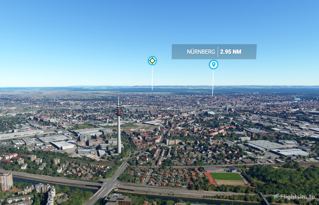
- Fernmeldeturm Nürnberger Ei
- Olympiaturm München
- Sender Westerland
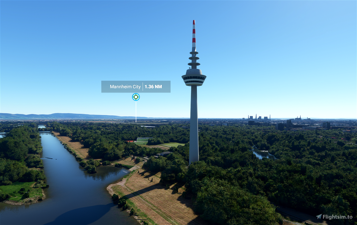
- Fernmeldeturm Mannheim
- Fernmeldeturm Hamburg-Lohbrügge
Because this scenery is mostly autogenerated there could be some problems with placing, etc. (Wikipedia coordinates are not so exact). Please contact me, I will correct it asap.
Some of the tv towers have already been available in my OWL Landmarks package, please update it to the latest version, to avoid issues with double objects.
If you have already modelled one of the towers on the list, please contact me. I would be very glad to add it to this package. We could have one scenery package with all the towers vor VFR flying instead of several different packages.
Having problems with double objects? Have a look at the FAQ
Requests? I really drink a lot of coffee ;-) This speeds up my modelling, so feel free to buy me a coffee.
If you like to support me working for the freeware community: I invite you to become a member on my BuyMeACoffee Channel. Your benefits: Your requests for scenery will be handled with priority (regardless which of my projects), also you get beta access to my airfields I am currently working on (at the moment: EDVY, EDLR coming soon), before these are published.


Gockel
Quassel89
danke für die tolle arbeit
IronHide
Hello, does this works with Sim Update 8?
sleepyt author
I don't notice any problems. Please try it out for your system and inform others here if it is working.
2 years ago
GunStrauss
This looks very promising! Do you plan SU7 compatibility. And btw. do you use different kind of generic towers? Any screenshot of generic examples wold be great.
sleepyt author
I don't see any issues with the scenery up to SU8.
2 years ago
FWAviation
Is this scenery already compatible with Sim Update 6? If not, I would appreciate an update a lot, the TV towers are sorely lacking in my sim now. 😉 Thank you for your great work! Grüße aus Gütersloh!
sleepyt author
I don't see any issues with the scenery up to SU8.
2 years ago
deissek
Bitte die Sendetürme Marinefunksendestelle Rhauderfehn – Wikipedia
Die Marinefunksendestelle Rhauderfehn mit dem Rufzeichen DHO38 ist ein Längstwellensender der Deutschen Marine. Sie untersteht dem Marineunterstützungskommando. Die Anlage sendet seit 1984, wurde zwischen 2017 und 2019 mit Halbleitertechnik modernisiert und soll nach Planungen der Marine bis ca. 2039 in Betrieb bleiben. Die NATO-Bezeichnung der Anlage lautet NATO VLF / MSK Marinefunksendestelle Rhauderfehn. Bei der Bevölkerung im Umkreis ist sie als „Die Türme“ bekannt. Sie liegt innerhalb des Naturschutzgebiets „Esterweger Dose“.
Der Sender befindet sich in der Nähe von Saterland-Ramsloh im Landkreis Cloppenburg (Niedersachsen). Durch das Gelände der Marinefunksendestelle verlaufen die Grenzen der beiden Landkreise Cloppenburg und Leer. Fünf Antennen stehen in Ostfriesland, drei auf Cloppenburger Gebiet.
Archer374
Super danke. Ist das kompatibel mit "We love VFR Region 1"?
sleepyt author
Ja, aber die Infos unter "Häufig gefragt" beachten
3 years ago
Avee
This is a great help in orientation. For orientation, these towers are defining pieces of landscape. In X-Plane I can see TV towers (X-Europe) from everywhere, however MSFS scales down LOD too early. Is there something you can set so that MSFS will show the towers from greater distances? Skyscrapers show from much further out, so it is not necessarily my buildings settings, which are on high.
Kelkheim-Eppenhain (Atzelberg) is slightly besides the VFR objects tower, it seems to be off compared to OSM and bing satellite maps.
Coordinates in OSM are https://www.openstreetmap.org/#map=17/50.17448/8.38885
Thanks!
sleepyt author
Thanks, will fix this positioning in the upcoming release
3 years ago
FenEstron
Good work and an prety good addition to MSFS! Perfect landmarks!
EDVM96
Könntest du auch den FMT Sibbesse ergänzen? 😊
https://de.wikipedia.org/wiki/Fernmeldeturm_Sibbesse
xarotlp
Mountainbuilder
https://de.wikipedia.org/wiki/Sender_Donnersberg
niklasdetlefsen
Rhoentiger96
Warcry2oo2
is there a chance for the Steinkopf Tower:
Auf der Gipfelregion des Steinkopfs steht ein 105,35 m[5] hoher Fernmeldeturm (Typenturm), der bei gutem Wetter von Frankfurt am Main über die Wetterau bis zum Vogelsberg zu sehen ist. Der 1972 in Betrieb genommene Turm wurde ursprünglich auch als Fernsehsender genutzt, dient heute jedoch nur noch als Richt- und Mobilfunkanlage.
sleepyt author
3 years ago