
CYGK Kingston, Ontario, Canada scenery modification for Microsoft Flight Simulator 2020.
VERSION 2.5 - May 2023
FREE AND EXCLUSIVE TO FLIGHTSIM.TO (If you find this file elsewhere, let me know).
Installation:
NOTE the TWO folders.
arh-cygk-apt = contains the CYGK airport and CPJ7 Heliport and all the scenery except landmark locations.
arh-cygk-lm = contains only landmark locations for cities, natural features and points of interest, but no scenery.
Place the folders in your community folder. If you do not wish all the POI showing, do not install the arh-cygk-lm folder. I hope you enjoy the updated area!
You may also wish to filter out POIs on your World Map > Open Filters > Points of Interest (turn them off), and for a full sense of immersion, turn POIs off with your Assistance > Navigation Aids settings (or just do not install the folder arh-cygk-lm).
Scenery:
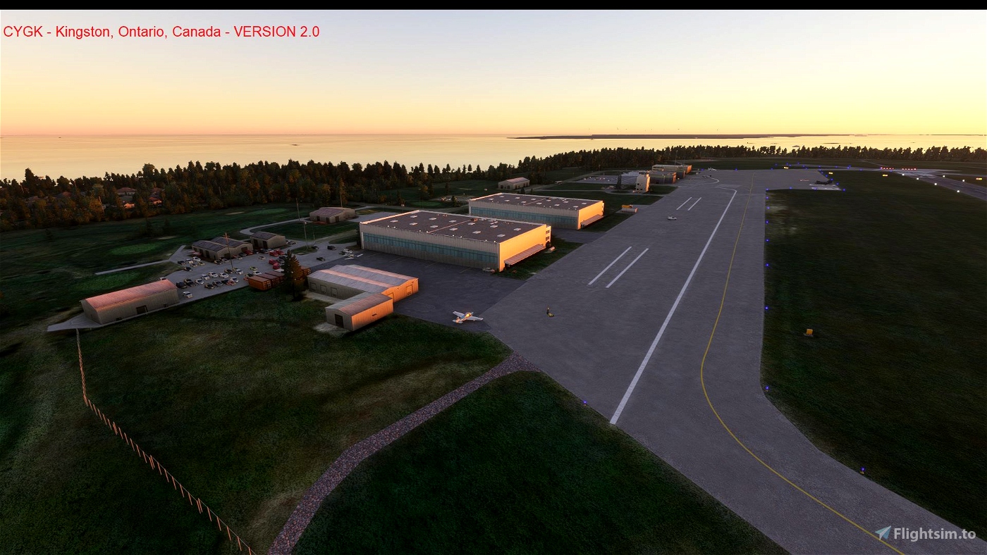
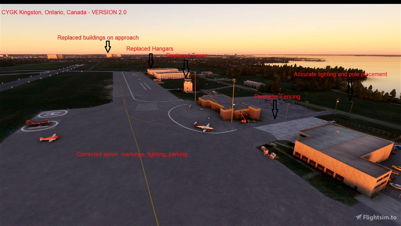
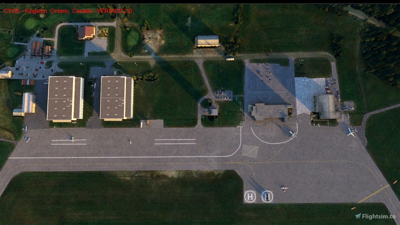
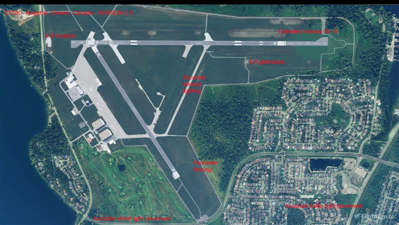
In the default scenery, Kingston Norman Rogers (CYGK) airport exists but with many issues, such as incorrect taxi paths, missing taxiway texture, incorrect runway length, and many more. This scenery modification removes the default scenery and replaces it with all new airport scenery (with the exception of a few buildings). Also, the surrounding area has details added. Furthermore, the Hotel Dieu Hospital Heliport (CPJ7) has been added along the Kingston waterfront. This scenery was created using information from the Canadian Flight Supplement and Canada Air Pilot (expired editions), an examination of various internet mapping sites. At this time, this scenery uses only default SDK elements and each has been placed at appropriate locations by examining the various internet mapping sites and personal memory.
Location details of the airport:
* ICAO: CYGK
* IATA: YGK
* Airport location: 44-13-31 N, 76-35-49 W (44.225278, -76.596944)
Location details of the heliport:
* ICAO: CPJ7
* IATA: ?
* Helipad location: 44-13-20 N, 76-29-34 W (44.222222, -76.496944)
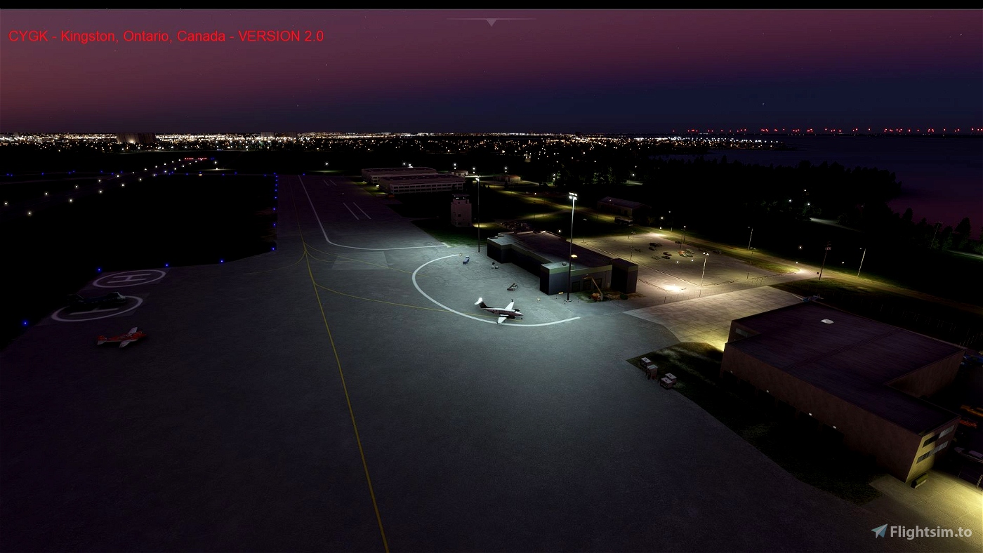
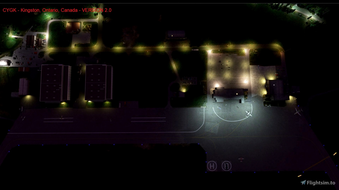
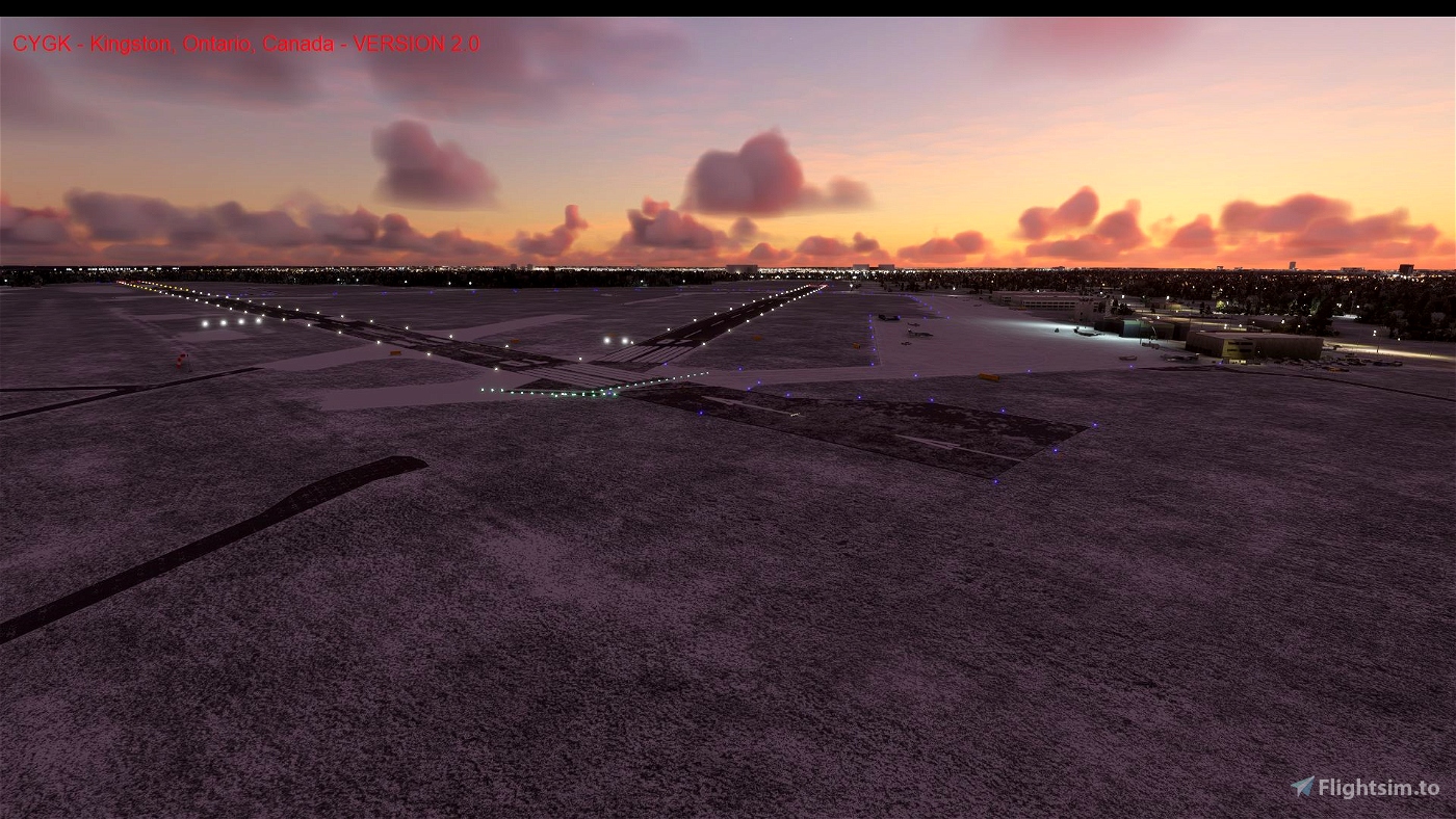
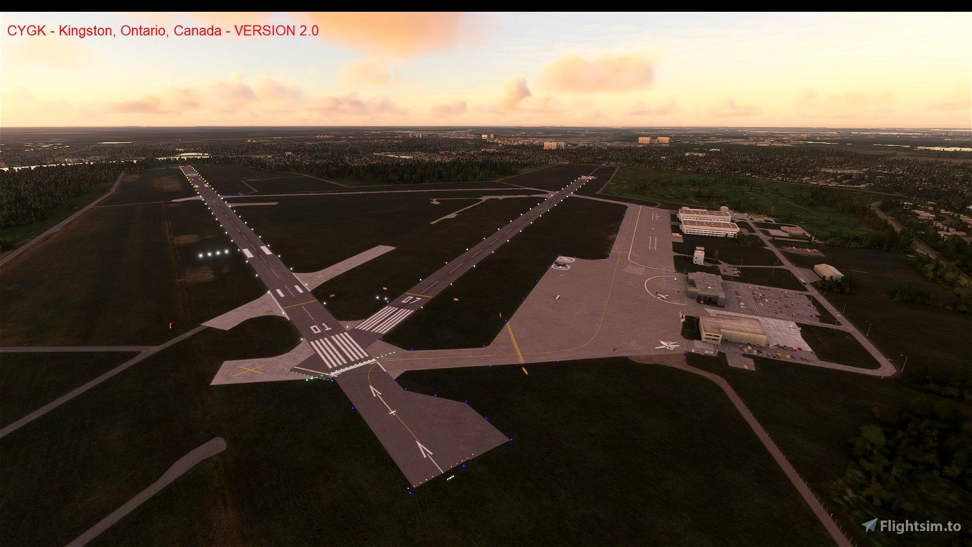
CYGK Norman Rogers Airport scenery includes items placed at accurate locations, including:
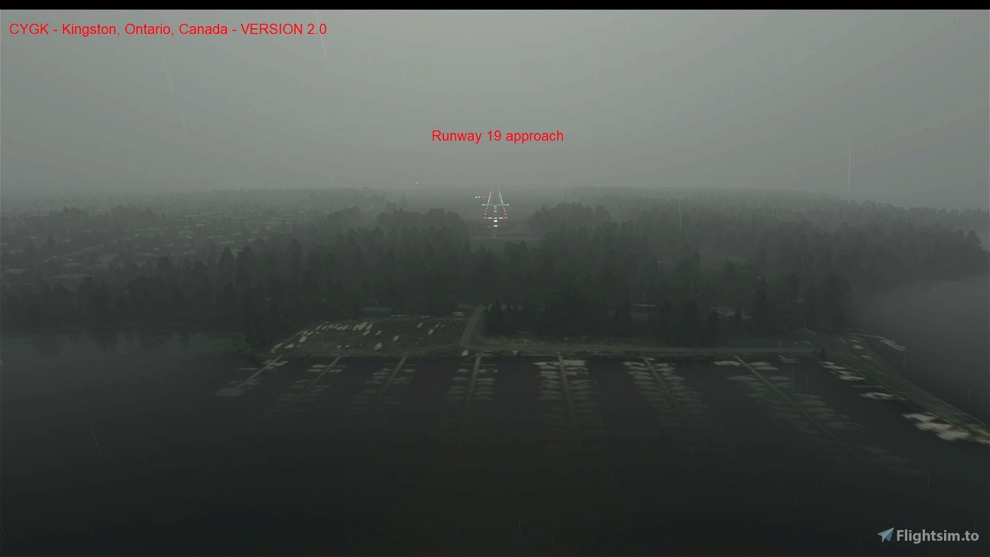
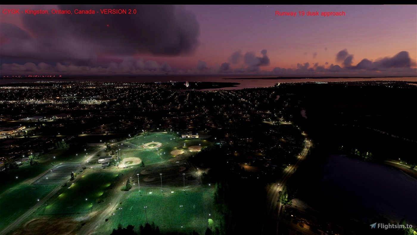
* runways and associated lighting (including proper runway 01/19 approach lighting).
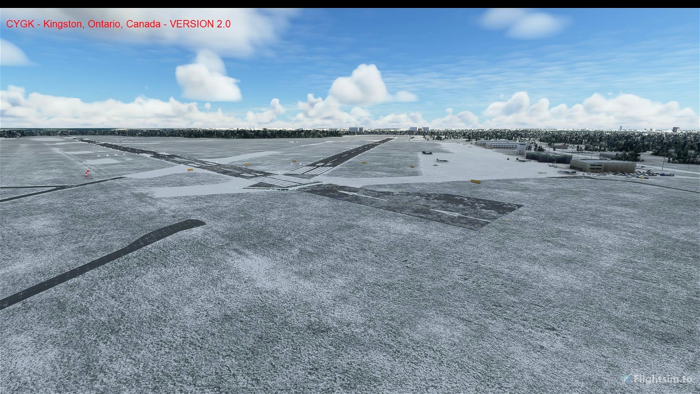
* taxiways, lighting and signage at proper locations.
* aprons and parking.
* ATIS Com radio (back to default in Version 2.1).
* ILS localizer and glideslope antennas and support buildings.
* windsocks.
* hold points and painted lines.
* hangars.
* control tower.
* apron light masts.
* perimeter fencing with gates at actual locations.
* airport details including runway cleaner, baggage carts, fuel tanks, fuelers, vehicles, garbage containers...
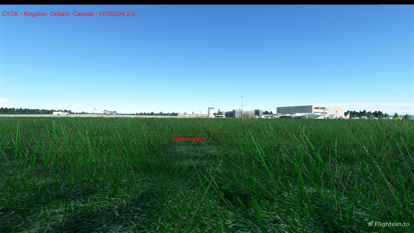
* shrubs and trees.
* helipads and static helicopter
* some static aircraft.
* Antenna at actual NDB location north of the airport.
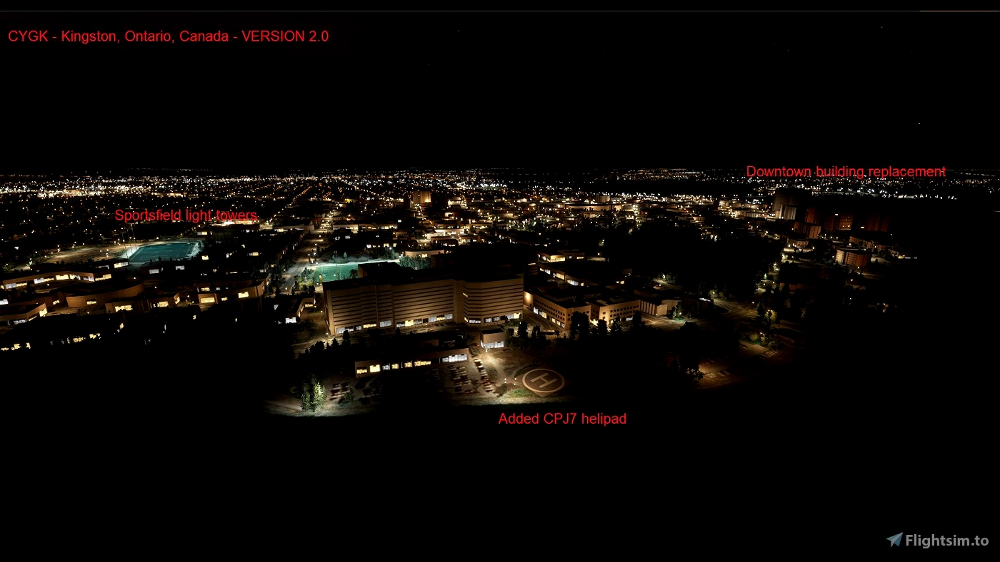
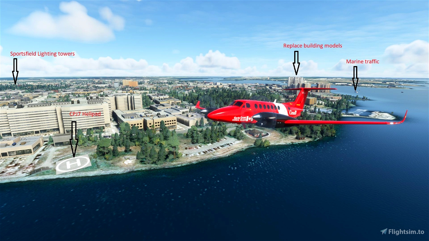
CPJ7 Hotel Dieu Hospital Helipad:
* helipad at 261 feet elevation.
* appproach lighting.
* windsock on hospital roof.
* fencing.
* concrete pipe sculpture.
Scenery placed at actual locations include:
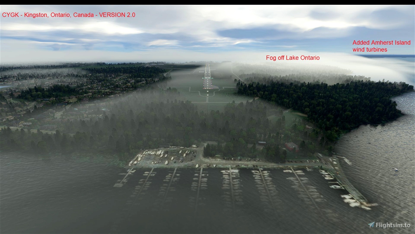
* windfarm on Amherst Island.
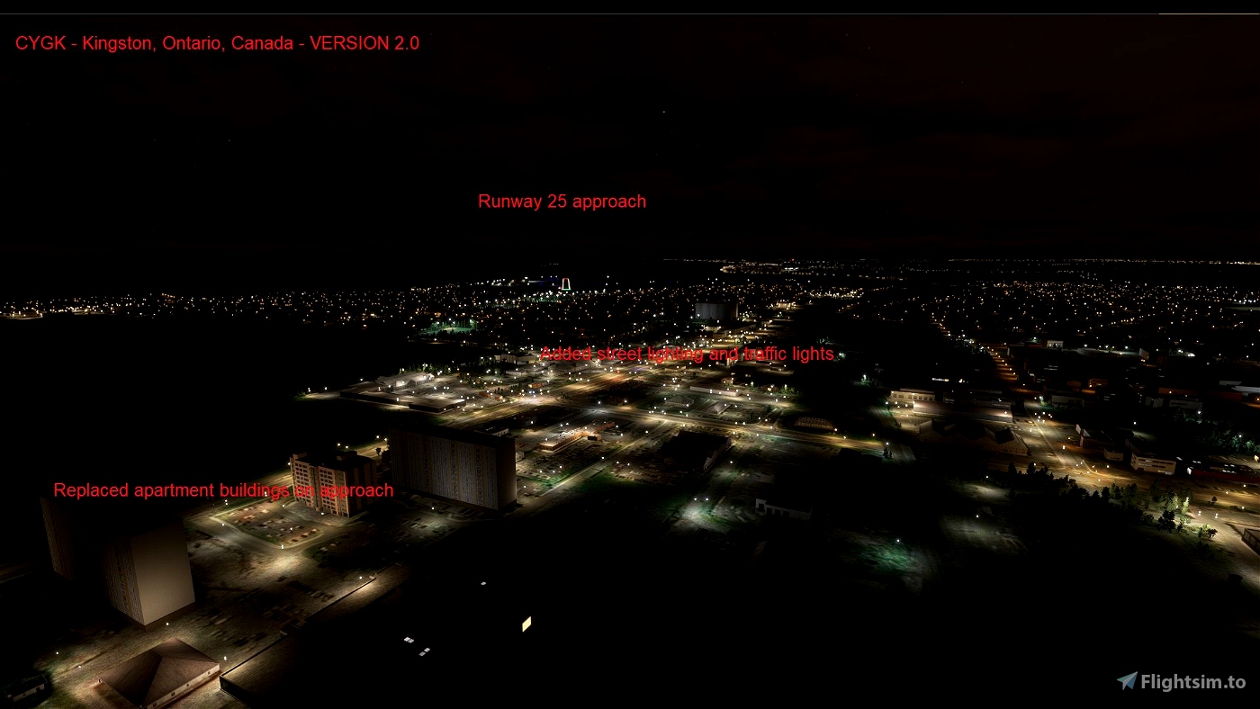
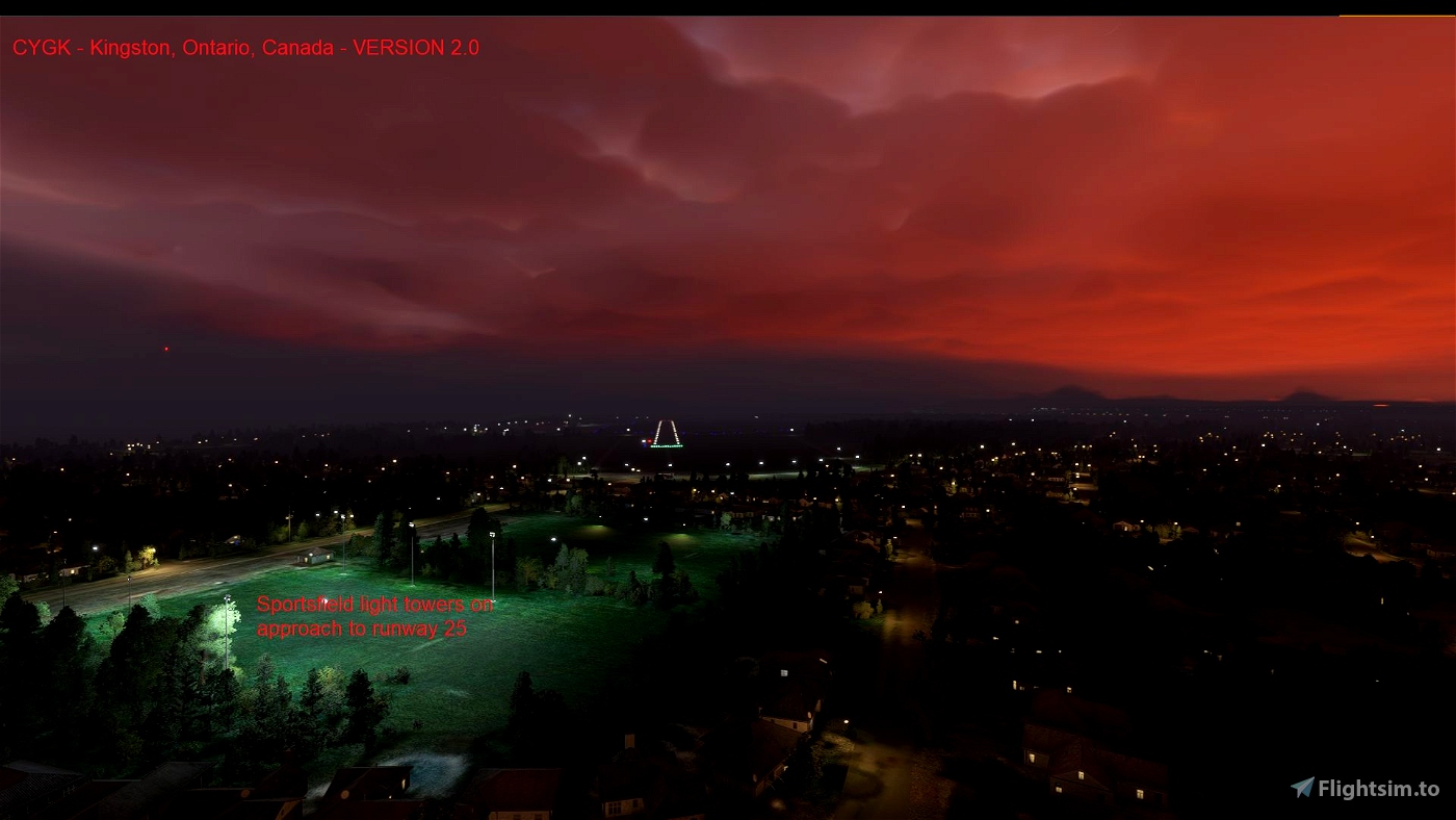
* sportsfield lighting, especially on approaches to CYGK.
* street lighting, traffic lights, telephone poles, road signs, buses and other vehicles.
* boats and buoys.
* prison walls at Collin's Bay and Kingston Penitentiary.
* larger apartment buildings on approaches and in Kingston.
* picnic tables.
* point of interests (POI) for towns, islands and important noteworthy locations (located separately in arh-cygk-lm folder for optional installation as of Version 2.2).
Changes for Version 2.5
* added more street lighting, signs near helipad and traffic lights along shoreline over causeway.
* improved fencing around airport, added fencing to farm field to the west of the airport
* removed MSFS default lighting around the airport and to the west that is not there in reality.
Changes for Version 2.3:
* fix of a bump on the main apron that caused aircrafft crashes during taxi.
* fixed incorrect direction of Hold Short line on Rwy 07/25 for Rwy 01/19.
Changes for Version 2.2:
* separation of points of interest (POI) from main scenery.
- POI are now in arh-cygk-lm folder for optional install.
* added some more sportsfield and parking lot lighting.
Changes for Version 2.1:
* deletion of custom ILS and Radio/ATIS
- revert to MSFS default ILS and Radio for CYGK airport.
Changes for Version 2.0:
* deletion of CYGK airport, including:
- windsocks.
- control tower.
- beacon tower.
- two old hangars.
- automobiles at the end of runway 01 (19 start point).
* extend runway 01/19 to 6001 feet.
* add runway turnarounds at either end of runway 01/19.
* improved apron and taxiway lighting.
* proper runway 01/19 approach lighting.
* add more electrical lines, traffic lights and light poles.
Improvements to come:
* At CYGK Kingston Norman Rogers Airport:
- Reinsertion of old runway 12/30.
- Better hangar representations.
* Better building representations.
* Add more prison scenery improvements to Kingston area Penitentaries.
* Adjusting night lighting patterns.
- Adjust height of lighting structures.
- Add more traffic lights throughout the city.
- Add more street lighting throughout the city.
- Add anti-collision lighting to Amherst Island windmills, airport control tower and surrounding apartment buildings.
* Addition of more boats and vehicles to the surrounding area.
* Addition of marine navigation aids, including lighted buoys and lighthouses.
* Add more electrical lines.
* Addition of more Points of Interest (POIs) identifying nearby features.
NOTE: I am experimenting with a NEW method for scenery. This scenery is ready for that implementation. In general it would comprise this file folder, for the changes to the default airport, essentially replacing it, a second file folder that replaces the tower, terminal and hangars with either photogrammetry (melted appearance) of the actual buildings, or 3D models should someone wish to create them, and a third file folder that contains all the points of interest (POI). Watch for these changes in the future. As of Version 2.2, two of the file folders have been created.
Kingston Norman Rogers Airport is located approximately:
* 8.4 km west of CPJ7 Hotel Dieu Hospital Helipad.
* 9.4 km west of Kingston City Hall.
* 28 km east of Napanee, Ontario, Canada.
* 37 km west of Gananoque, Ontario, Canada.
* 61 km northwest of Watertown, New York, USA.
* 63 km east of Belleville, Ontario, Canada.
* 79 km east of Trenton, Ontario, Canada.
* 83 km southwest of Brockville, Ontario Canada.
* 135 km north of Syracuse, New York, USA.
* 152 km southwest of Ottawa, Ontario, Canada
* 232 km east of Toronto, Ontario, Canada
* 279 km southwest of Montreal, Quebec, Canada
History:
Kingston is at the eastern end of Lake Ontario at the St. Lawrence River (containing the Thousand Islands heading toward Montreal) and the Cataraqui River (which forms the Rideau Canal heading toward Ottawa). Kingston is known as the Limestone City as many buildings are made of local limestone. European explorers came in the 17th century, and in 1673 established a French fort and trading post known as Cataraqui. The fort was later named Fort Frontenac and people settled around it. The British took control of the area around 1760. Cataraqui became Kingston after the British took possession of the fort. In the 1780's, United Empire Loyalists began settling in the region. Kingston became the first capital of the United Province of Canada in 1841. The Airport was built in 1940 to train RAF and other Commonwealth pilots for World War II. Today the southeast portion of airport lands is the Landings Golf course.
ARH64CDN - contact on flightsim.to or www.flightsimulator.com
May 2023

 ARH64CDN


MacAndCheese83
Thanks for the update!
AHal
Are all of the accompanying POIs included in this download really necessary? I do not want to turn off POIs as I like being able to find useful ones on my world map, but these are mostly just a messy heap of nothing of POIs that aren't handcrafted or really useful at all. Could you please separate the POIs from the airport download into two separate add-ons so that those who want them can still get them, but those who want just the airport can just download it?
It's just far too busy. Note that I am happy with the work, it is a job well done, I just think all of the POIs are a bit much here.
Cheers
ARH64CDN author
I put the POIs in by request as others wanted them. So to make everyone happy, they are now in a separate folder that those that want them can install, and those that do not want them do not have to install. The scenery is self contained in one folder, and the POI indicators in another. I will also do this for other scenery as I update it. And should I ever get around to figuring out how to get photogrammetry to look good, that will be a third folder with surrounding scenery elements.
Hope this solution is more acceptable to everyone.
2 years ago
Garyp
Just downloaded CYGK looking forward to the update, got my license in CYGK in 1962 on an air cadet scholarship when Doug Wagner was the CFI of the Kingston Flying Club. We lived on the field in tents during our training. Wonderful time, great memories and many changes to the field since then.
ARH64CDN author
Hope you enjoy it - not perfected yet as there are issues but with the SDK changing with nearly every update, it is hard to keep a scenery up to date. I am working on other sceneries in the area, currently Napanee. I also intend to replace some of the buildings in Kingston with photogrammetry as soon as I understand how to do it again.
2 years ago
Crunchmeister
Any plans on revisiting this to fix the missing runways 07/25 from ATC?
Otherwise, still loving it. Fly out of here almost every day.
ARH64CDN author
I have not figured out what is making that happen yet. Also will revisit as it seems that is the only way to get it SIM Update 5 certified. I have had no issues from Sim Update 5 with this or any of my sceneries, thankfully.
3 years ago
RaymondLaniel
To me POI's identify accurate reproductions of objects and thus interesting to see. Went to Fort Henry - only saw the default (not a fort at all). Therefore not a point of interest . Same with the majority of identified POIs...... Other than that, good work. Thank You!
ARH64CDN author
Understood, but I had a couple requests to place them in, since not everyone is spatially able to identify locations easily. As a geographer myself, I like to help those people out in finding things they wish to see. Unfortunately I do not have the time to create and place models at those locations, but others might do that.
It may seem strange that Flight Simmers may be spatially challenged but when watching streams I am amazed about how many things are overlooked that should be pointed out. I remember the days way back when the pilot would describe some of the key places the flight would pass over on a commercial flight - those days are long gone now. I find the passing world below far more interesting than the inflight entertainment that is offered.
I do thank you for the thanks :) Always room for improvement in my scenes :)
3 years ago
tasev1
This is a phenomenal amount of work for a free enhancement. Thank you so much!
ARH64CDN author
Thank you - I still see room for improvement and additions :)
3 years ago
EddiemacWp
Great job, love all the
poi’s. Isn’t the heli pad at the Kingston General Hospital, not at Hotel Dieu
ARH64CDN author
Thank you - you are correct, it is serving Kingston General Hospital, but the Canada Flight Supplement I used to get the code stated Kingston Hotel Dieu Hospital - strangely enough, so that is what I put. If someone has a more up-to-date page than mine from the early 2000s I would appreciate seeing it :) If I ever get time I will do some fixes to the fencing and other features, and also do the Photogrammetry Terminal and Hangars that I have the scenery set up to take. It would be an optional drop into this scenery that you can take or not, depending on your frame rates and whether one likes melted buildings :)
3 years ago
SakuraSayaka
Thanks!😃
ARH64CDN author
3 years ago
CharlieFox27
ARH64CDN author
3 years ago
ARH64CDN
pilotmic
ARH64CDN author
3 years ago
Crunchmeister
At work on my lunch break atm, but will download it tonight and check it out.
And THANK YOU.
EDIT:
BTW - Google Street View has excellent imagery of the buildings if you need info on layout and what the buildings actually look like.
ARH64CDN author
3 years ago
fuzz1
One of the few smaller and charming ones in the vicinity that has an ILS.
ARH64CDN author
3 years ago
CaptJohnCoPPickles
ARH64CDN author
3 years ago
CharlieFox27
ARH64CDN author
3 years ago