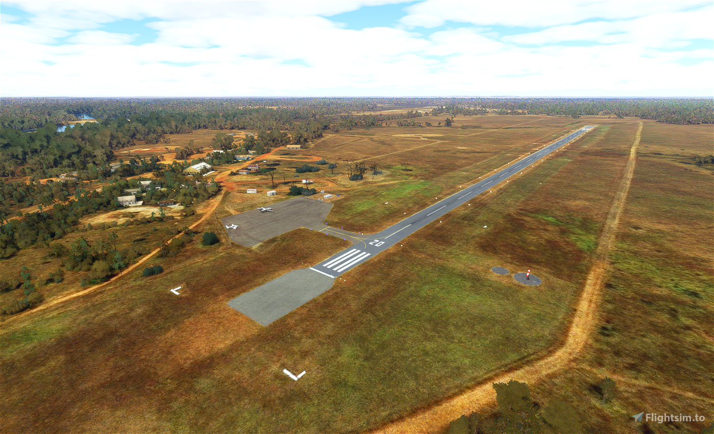
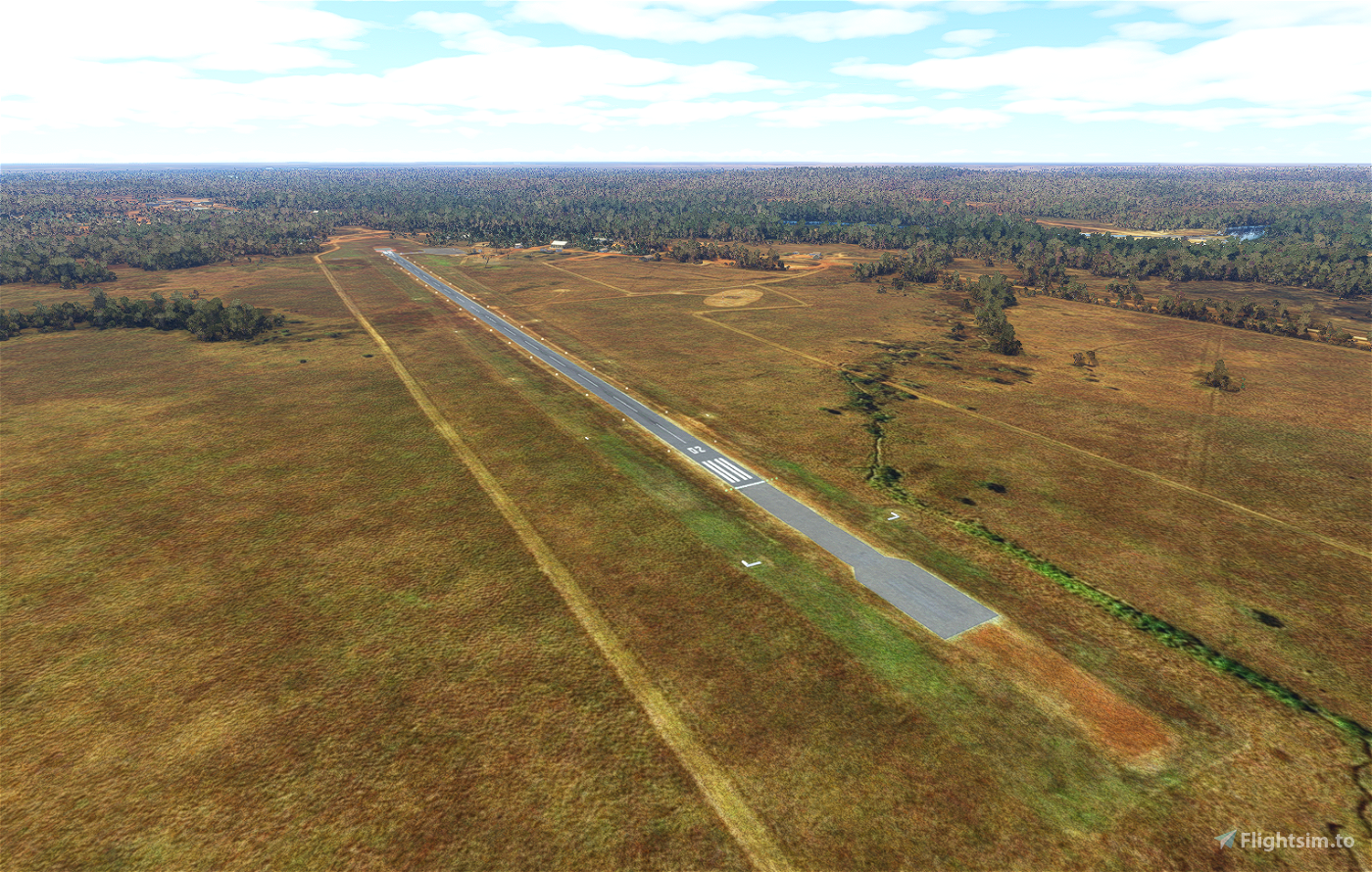
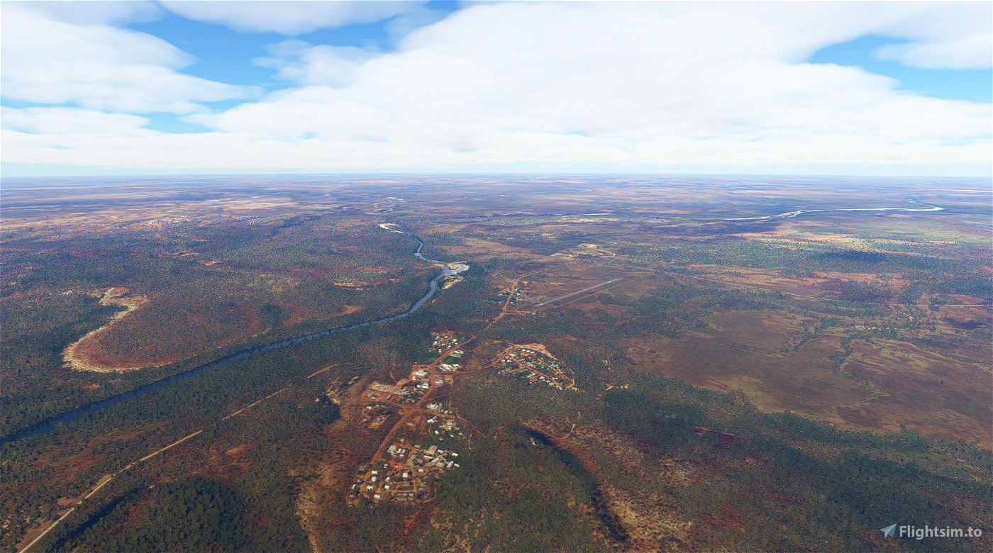
Borroloola Airport is a small public airport owned by the Government of the Northern Territory and serving the outback town of Borroloola. The airfield and town sit approximately 490km west of Burketown, 460km SE of Katherine, and 1055km SE of Darwin. Borroloola has no scheduled commercial flights, but handles plenty of charter and medical flights. It is busiest during the wet season, when Highway One floods in much of the Barkly Tablelands, making access by road difficult or impossible. Katherine Aviation bases at least one aircraft at the airport year-round to service charters for scenic, personal transport, medical, and relief flights. Flights over the Sir Edward Pellew Islands and other interesting points along the coast are popular scenic destinations.
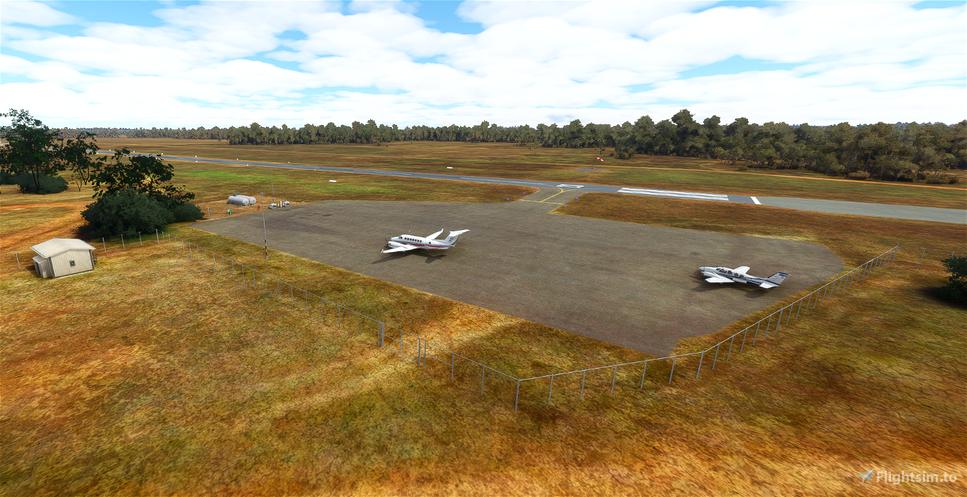
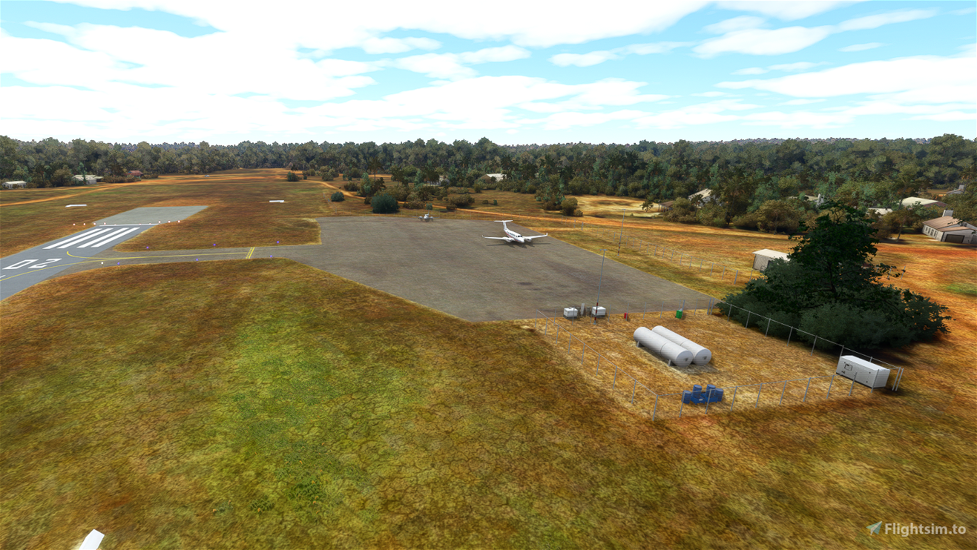
The main focus here was to add the apron that was visible in the satellite imagery but hadn't been autogenerated, and genereally touch up the scenery. This scenery uses all stock assets, you don't need to download anything else for it to work.
Version 1.0:
- Corrected runway material, added edge lighting and custom runway markings
- Fixed windsock location and pad
- Added gables and cones around runway
- Added apron, taxiway lighting, and painted lines
- Added parking locations on the apron
- Added the fuel area on the south side of the apron
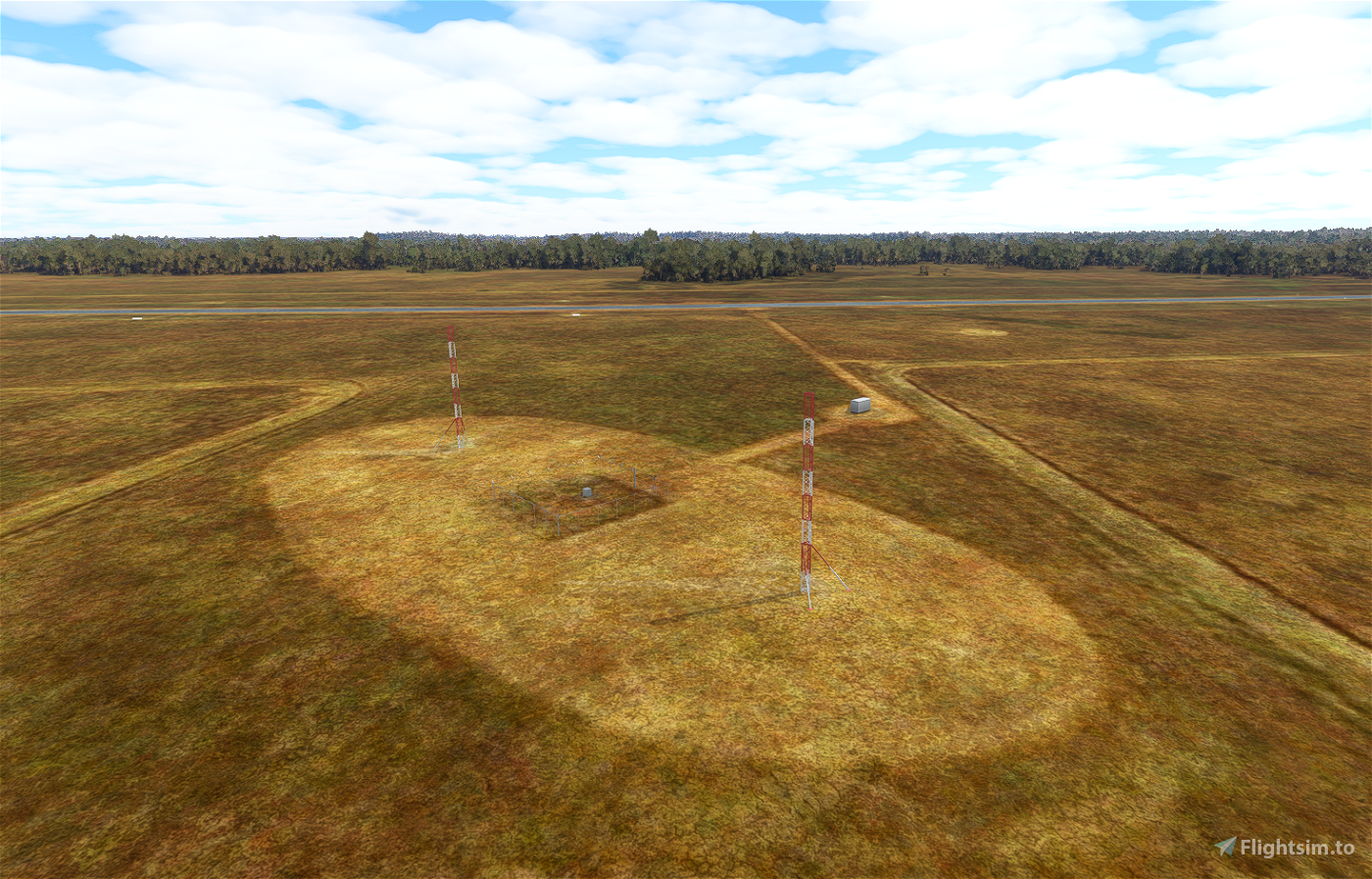
- Added the NDB masts and associated equipment on the east side of the field
- Removed blurry autogen roads near the airport
- Removed airport service vehicles
- Removed trees from some of the roads
- Misc. scenery and vegetation fixes/additions
Known Issues:
- No perimeter fence until Asobo adds a fence tool
- Ground texture issues
If I've overlooked anything or you have any suggestions, please leave a comment.
Thanks, and enjoy!

 kliff0rd


conan222
Thanks for this.