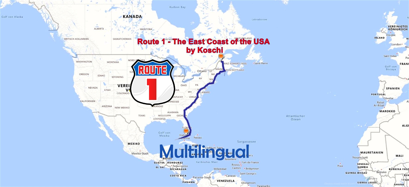


Discover the East Coast of the USA on the legendary Route 1
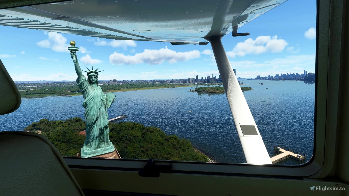
U.S. Highway 1 (also U.S. Route 1 or US 1) is a highway that runs along the U.S. East Coast. The total length is 2077 nautical miles (3846 kilometers). In the north, the highway ends at Fort Kent, in Maine, on the Canadian border. In the south, it is Key West on Florida's coast to the Gulf of Mexico. U.S. Route 1 runs parallel to U.S. Highway 95 in many places, and was initially established in 1926 only between the Canadian border and U.S. Highway 94 in Miami. For this reason, along with Route 66, it is one of the legendary highways of the United States.
The highway is numbered 1 because it is the most easterly and north-south highways are numbered from east to west.
Specification:
- The flight includes 8 legs over 2077 NM.
- The aircraft can be exchanged with some manual work. See exchange file. Preset is the Cessna Skyhawk G1000. Alternatively, there is also the MissionChanger from BuffyGC.
- The package is multilingual in the languages: English US, Spanish, French, Italian, Polish, Portuguese, Portuguese BR, Russian, Dutch, Finnish, Norwegian and Swedish. The basic language is German. The other languages are machine translated, so there may be errors in the translation. If you have a better translation, please send it to me.
- For all waypoints there is an English voice output (TTS) with many explanations and description of the route. All this can be read in the NAVLOG.
- The weather is freely selectable, the button "loading and refueling" is available at airports with refueling station, ATC and GPS are usable but the flight route is not available in the GPS.
- The POI's are unfortunately no longer visible in bush trips since SU5.
- An LNMPLN file, for Little Navmap (LNM), is included in the package.
Flight tips:
- This bushtrip is a real challenge to all experienced bushpilots, if either no other aids or a roadmap, like Open Streetmap or Google Maps are used, which can be a good help in bigger cities. Otherwise, Route 1 is easy to follow, especially along the coasts.
- If you want to make it a little easier, you can use the G1000 and enter there the airfields that are close to the route. Of course it is very easy if you use LNM as a tool. But then it is not a real bushtrip anymore. The LNMPLN file is normally meant for people who just want to fly the route before or after, because unfortunately with bushtrips no change of the simulation rate is possible. However, the course does not follow the road exactly, but only connects the next waypoint on the shortest way.
- The recommended altitude is 1,000 - 2,000 ft above terrain.
Have a good flight.
Created with BushTripInjector by BuffyGC.
Recommended AddOns:
All 29 New York Bridges - Sample by mngydg
Daytona International Speedway by kjpwv
Fenway Park, Boston MA USA by FreakyD
Gillette Stadium by kjpwv
Nationals Park, Washington, DC (2015 Winter Classic) by kjpwv
RFK Stadium, Washington, DC by kjpwv
Sun Life Stadium by Urbanhunterdva
Empire State Building by Chris Neese
Hudson Yards by VFXSimmer
Kennedy Space Center by Acktu
Miami Star island Home Scene by foufou
New York, Twin Towers World Trade Center before 200 NY by andre85
Shearon Harris Nuclear Plant by mhcrowder
The Guitar Hotel at Seminole Hard Rock by Acktu
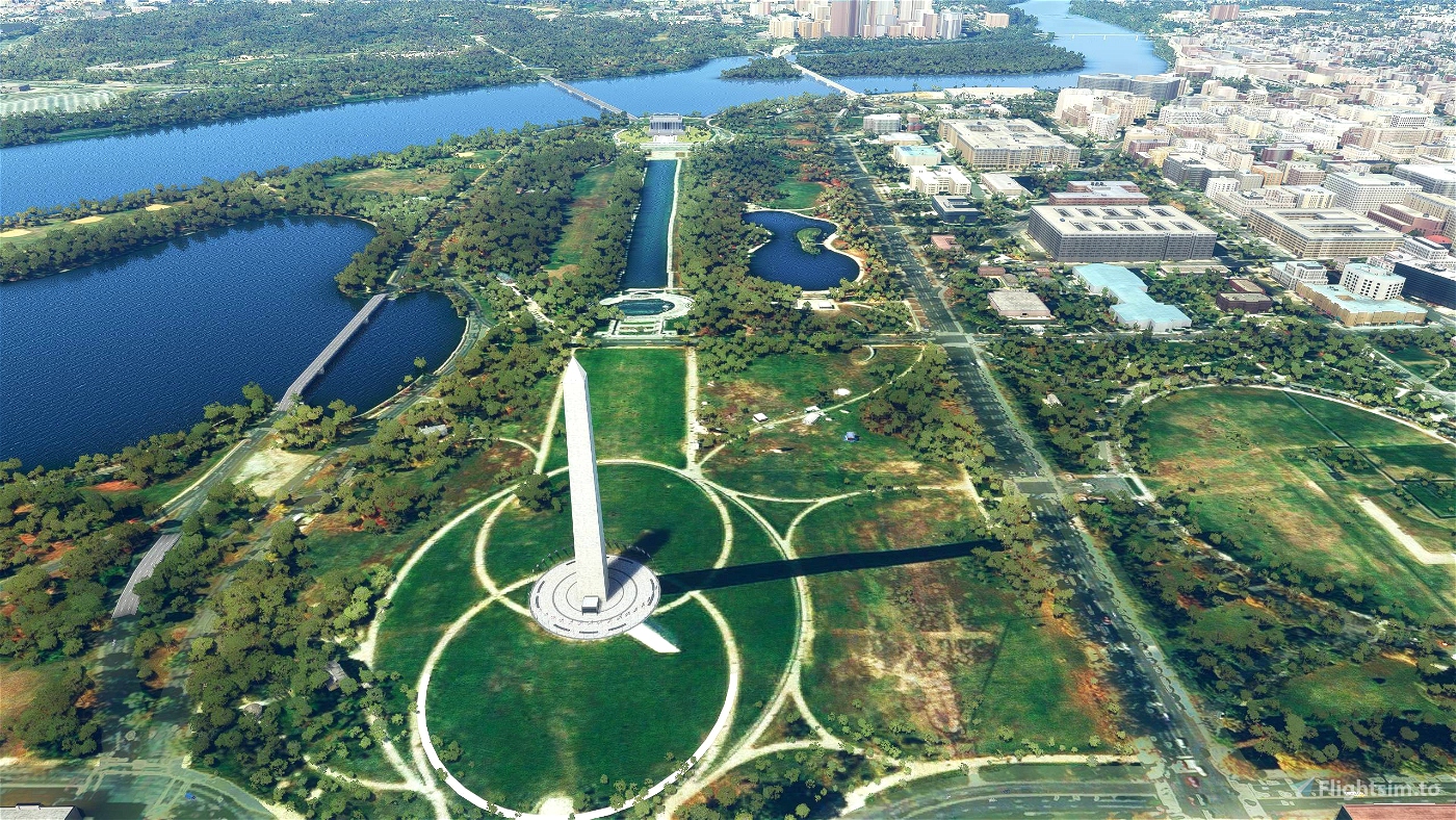
Washington, D.C. Monuments by w3wym
Fix for annoying building on the DC mall by BufordTX
TIMES SQUARE NYC by Noshadez
USS Constitution, Boston MA USA by FreakyD
NYC Financial District by Expertise
NYC Midtown by Expertise
Washington DC Landmarks Pack by srinivasman
World Trade Center New York City [WTC1 & WTC2 from 2001 and before] by LeRoi
KLGA LaGuardia Airport + NYC Bridge Improvement by srinivasman
Auf der legendären Route 1 die Ostküste der USA entdecken
Der U.S. Highway 1 (auch U.S. Route 1 oder US 1) ist ein Highway, der entlang der US-Amerikanischen Ostküste verläuft. Die Gesamtlänge beträgt 2077 Nautische Meilen (3846 Kilometer). Im Norden endet der Highway in Fort Kent, in Maine, an der kanadischen Grenze. Im Süden ist es Key West an Floridas Küste zum Golf von Mexiko. Die US Route 1 verläuft an vielen Orten parallel zum U.S. Highway 95. Festgelegt wurde sie 1926 zunächst nur zwischen der kanadischen Grenze und dem U.S. Highway 94 in Miami. Von daher zählt er, neben der Route 66, zu den legendären Highways der USA.
Der Highway trägt die Nummer 1, weil er der am östlichsten gelegene ist und Nord-Süd-Highways von Ost nach West nummeriert werden.
Spezifikation:
- Der Flug beinhalltet 8 Legs über 2077 NM.
- Das Flugzeug kann mit etwas Handarbeit ausgetauscht werden. Siehe Exchange-Datei. Voreingestellt ist die Cessna Skyhawk G1000. Alternativ gibt es dazu auch den MissionChanger von BuffyGC.
- Das Paket ist multilingual in den Sprachen: Englisch US, Spanisch, Französisch, Italienisch, Polnisch, Portugiesisch, Portugiesisch BR, Russisch, Niederländisch, Finnisch, Norwegisch und Schwedisch. Die grundlegende Sprache ist deutsch. Die anderen Sprachen sind maschinell übersetzt, darum können Fehler in der Übersetzung enthalten sein. Wer eine bessere Übersetzung hat, kann sie mir bitte schicken.
- Zu allen Wegpunkten gibt es eine englische Sprachausgabe (TTS) mit vielen Erklärungen und Beschreibung der Route. Das alles ist im NAVLOG nachlesbar.
- Das Wetter ist frei wählbar, der Button „Beladung und Tanken“ ist an Flughäfen mit Tankstelle verfügbar, ATC und GPS sind nutzbar aber die Flugroute ist nicht im GPS vorhanden.
- Die POI's sind seit dem SU5 in Bush-Trips leider nicht mehr zu sehen.
- Eine LNMPLN-Datei, für Little Navmap (LNM), ist im Paket enthalten.
Flugtipps:
- Dieser Bushtrip ist eine echte Herausforderung an alle erfahrenen Bushpiloten, wenn entweder keine weiteren Hilfsmittel oder eine Straßenkarte, wie Open Streetmap oder Google Maps verwendet werden, die in größeren Städten eine gute Hilfe sein können. Ansonsten ist der Route 1, gerade an den Küsten, gut zu folgen.
- Wer es sich etwas leichter machen möchte, kann das G1000 nutzen und dort die Flugplätze eingeben, die dicht an der Strecke liegen. Ganz einfach geht es natürlich, wenn man LNM als Hilfsmittel benutzt. Aber dann ist es schon kein echter Bushtrip mehr. Die LNMPLN-Datei ist normalerweise für Leute gedacht, die vorher oder nachher einfach nur die Strecke abfliegen möchten, da bei Bushtrips leider keine Veränderung der Simulationsrate möglich ist. Der Kurs folgt aber nicht genau der Straße, sondern verbindet lediglich auf kürzestem Weg den nächsten Wegpunkt.
- Die empfohlene Flughöhe beträgt 1.000 – 2.000 ft über Terrain.
Habe einen guten Flug.

 Koschi


sirbruce
Not sure if this is due to the latest SU but the bush trip will not trigger when landing at KBCT. Yes, I've shut down all avionics and battery and applied the parking brake. I've tried developer mode as well and it still won't trigger. Also, there's the flight plan doesn't show in the GPS, which is a bit annoying even though, yes, it's a VFR flight. Can you please release an update to address these issues?
sirbruce
Quick update, by restarting the leg, not turning the aircraft on, and then using dev mode to teleport to the next airport, I was able to get it to trigger, but I had to wait like a minute before it finally recognized that I had landed. However, I tried to fly the second leg and had the same issue; once you land and turn everything off it still won't register the landing. However, if you teleport the plane without ever turning anything on, it registers... eventually.
2 years ago
Stravinsky42
I changed the aircraft to the Bonanza G36 improvement proj. After flying the first leg, and shutting down everything I could, incl setting the parking break, I did not get the completion message. So I don't know what to do now.
Koschi author
Hello Stravinsky42,
hmmm ... this should work if engine, battery, avionics are switched off and the handbrake is applied. The Bonanza has 2 battery main switches. They both need to be off. Otherwise stand on the runway and try again there.
2 years ago
FndrStrat06
This looks like fun! Thanks for the instructions on changing the aircraft!
Koschi
In der ersten Version funktionierten TTS und POIs nicht. Der Fehler ist behoben. Bitte die neue Datei herunterladen und die SAVE-Dateien im Ordner .\LocalState\MISSIONS\ACTIVITIES vom begonnenen Trip löschen.
#########
In the first version, TTS and POIs did not work. The bug is fixed. Please download the new file and delete the SAVE files in the .\LocalState\MISSIONS\ACTIVITIES folder from the started trip.