KLCH-Lake Charles Regional Airport - Located 05 miles S of Lake Charles, Louisiana on 1878 acres of land.
Surveyed Elevation is 14 feet MSL.
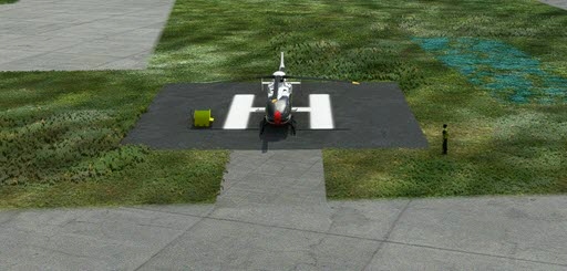
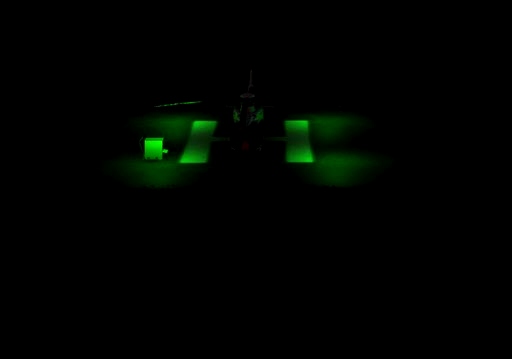
- added two helipads with lights
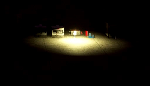
- added lights for the fuelstations 2 of them
The lights for the helipads came from a library: EDHK Lights & Objects Developers Pack. Here is the link to get that.
https://flightsim.to/c/scenery/libraries/
Services Available
Fuel: 100LL (blue), Jet A-1+
Transient Storage: Hangars,Tiedowns
Airframe Repair: MAJOR
Engine Repair: MAJOR
Bottled Oxygen: NONE
Bulk Oxygen: NONE
Other Services: AIR FREIGHT SERVICES,AVIONICS,CHARTER SERVICE,PILOT INSTRUCTION,AIRCRAFT RENTAL
Nearby Airports with Instrument Procedures
ID Name Heading / Distance
Chennault International Airport KCWF Chennault International Airport 039° 6.6
Southland Field Airport KUXL Southland Field Airport 272° 8.0
Welsh Airport 6R1 Welsh Airport 071° 21.6
De Quincy Industrial Airpark Airport 5R8 De Quincy Industrial Airpark Airport 325° 22.9
Jennings Airport 3R7 Jennings Airport 076° 29.4
Orange County Airport KORG Orange County Airport 263° 30.4
Jack Brooks Regional Airport KBPT Jack Brooks Regional Airport 256° 42.8
Beauregard Regional Airport KDRI Beauregard Regional Airport 351° 42.7
Eunice Airport 4R7 Eunice Airport 063° 46.3
Allen Parish Airport KACP Allen Parish Airport 036° 46.5
Beaumont Municipal Airport KBMT Beaumont Municipal Airport 266° 51.7
Hawthorne Field Airport 45R Hawthorne Field Airport 283° 55.2

 rcla39652


MrMo
Hello
Thanks for using my EDHK Developers Pack . You can also use my modeled Helipad FOTA, TLOF and Flood lights.
For this type into the object console the following keywords to find them:
Helipad_TLOF
Helipad_FOTA
Helipad_Flood
They are available in different strengths.