This is a simple, fictional Seaplane Base located at Yap Island in Indonesia. It is to serve as a possibility to round the world in seaplanes and flying boats, if and when more of them finally are coming to the simulator. Other packages will be uploaded to complete a network of Seaplane Bases so that the lack of such in MSFS will be remedied.
The ICAO-codes of those bases are made up. They consist of SP for Seaplane and a consecutive number which does not correspond in any way with the location. For example Wake Island Seaplane Base becomes SP02, Saipan Seaplane Base (Flores Point/Tanapag) will be SP03 and so forth. They are marked as star airports so as to be easy to find.
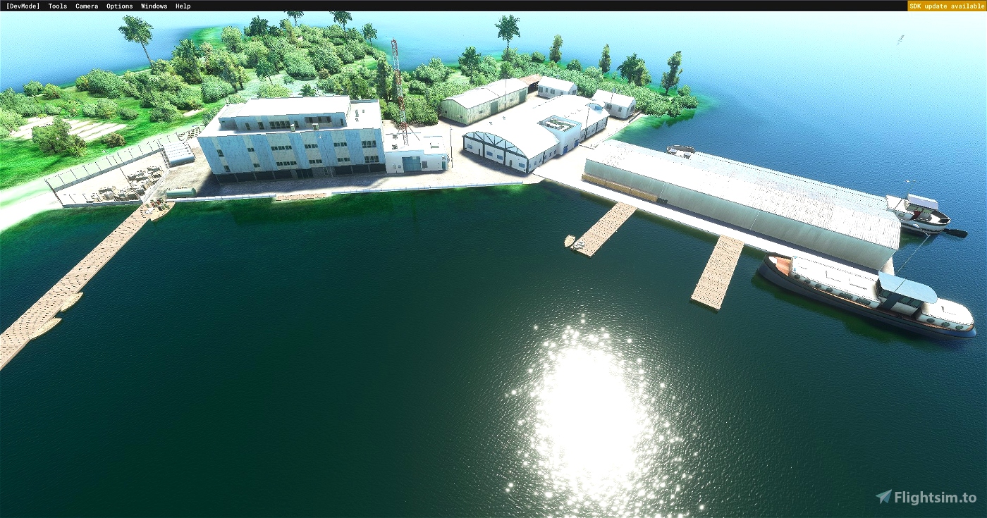
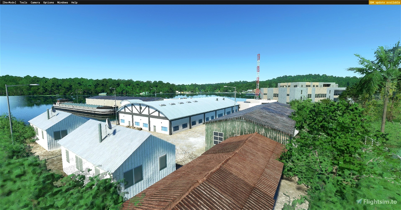
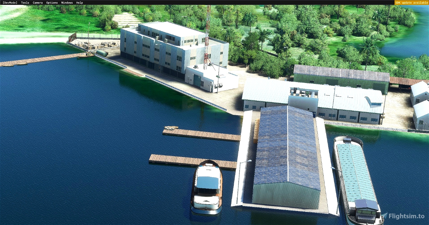
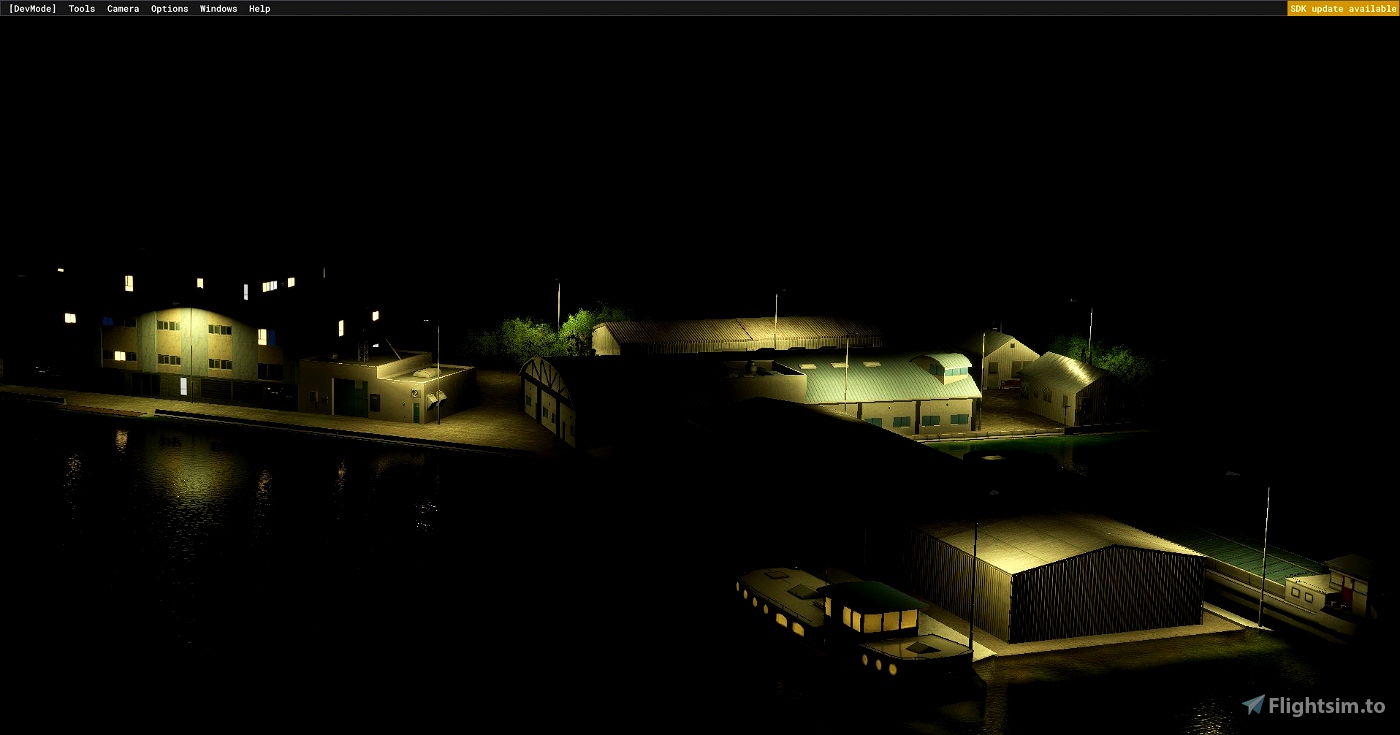
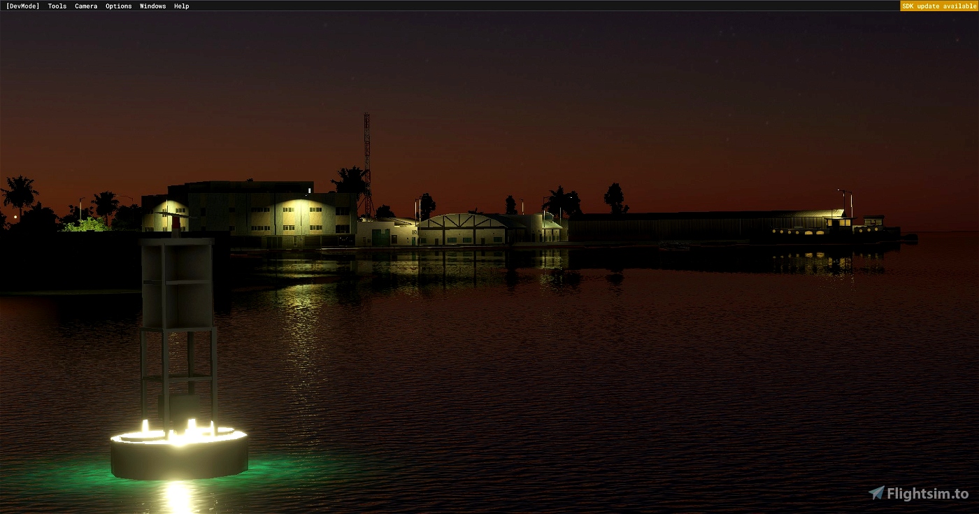
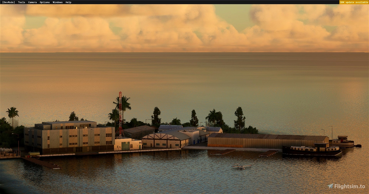
This package consists of a water runway approximatley 3200m in length. There are also parking docks. Lighting is provided by a beacon and runway marking buoys.
Installation is as follows: Just copy the package Folder inside the .zip into the community folder of MSFS.

 No4124485


RF86_kojak
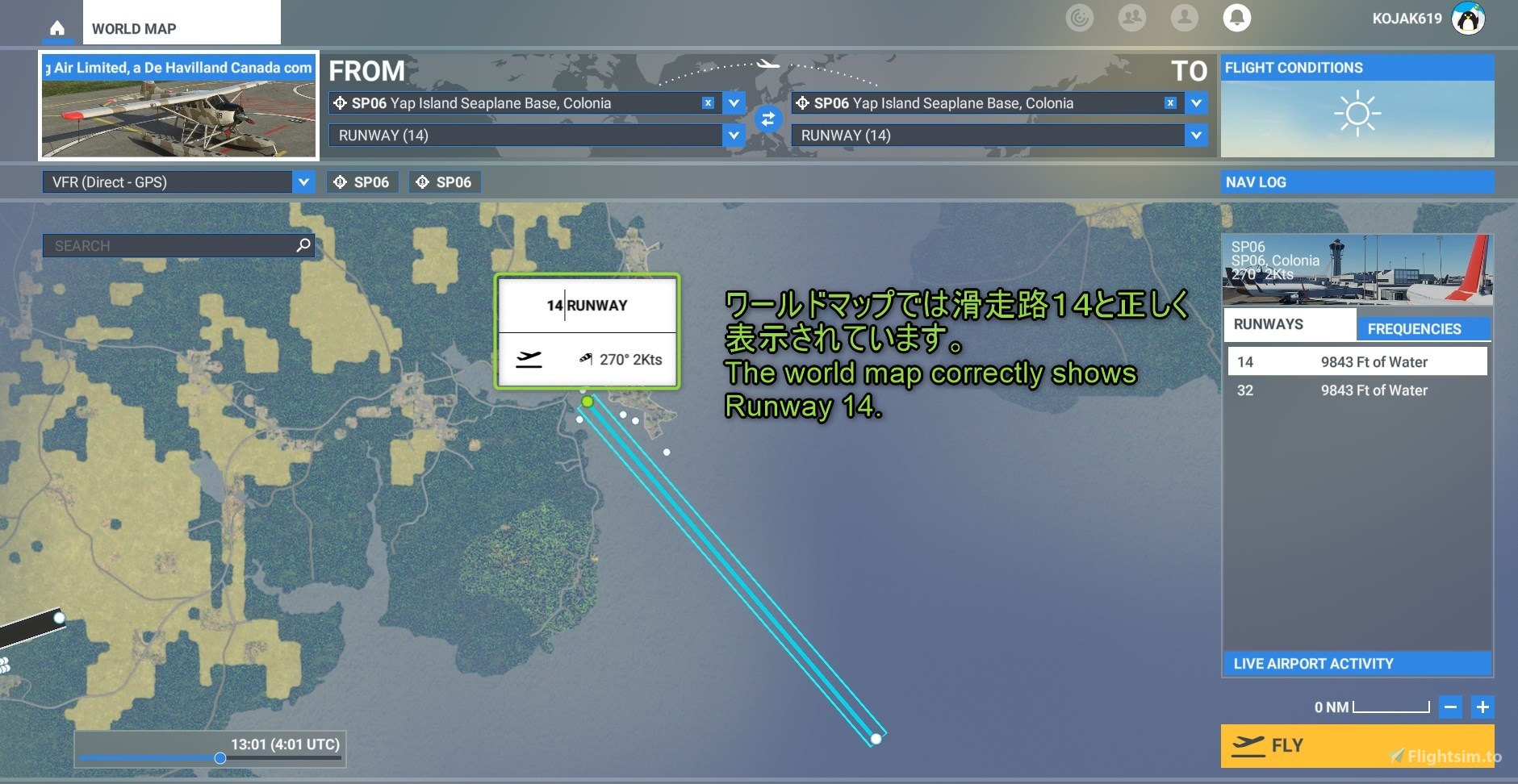
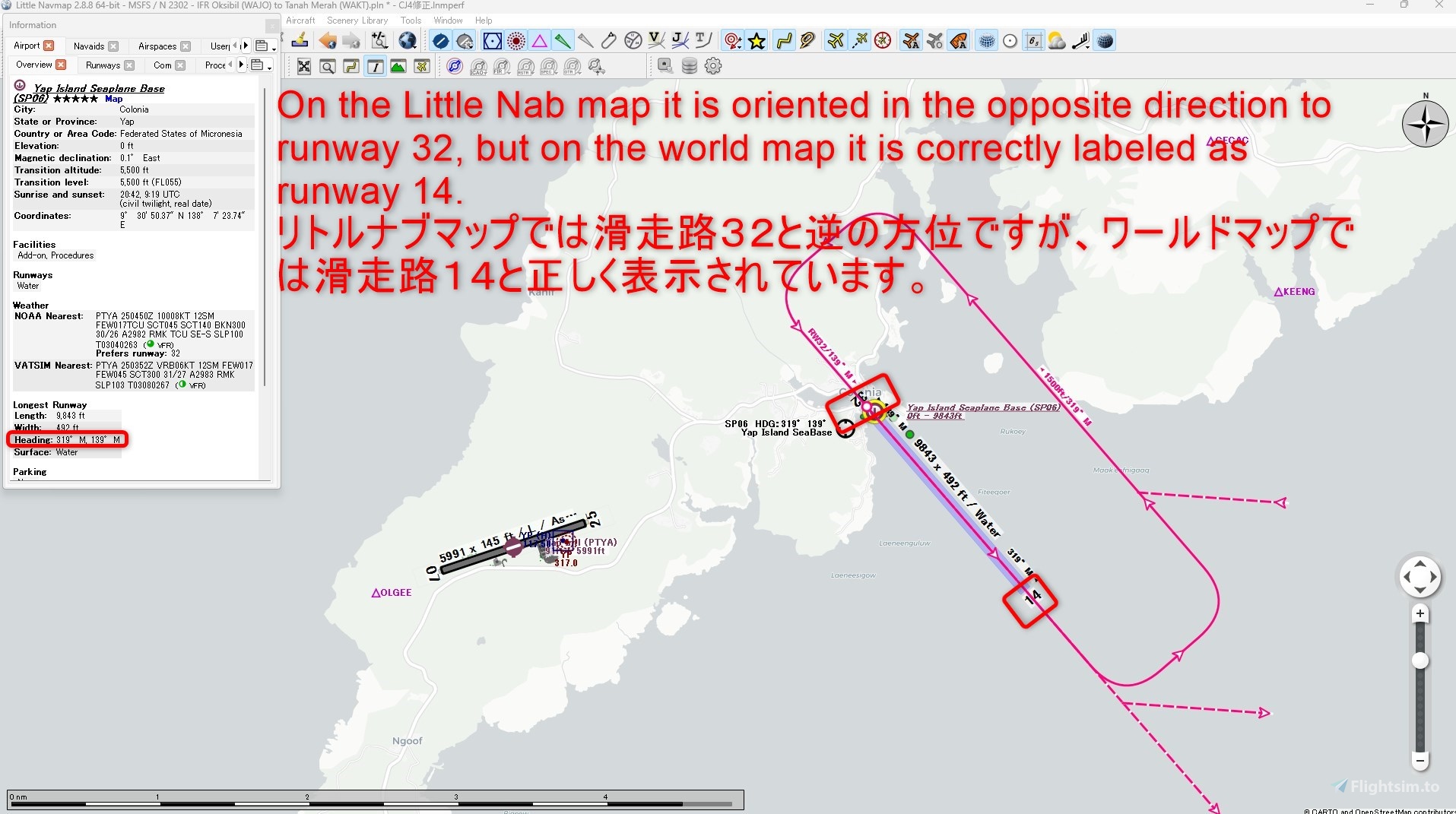
リトルナブマップでは滑走路32と逆の方位ですが、ワールドマップでは滑走路14と正しく表示されています。
On the Little Nab map it is oriented in the opposite direction to runway 32, but on the world map it is correctly labeled as runway 14.
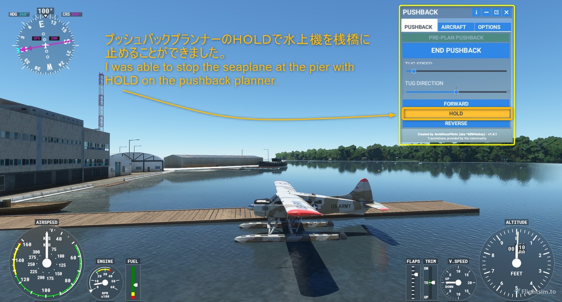
プッシュバックプランナーのHOLDで水上機を桟橋に止めることができました。
I was able to stop the seaplane at the pier with HOLD on the pushback planner.
水上飛行場を作成されたことに感謝申し上げます。LNMは補助的に使うのでさほど気にしません。
Thank you for creating the Seaplane Airfield. I don't really care about LNM because I use it as a supplement.
No4124485 author
I have no idea why on LNM it is designated the other way around. I am not so deep in the particularities of how all the programs process the data. Also I have found that the MSFS SDK makes the opposite of a "northwest" designated runway a "northeast" one instead of "southeast". That is too much for me, I just want to give you some seaplane bases :(
1 years ago