Uapishka Station and Mounts Groulx scenery
Quebec, Canada
ICAO code (fictitious): CMN7
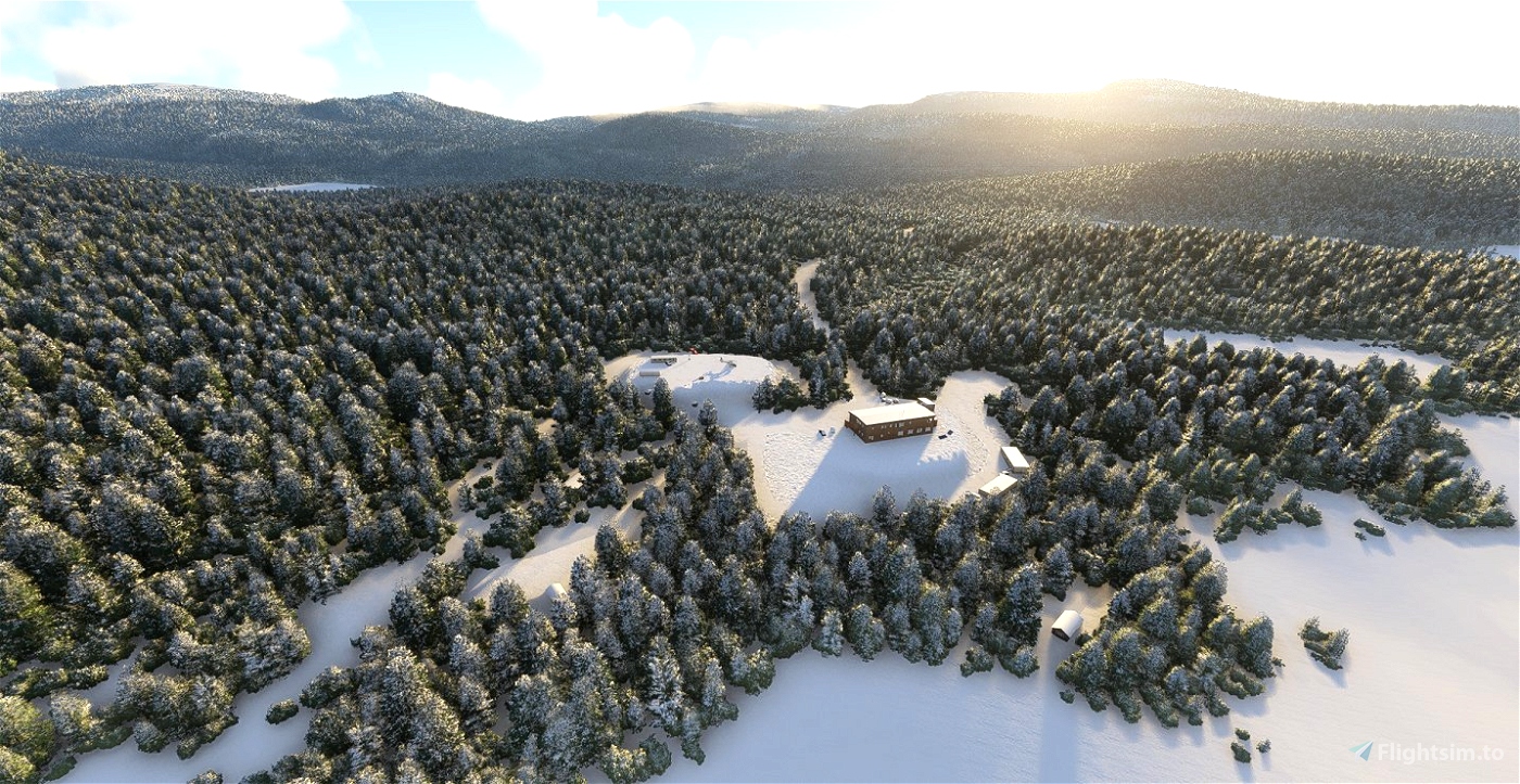
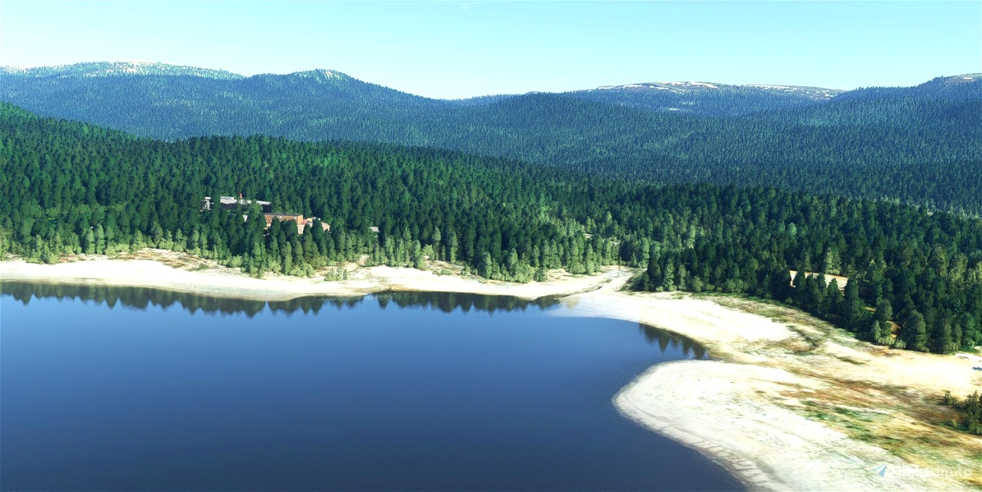
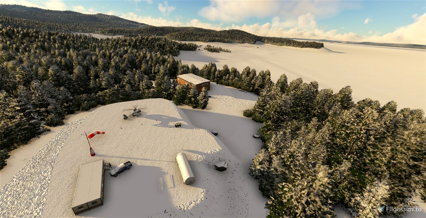
This scene represents the Uapishka station, a station dedicated to northern and aboriginal tourism as well as research, located on the edge of the Manicouagan crater lake. The station is co-managed with the Innu Council of Pessamit and the Manicouagan-Uapishka World Biosphere Reserve (UNESCO). The station shares the Innu culture and values so that visitors leave with a better understanding of this cultural heritage. The joint venture is also involved in the management of the Uapishka Biodiversity Reserve, a protected area located East of the Groulx mountains, managed in consultation with the community by the Government of Quebec.
For more information: https://www.stationuapishka.com/about-us
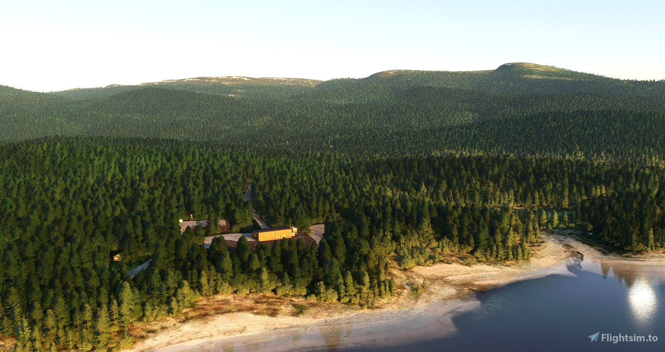
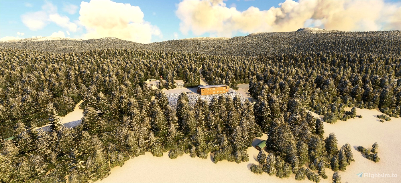
The scene includes most of the infrastructures present on the station map: https://www.stationuapishka.com/our-maps
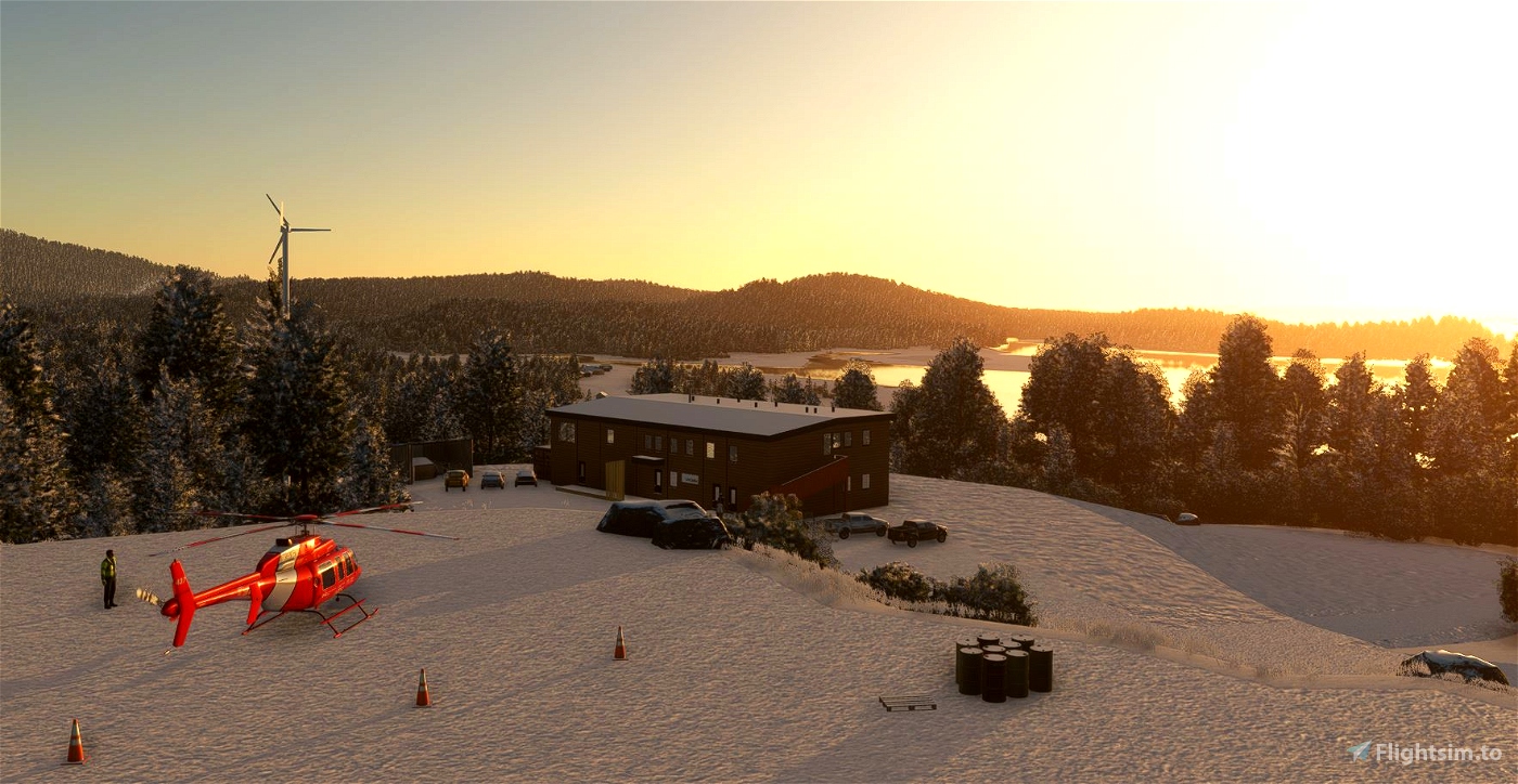
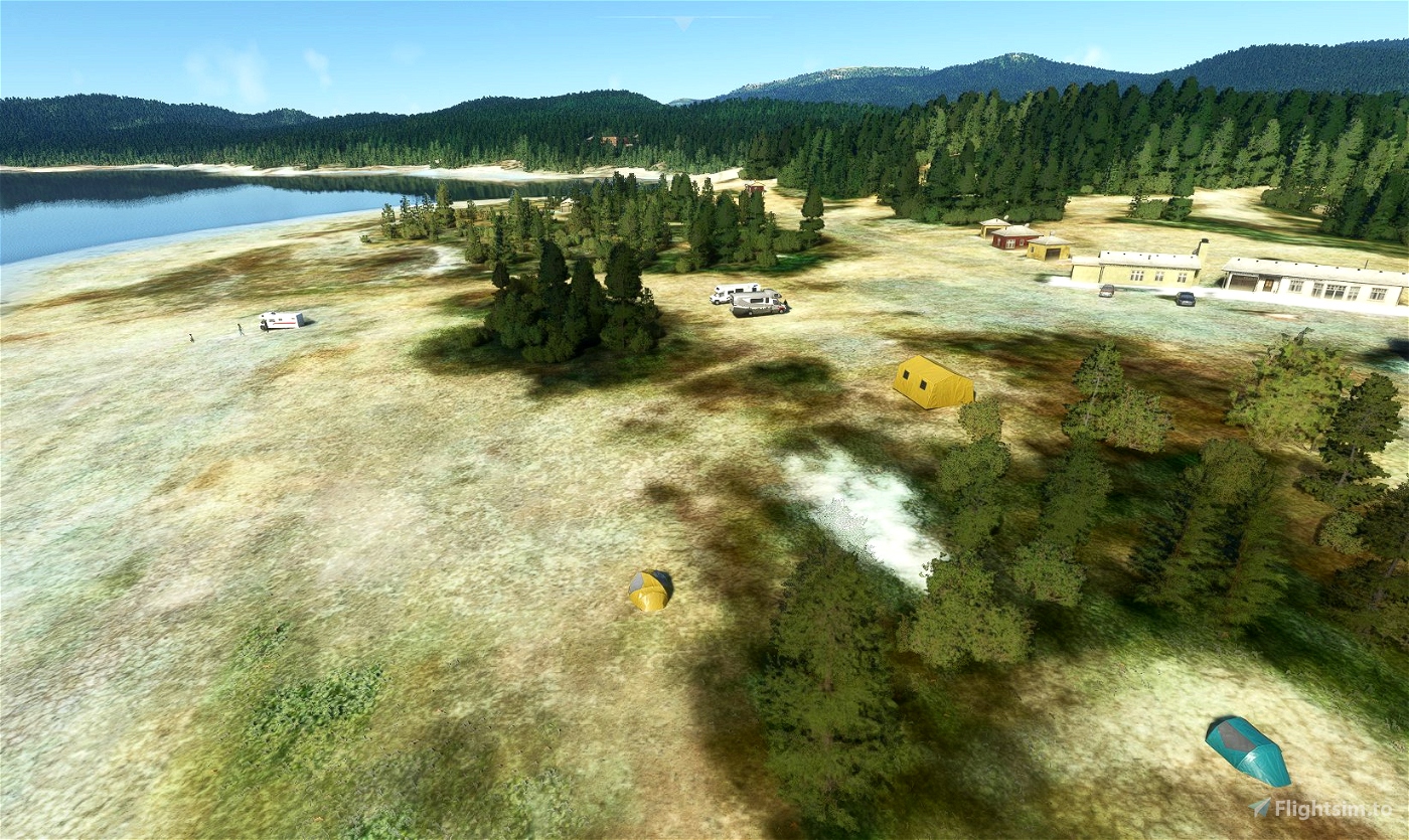
- The main building
- Related buildings and chalets for rent
- Camping and campers
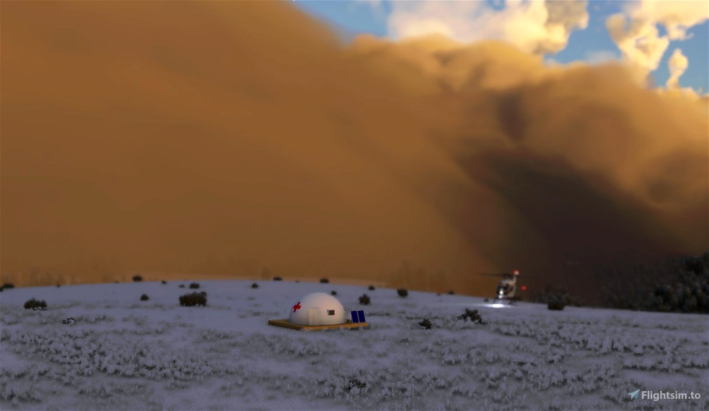
- The helipad
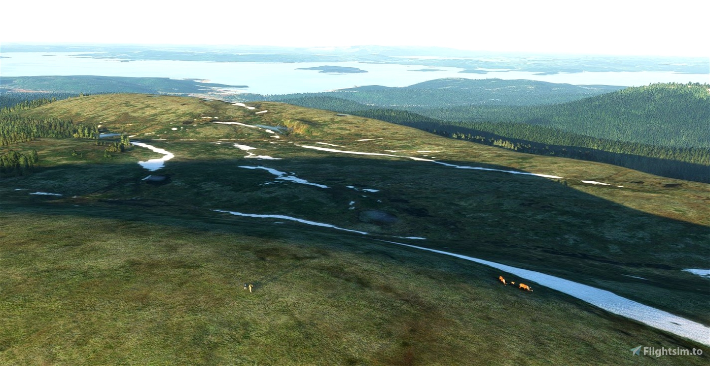
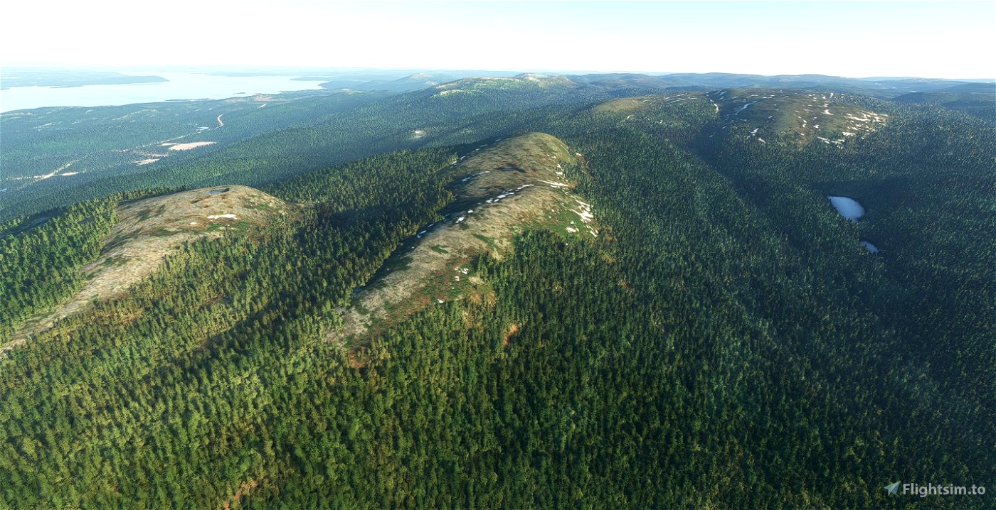
- The emergency shelter located on the Monts Groulx to the east of Mont Veyrier
- The Mont Veyrier antenna and the weather station near the emergency shelter
- The Quintin lake refuge
- Walkers and caribou on Mont Provencher
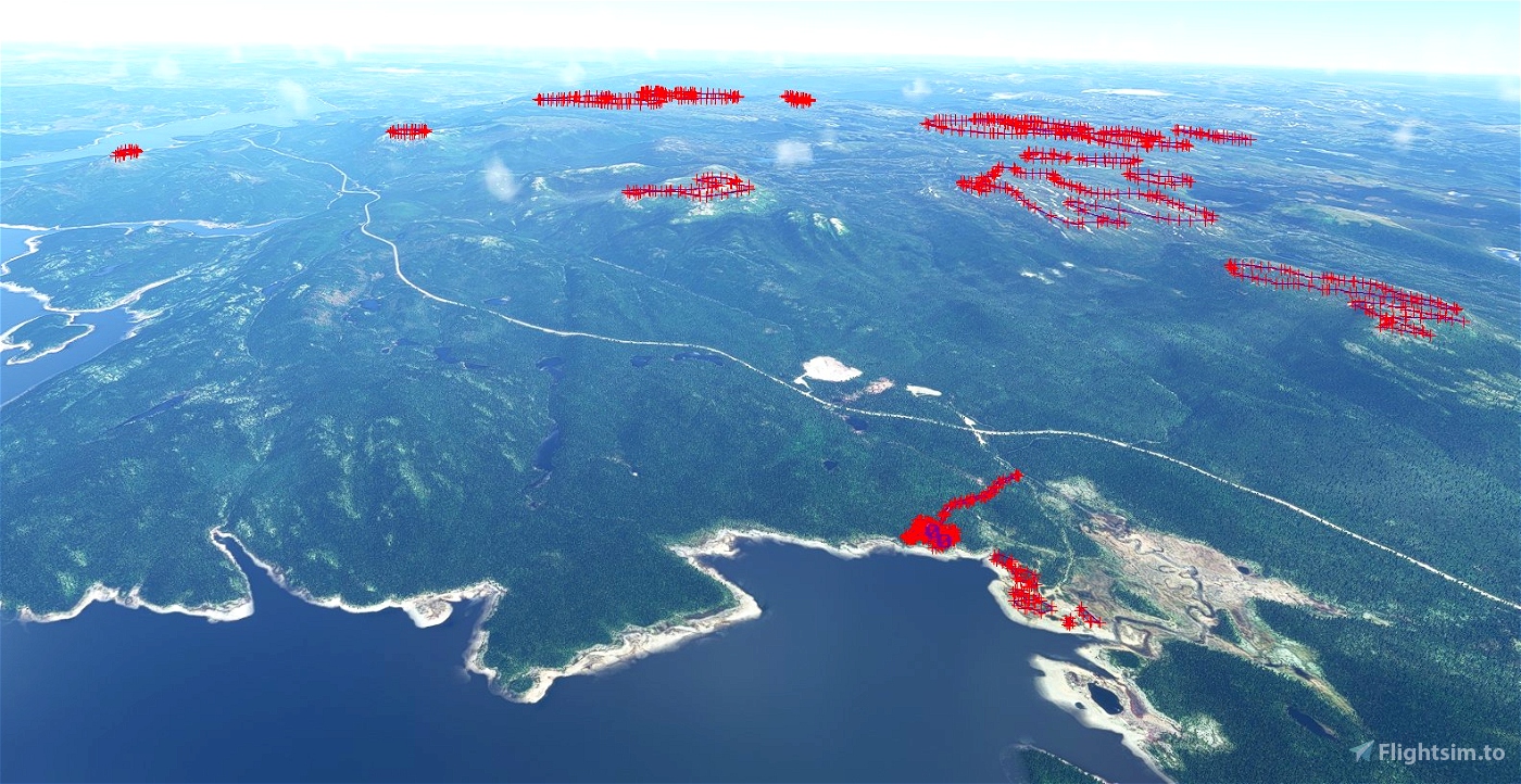
- The removal of trees from the summits of Monts Groulx and Mont de Babel (Île René-Levasseur)*
- Vehicles in the various remote parking lots at the start of the trails
- The station's two wind turbines have not been integrated
A water runway has been added to get access to the scenery with a floatplane.
The following libraries will allow you to see people, animals and campers. Many thanks to these authors.
- daves3danimals: https://flightsim.to/file/6841/dave-s-3d-animals-library
- library daves3dpeople: https://flightsim.to/file/5452/dave-s-3d-people-library
- Library-deltatango-camper: https://flightsim.to/file/12386/camper-library
* More trees should be removed to better represent the state of Monts Groulx. However, this would make the demarcation between treeless areas more evident. The approach used was to widen the default treeless areas to take advantage of the simulator's more natural transition.
Installation: put the folder «gplamondon-airport-cmn7-station-uapishka» in your Community folder.
________________________________________________________________________
Scène de la Station Uapishka et des monts Groulx
Québec, Canada
ICAO code (fictif): CMN7
Guillaume Plamondon, 2022
Cette scène représente la station Uapishka, un lieu dévoué au tourisme nordique et autochtone ainsi qu'à la recherche, situé au bord du lac du cratère Manicouagan. La station est en cogestion avec le Conseil des Innus de Pessamit et la Réserve mondiale de biosphère Manicouagan-Uapishka (UNESCO). On y partage la culture Innue afin que les visiteurs repartent avec une meilleure compréhension de cet héritage culturel. La coentreprise est aussi impliquées dans la gestion de la Réserve de biodiversité Uapishka, une aire protégée gérée située à l'Est des monts Groulx, gérée en concertation avec le milieu par le gouvernement du Québec.
Pour plus d'information : https://www.stationuapishka.com/a-propos
La scène inclue l'essentiel des infrastructures présentes sur la carte de la station: https://www.stationuapishka.com/cartes
- Le bâtiment principal et ses annexes
- Les bâtiments connexes et chalets en location
- Le camping et des roulottes
- Le hélipad
- L'abri d'urgence situé sur les monts Groulx à l'Est du mont Veyrier
- L'antenne du mont Veyrier et la station météo près de l'abri d'urgence
- Le refuge du lac Quintin
- Des marcheurs et caribous sur le mont Provencher
- Le retrait d'arbres sur les sommets des monts Groulx et du mont de Babel (Île René-Levasseur)*
- Des véhicules dans les différents stationnements éloignés au départ des sentiers
- Les deux éoliennes de la station n'ont pas été intégrées
Une piste sur l'eau a été représentée pour permettre l'accès à la scène avec un hydravion.
Les librairies suivantes vous permettront de voir des personnes, animaux et roulottes. Merci à ces auteurs.
- daves3danimals : https://flightsim.to/file/6841/dave-s-3d-animals-library
- library daves3dpeople : https://flightsim.to/file/5452/dave-s-3d-people-library
- Library-deltatango-camper : https://flightsim.to/file/12386/camper-library
* Plus d'arbres devraient être retirés pour mieux représenter l'état des monts Groulx. Cependant, ceci rendrait plus évidente la démarcation entre les zones sans arbres. L'apporche utilisée a été d'élargir les zones sans arbres par défaut afin de profiter de la transition plus naturelle produite par le simulateur.


ECPatterson
Scène très réussie. Les modèles des bâtiments sont fidèles. J'ignorais qu'il y avait un heliport! Dans une prochaine version, j'apprècierais beaucoup l'ajout d'un marqueur d'hydrobase dans la baie (autour de 51° 28' 7,13" N 68° 14' 18,94" W) pour qu'on puisse y décoller. Un cub y a attéri quand j'y faisais du kayak avec la famille. Aussi, si possible, des textures un peu plus nuancées pour les bâtiments et les chemins seraient de belles améliorations car on a tendance à voler bas dans cette région... 😊
Gouaill author
Merci ! Je travaille à ajouter la piste sur l'eau pour un départ en avion plus convivial en été ou hiver. À venir sous peu.
2 years ago
ECPatterson
Génial! J'y étais l'été dernier. Bien hâte de voir ça dans la sim. Merci!
jim007
Great to have a such scenery in this remote place - many thanks !
PS : About this area, for anyone who would like to a have round trip, some views in the following post I made for Orbx forum a few years ago ...
https://forum.orbxdirect.com/topic/187930-something-different-8-part-6c-a-few-memories-of-tioralak-inuit-bush-pilot-in-southern-labrador/
Gouaill author
Interesting post indeed! I like to fly in this region too and have some landing strip made to land here and there inspired from real life (pic Pyramide and head of Koroc river where DHC6 land for mount Iberville climbers). Hoping MSFS will improve photo coverage in these lands since a lot is FSX style coverage.
2 years ago