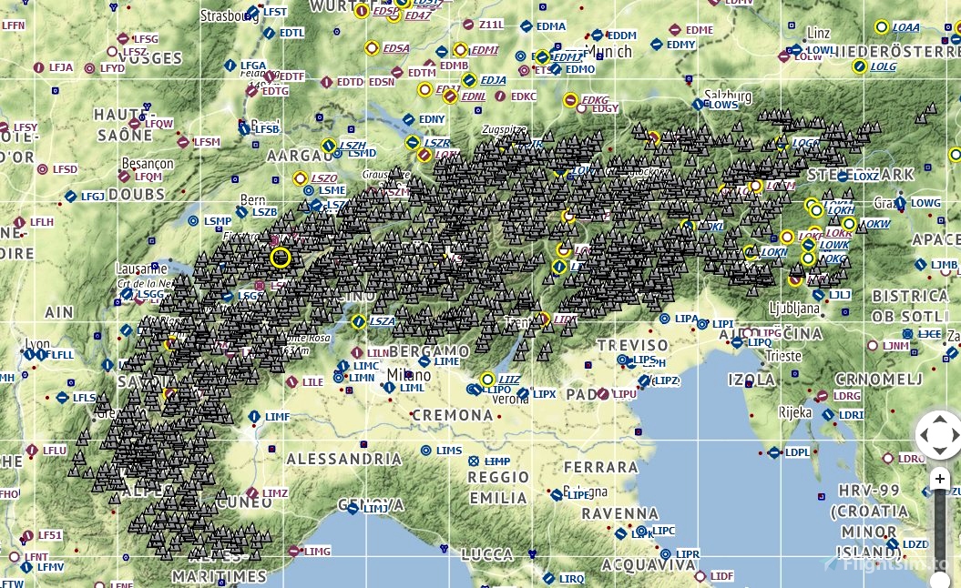
CSV files to be imported into Little NavMap to show the names altitudes of all Alp peaks above 2000 m. In case you don't want to import all of them in one go, I've created subsets in 500 m and 1000 m steps.
Reviews
There are no reviews yet.
Comments
Pretty empty over here.

cctvgrant1
How the hell do you add them to it though Instructions?
Scooty
This sounds like a great idea, thanks for this one!
Is it possible, to also create something with your data, to create POIs to see them ingame?
Best would be to also split them into packages of maybe each 1000m, like "package1 = 0-999m", "package2 = 1.000-1.999m", ... to maybe just use the higher/highest peaks of a region.
I think, ingame POIs would round up your project to perfection.
😊
Flyrex author
Servus Scooty....eine neue Herausforderung und gute Idee, die ich mir mal anschauen muss, ob und wie das geht. Danke fuer den Hinweis...
2 years ago