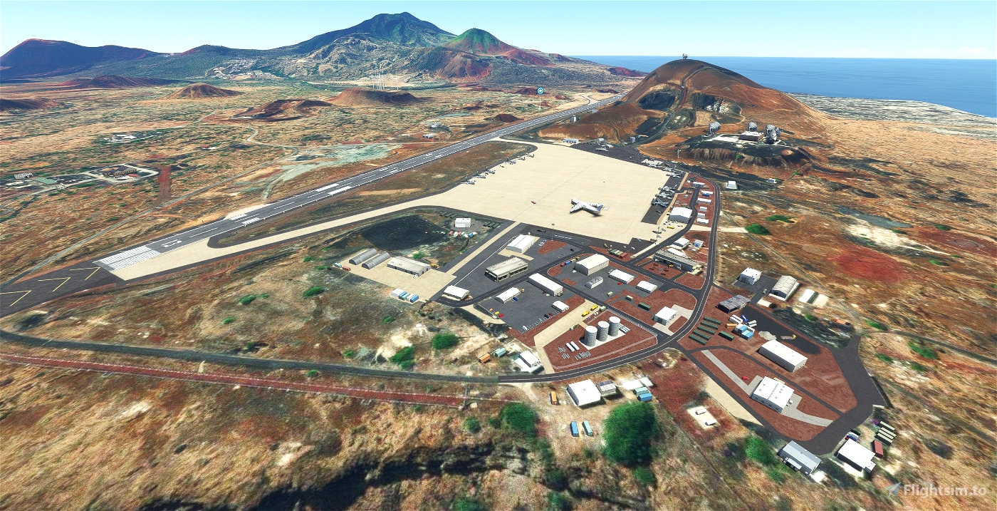
This is an upgrade of FHAW - RAF Ascension Island/ Wideawake Airfield.
Owned by the Brits. Run by the Americans. The main stuff that seems to come through here is big stuff on its way somewhere else. Fairly inevitable really.
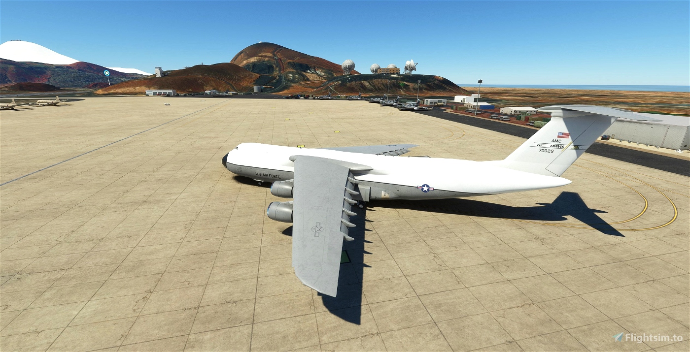
This area is a right throwback to the start of the sim. The stock version still has no satellite image and the elevations come and go depending on their mood.
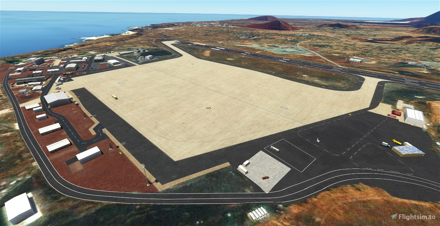
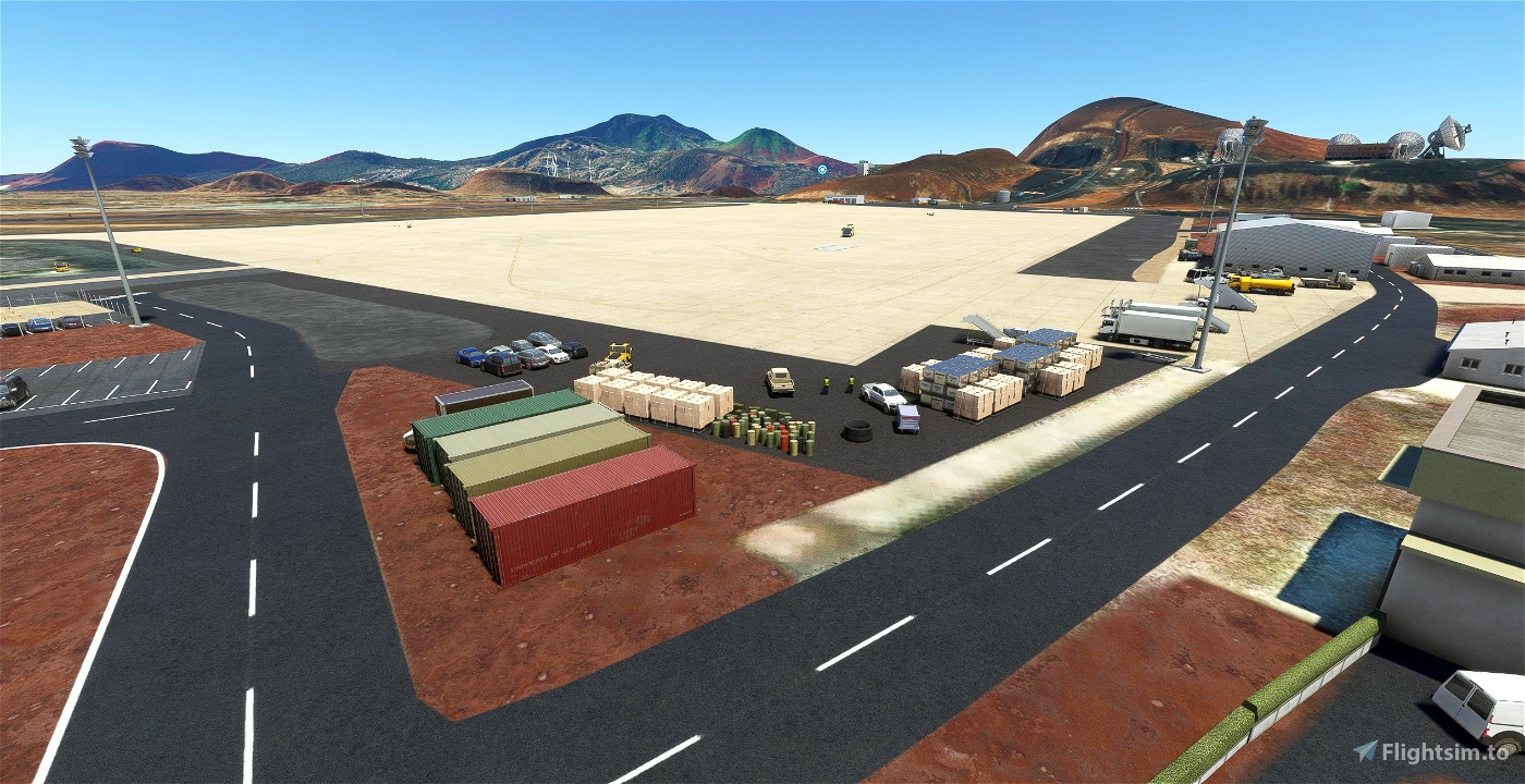
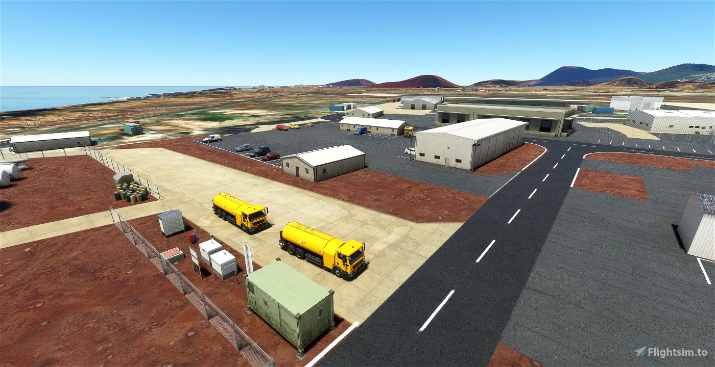
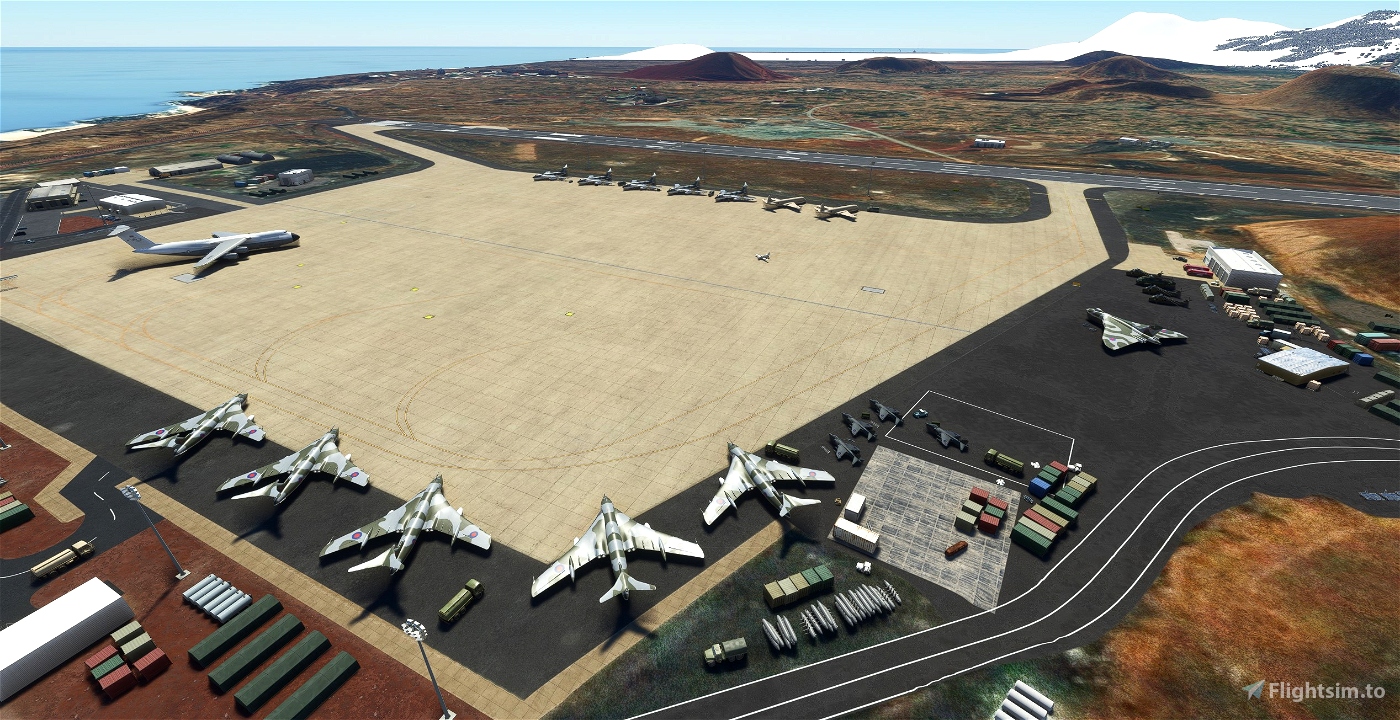
The airport has been filled out with some details. Some buildings have been replaced, some added. Ground textures have been tarted up. Some light added.
This isn't premier league but it's an improvement on the utter blankness of the original.
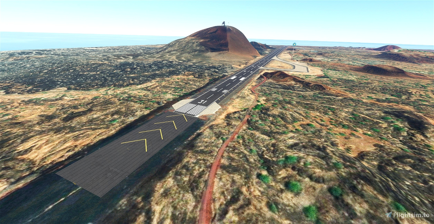
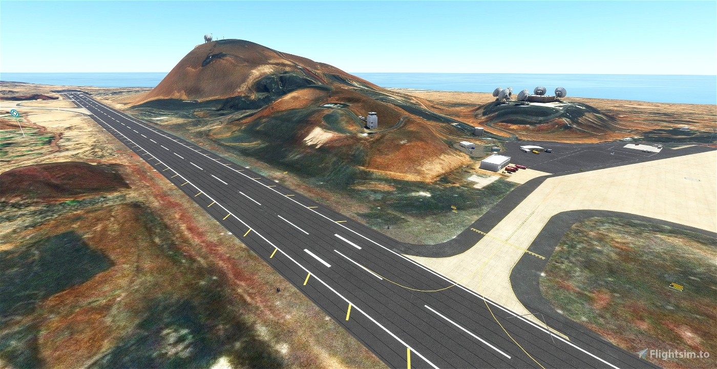
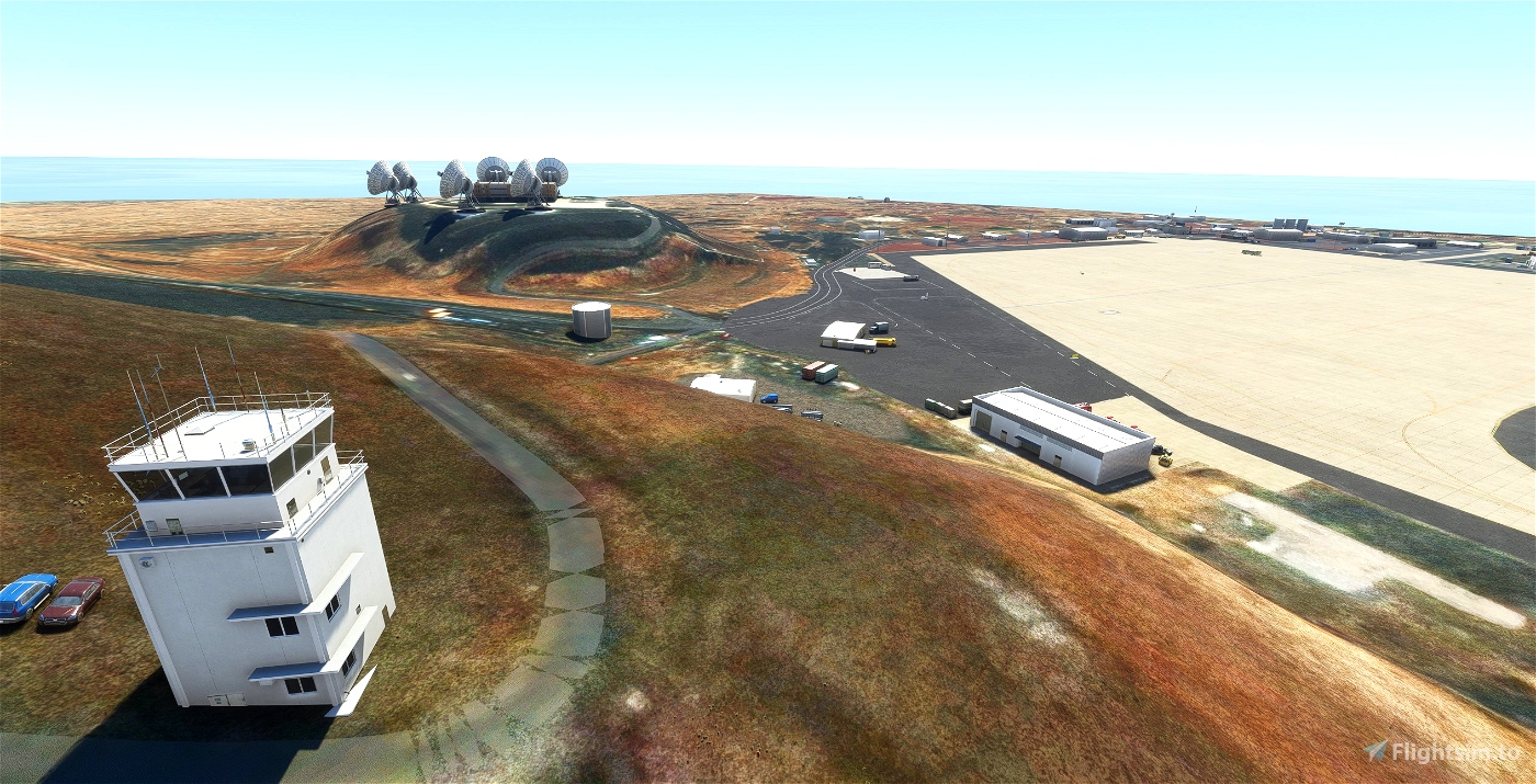
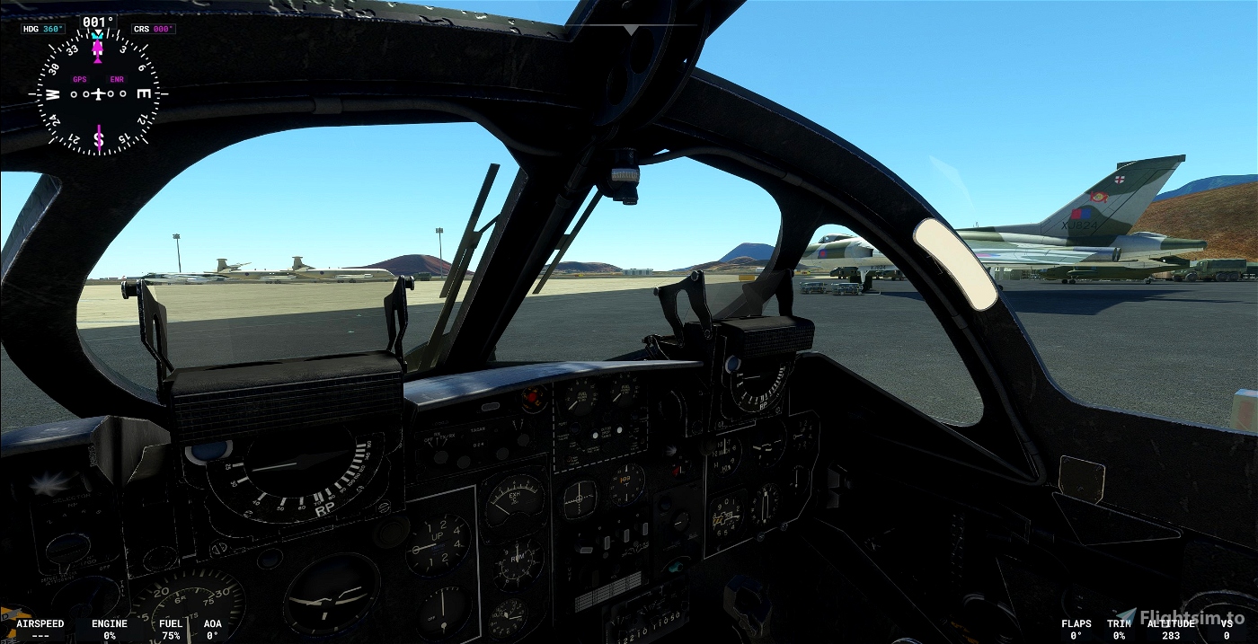
The runway's gradients have been tweaked to try to match its famous hump. For some reason ATC only wants you to go to the wrong end of the runway.
Some hills have been returned as this half of the island is flat as a pancake in the original.
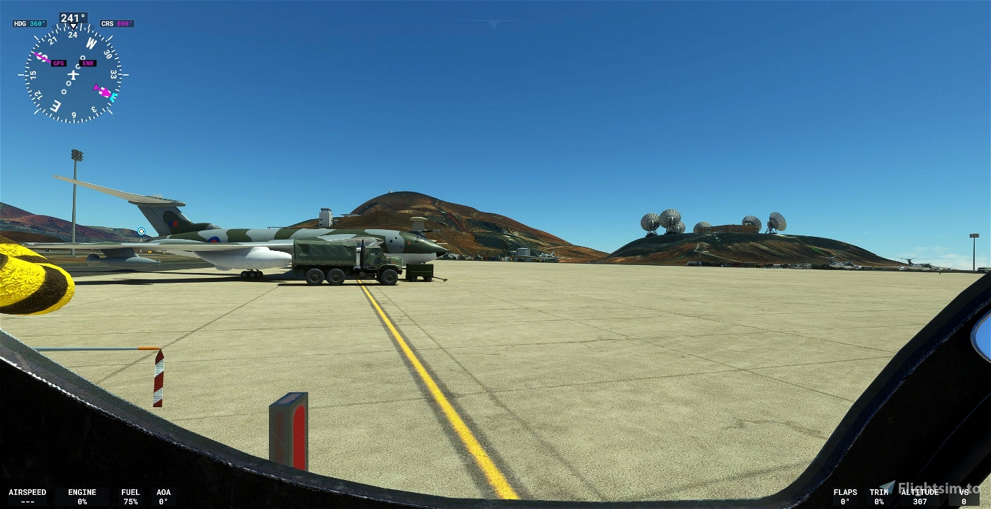
A fuel truck is available for your thirst. You're gonna need it.
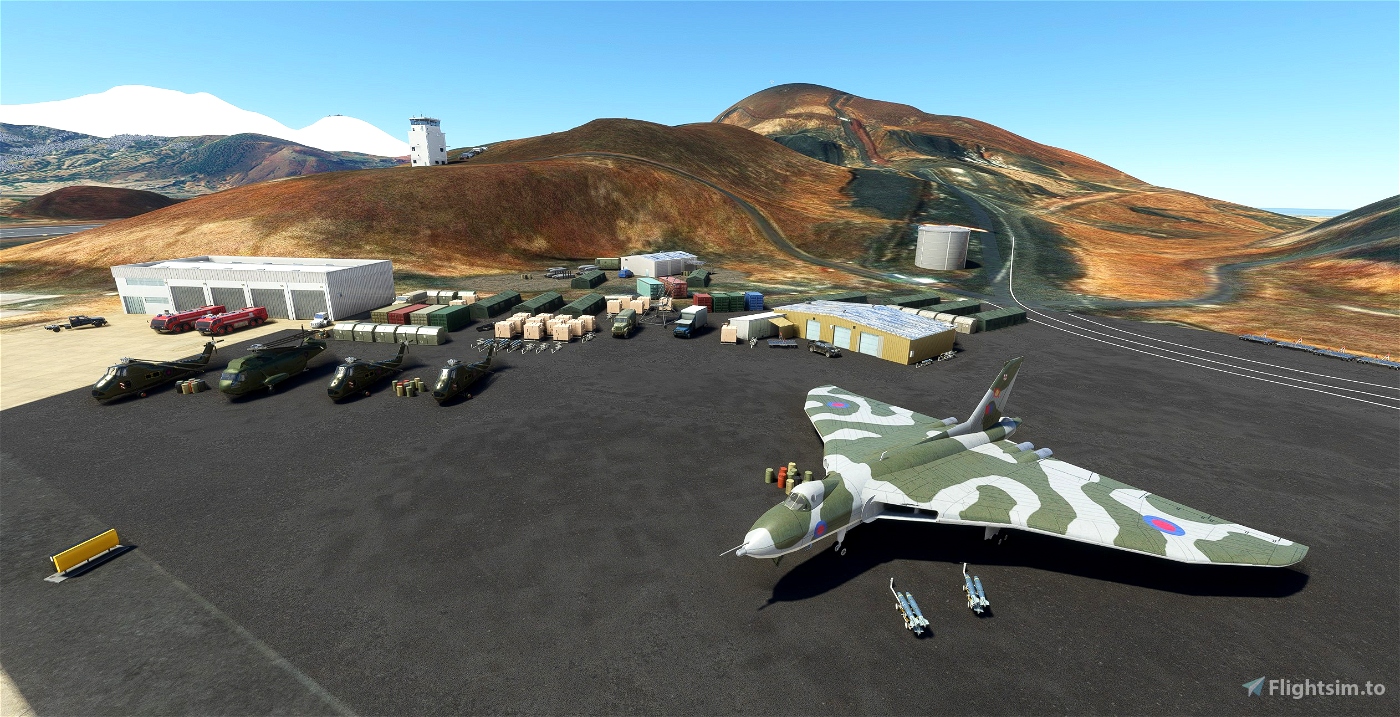
There are now two versions of this so click again to find them.
V 1.7
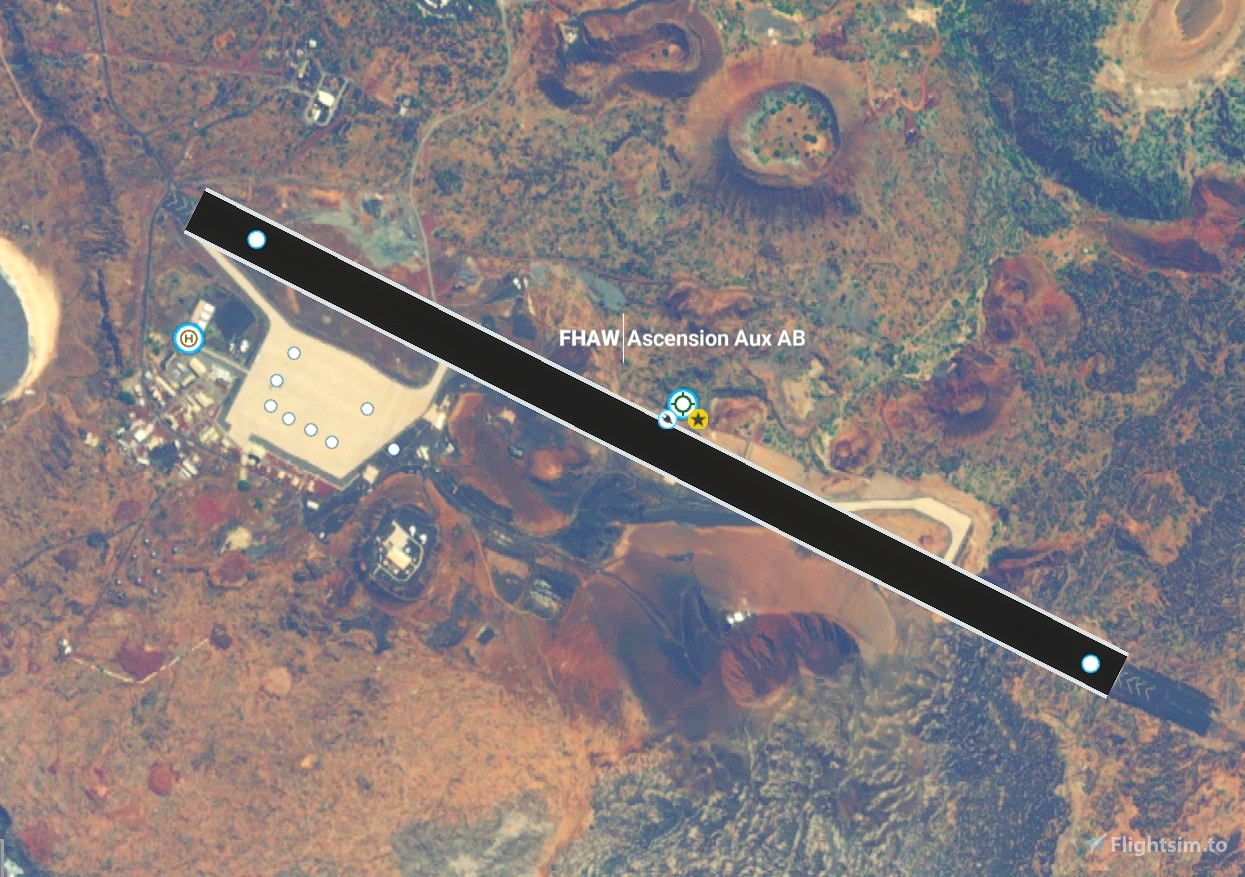
Bends the airfield around the aerial image of the island found here - https://flightsim.to/file/64419/ascension-island-aerial-ground-image
The aerial image is a right storage hog so you may not want it. I understand.
Attempts to add more elevations. There's something seriously screwed with them here on the airfield side of the island. I sometimes see the correct ones for a couple of seconds and then they disappear again.
I think it's something to do with areas without a proper satellite image but I'm really not sure. If you get proper ones then I'm envious but this mod may not work with it. There will no doubt be weird lumps here and there and some that refuse to appear. So be it.
Improves ground textures and details. Redesigns the taxi system to reflect the proper ground markings. Adds a helipad, though I've no idea where you'd fly to.
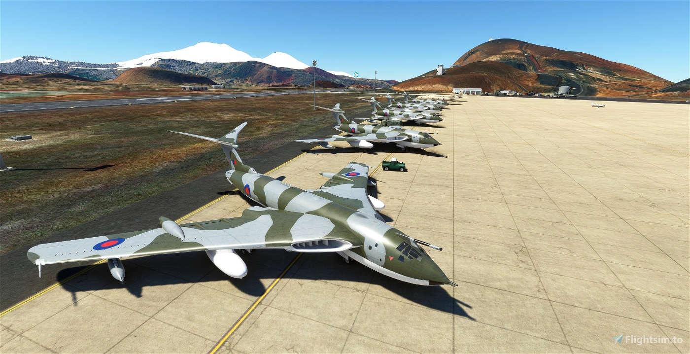
Adds a second version for all you new Vulcan owners that sort of looks like the 1982 version. I'm sure you're looking forward to flying for 16 hours over featureless water.

 superspud


CaptainMoonlight
glider1001
wanchaibanzai
https://youtu.be/Q8XWtS6poCI
Cheers...
Nuno747
Can we just install this upgrade or we need a previous version?
Thks
Nuno
superspud author
6 months ago
VForce
DownedAviator
The 1982 version is great, much more alive, and fantastic to see Nimrods, hopefully one day we see them at RAF St. Mawgan also for authenticity.
superspud author
7 months ago
StephenEllis
JohnG
The Google map, using 3D and down low, shows horrendous rises and dips in the runway, BTW
superspud author
The Google interpretation is categorically ludicrous. The runway does have a huge hump which I've tried to capture, but it's not quite there yet.
The island is now so bad in this it really needs a proper digital elevation map applied to the whole of it, but the only one out there seems to be some sort of private effort.
We'll have to wait for the Arse Ends of Nowhere World Update.
3 years ago
JohnG
Wideawake only uses one end of the runway, because the other end is dangerous, which they didn't realize when they were building it, apparently.
It's explained in this video https://www.youtube.com/results?search_query=wideawake+airfield what the reason for the closure of the other end (windsheer?).
Another article you may find interesting is https://en.mercopress.com/2020/02/14/ascension-island-airport-to-reopen-to-wide-body-traffic-by-2022
Apparently the airfield is staffed by 19 RAF personnel, headed up by a Wing Commander. I wonder what she did to upset the RAF to get such a forlorn posting?
superspud author
Thanks for the links. I have often wondered about the one end only bit. Unfortunately the ATC in this version only seems to be interested in the wrong end and I still don't know how to stop it.
I would love that posting myself. I would've been there long ago in person but for the runway breaking and there's also some disease I've just heard about.
There is, or has been, a flight from St Helena in an aircraft light enough to not annoy the runway, but your travel choices with it are either staying a couple of hours or one month because it's for workers. Neither quite fit the bill.
When things are rolling again I'm going to do here, St Helena and the Falklands in one extravagant loop.
3 years ago
Tanglykroliczek
Hi,I was posted to Ascension in the early 90's for 9 months. I'l dig out some photos which might help but I don't know if I have any of the airfield.
superspud author
I'm definitely interested in seeing more. I've spunked the last few days trying to return the hill to the site which really isn't working, but a more accurate airfield will stop people from hitting me at least.
3 years ago
AVCORP
Thanks, a very good addition. A shame Asobo didn't put this one. I'll land there with the DC6 in two hours. A nice step to cross the ocean.
superspud author
I'm glad it's of use. It's pretty far out that neither this nor St Helena are in there.
That'll be down to the pisspoor satellite imagery but since just these two cover such a huge stretch of the planet you'd think they would've done a hand addition of some sort.
I've been trying to bring Ascension back to how it was when first made with some actual elevations around the airport, but it's still an unworkable pancake. Quel dommage.
3 years ago
xone32
xone32
https://xone32-gmail.tinytake.com/media/f71782?filename=1614988406575_FHAW+missing+mount.png&sub_type=thumbnail_preview&type=attachment&width=1199&height=779
superspud author
3 years ago
coull
superspud author
3 years ago
fulatoro
https://forum.navigraph.com/t/multiple-addon-sceneries-priorities-and-the-double-runway-effect/2357/25
superspud author
4 years ago