Hi and welcome to New Zealand!
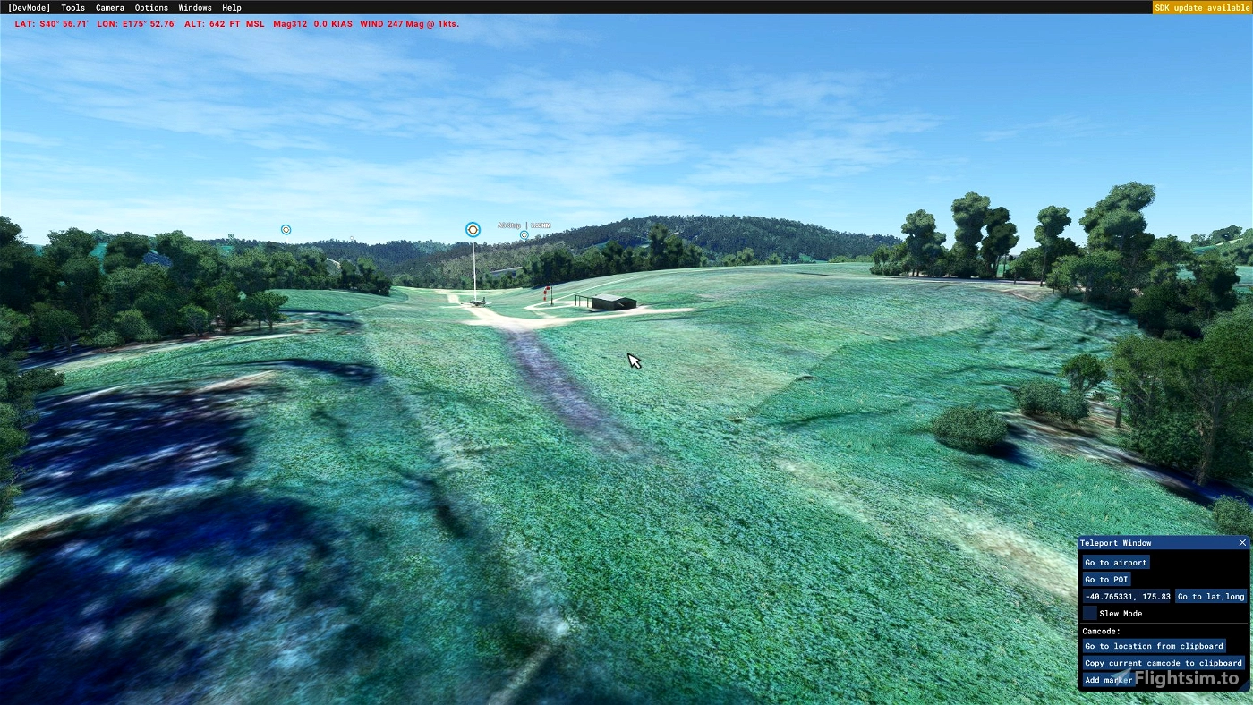
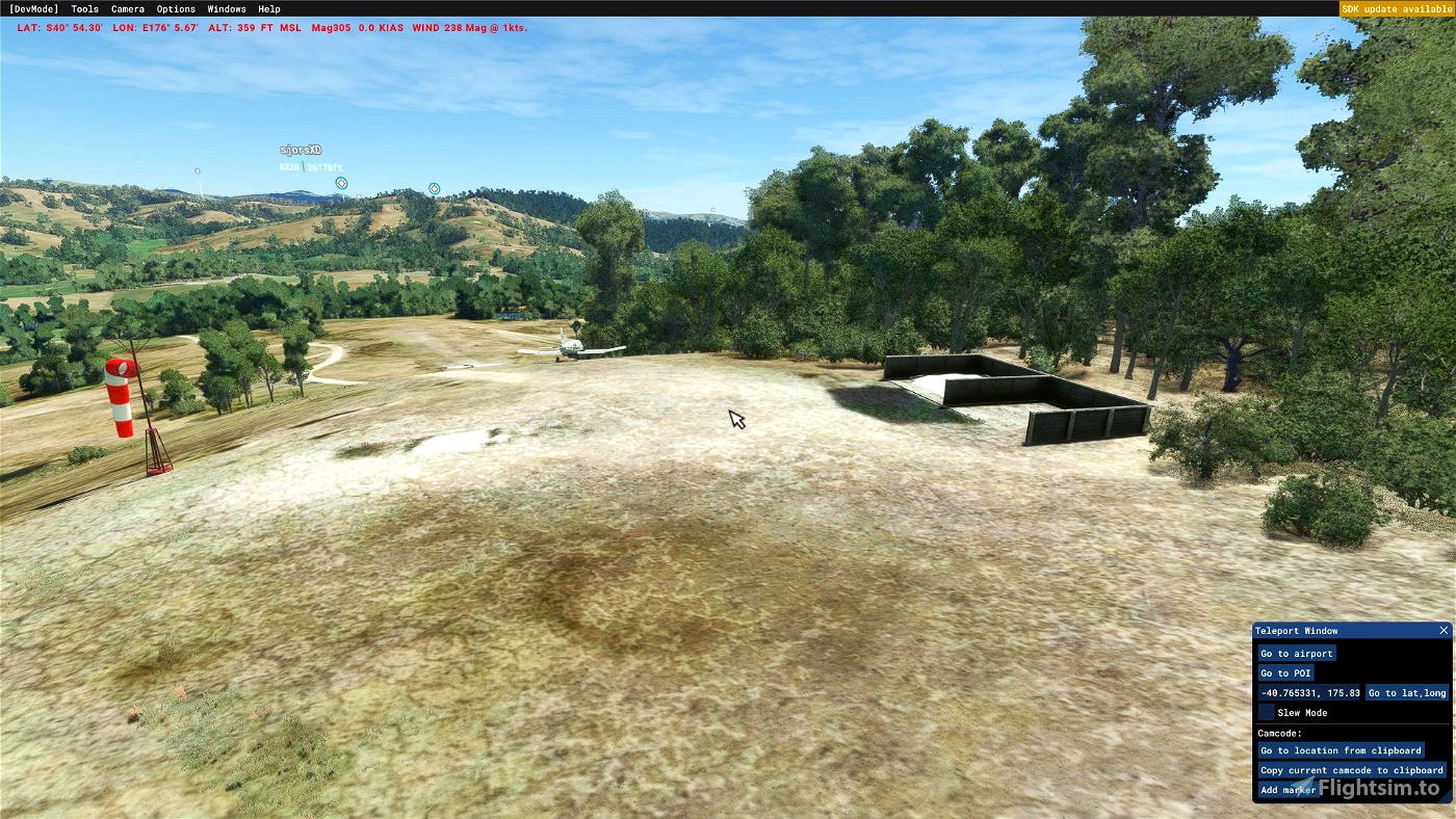
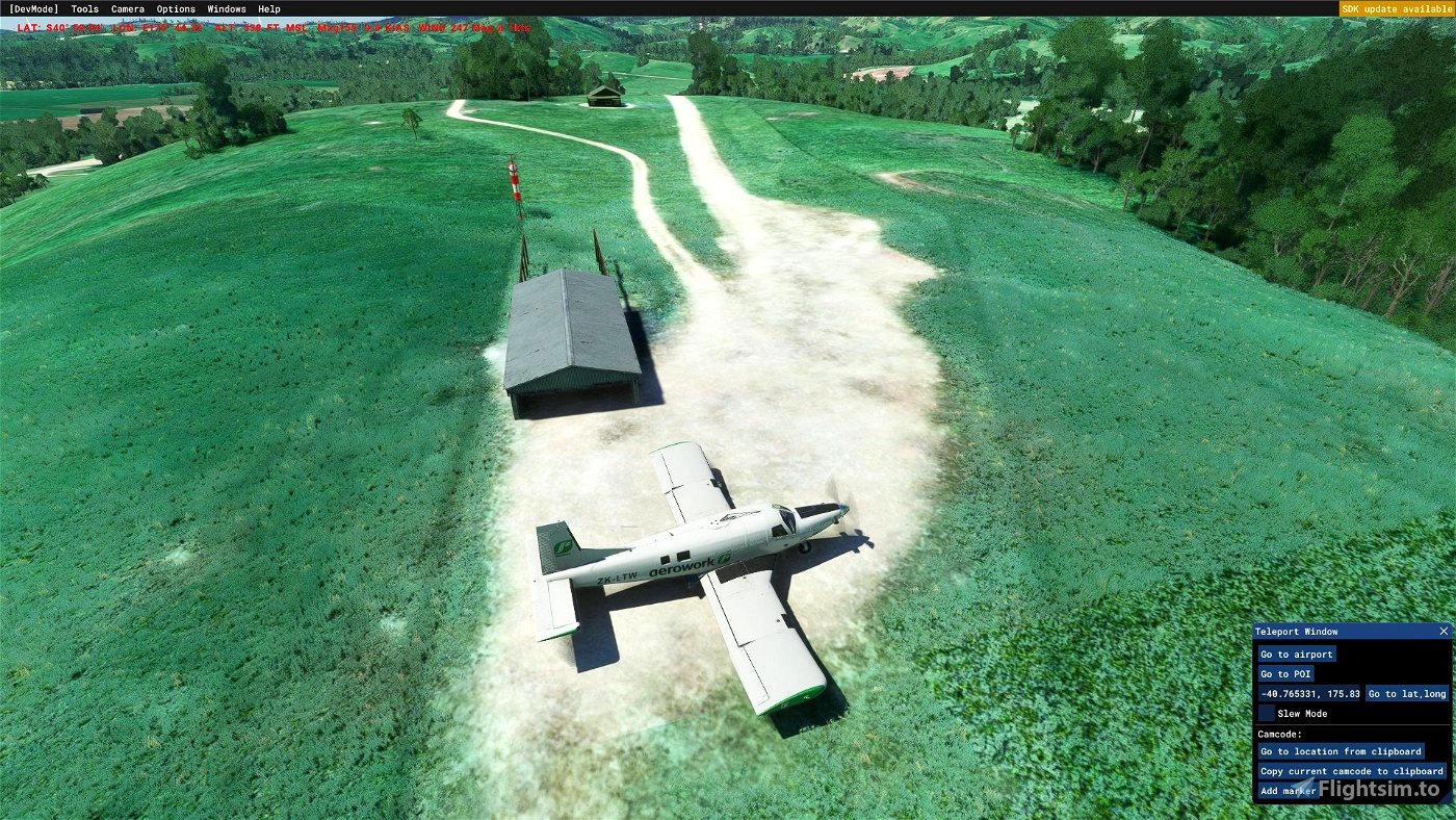
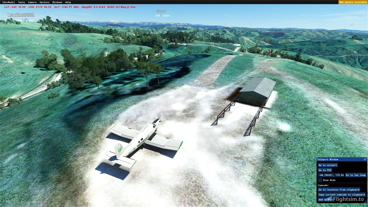
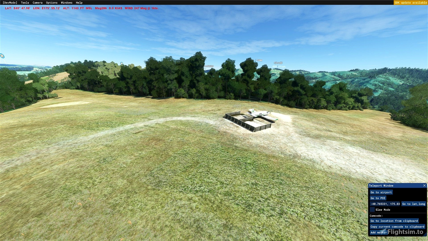
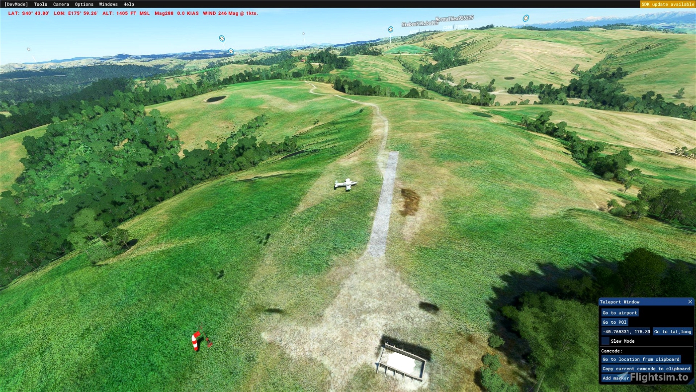
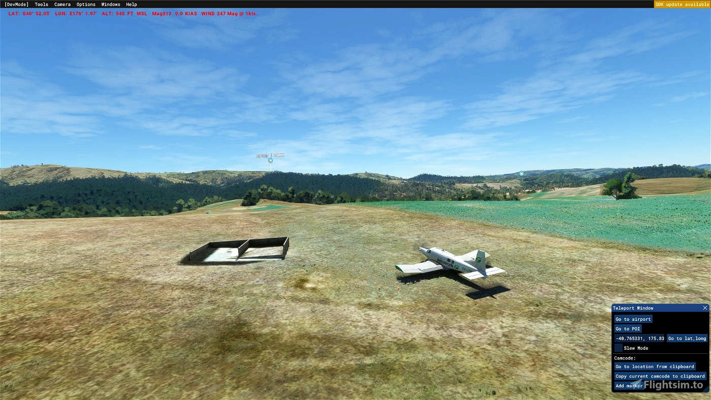
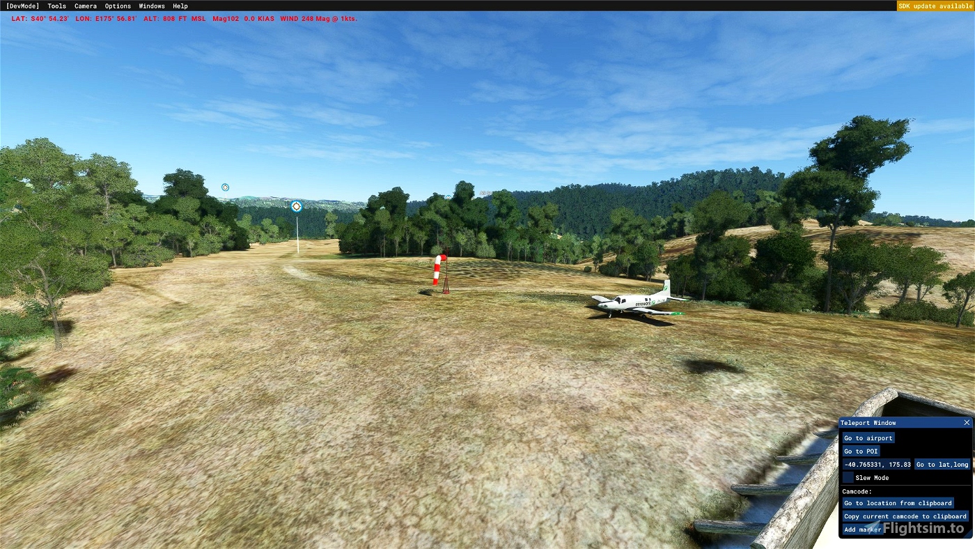
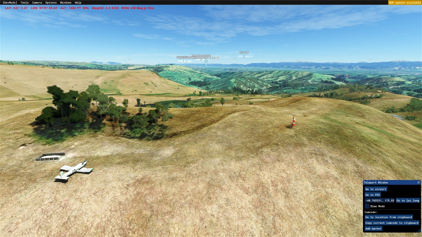
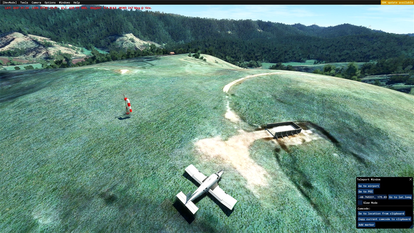
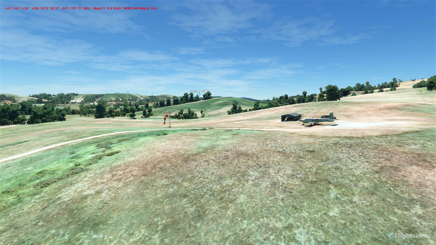
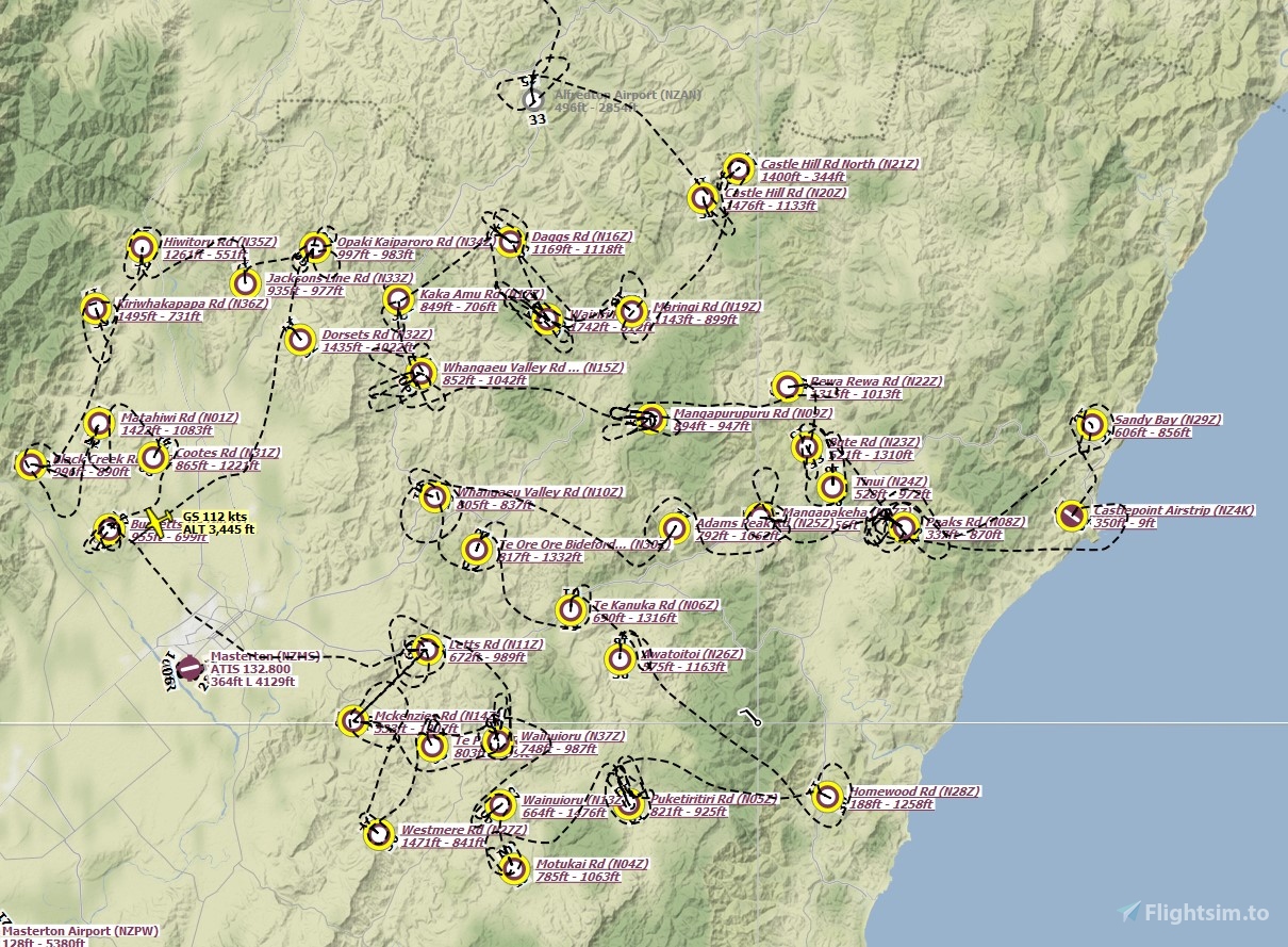
This airfield pack features 37 agricultural airstrips in the vicinity of Masterton, ~30NM north-east of Wellington.
The airfields included range from 700ft up to 1400ft of usable runway. Most of them are one-way strips, located on hills or in valleys.
The perfect playground for the ORBX PAC-750XL, especially in VR!
As most of them have no real ICAO code, I started to use N**Z as scheme for the airfield locators. This may change as the plan is to add all known AG Strips in NZ to the sim, which are roundabout 400 strips, at least in my export of the official data from the NZ government.
This pack is considered as an open Beta, so changes and updates are expected. This is the first step with adding of airport objects, runway starting points, windsocks and fertilizer bins. Fences, people, cars and other useful things will be added subsequently. I used the Google Maps Mod to work on these, so runway and fert bin locations may not be accurate when using bing maps!
For the Airstrips you need to install the SB Works Library, which models I may use by agreement.


zbootsum
Basic but works absolutely fine with WU12. Beware some strips are very marginal for PAC-750XL to takeoff.
sonicviz
Hi,
These look great, ty,
Are they optimised to work with the Orbx NZ mesh?
Are they all at the right height?
phr34k86 author
Hey there,
for now they work only with the default mesh. Maybe I'll add versions for ORBX, but that may take some time as terraforming is the hard and time consuming part of the work.
BR,
Dennis
2 years ago
sprunga
Thanks!! I've been watching Jimbo Burgess on YouTube so this is perfect!
ahunterg95
A lot of this work was done for FSX/P3D years ago. I have the files in sim which show as hundreds (752) of GPS locations, but further work is needed to make them show as startable runways, particularly in MSFS.
I have been trying to get in touch with ORBX to see if they are ok with their file being developed further for MSFS, but no luck so far... I had similar thoughts to see if SB works would be ok with their bins being used to enhance the locations.
phr34k86 author
Hi,
I think what ORBX has done is the same as I did. I used the online service of a NZ geoinstitute to export all known runway polygons to a google earth kml file with POIs for the reference points and polygons for the runways. I thought about adding them as POI and work on them but with the density of AG strips in NZ that would be a mess if POIs are shown inflight. So I use LNM to plan a flight and fly from strip to strip while working on them. If I add any strip to MSFS it would take years, I think. So I consider doing only the interesting ones, located on hills or near the sea or lakes.
2 years ago
uriahms
When the PAC-750XL came out I went hunting for the strip in the video posted on the NZ Herald website. From what I could find, the particular strip was in Bideford. But there are 2 strips just north of Bideford. The first is off Wairiri Road and the second is off Daggs Road. But from the location of the bin it appears the one off Daggs Road is the right one. Can you confirm which strip is in the clip? Here's the link?
https://www.nzherald.co.nz/nz/watch-new-zealand-pilots-amazing-manoeuvre/7LKO3OFPG2QGR6XNJCA5YLWJMY/
todorokipm
Hunting for this strip too, bus daggs rood doe not look like; it is not soil airstrip on sattelite view and lime fertilizer storage is not on the right side compare to the video. Still searching...
1 years ago