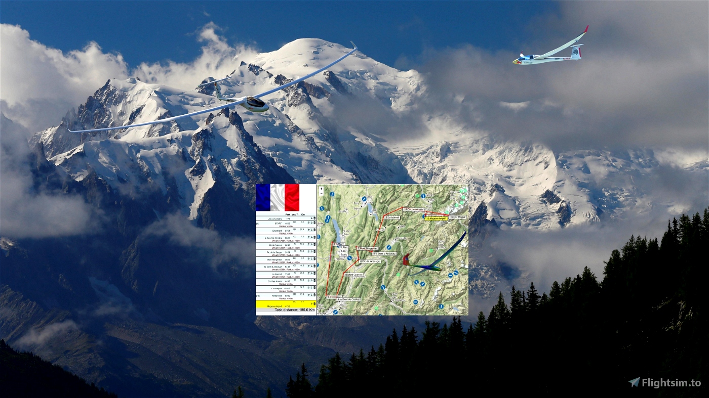
Distance:187km.Duration:60-120mn. .
Difficulty:Medium.Soaring Type:Ridge ..
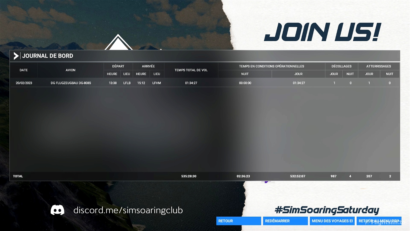
Departure: LFLB Aix-Les-Bains
Arrival: LFHM Megeve Airport
Weather report:
Few clouds
8-18 kts wind from SE
Notes:
Use the ridges Ouest of the airport to gain altitude before the start.
----
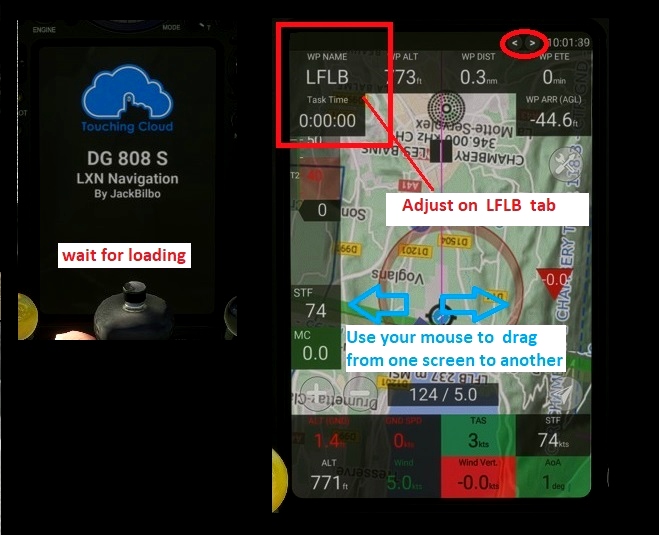
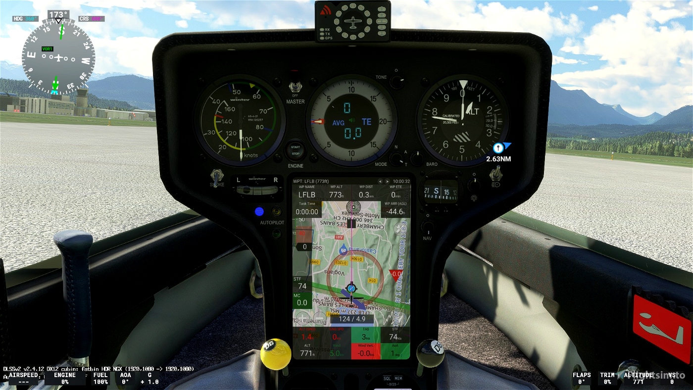
Use and look to GPS to validate all crossing points (notification when done).
Watch your GPS and wait for the map to finish loading.
Then adjust the GPS on the LFLB tab .
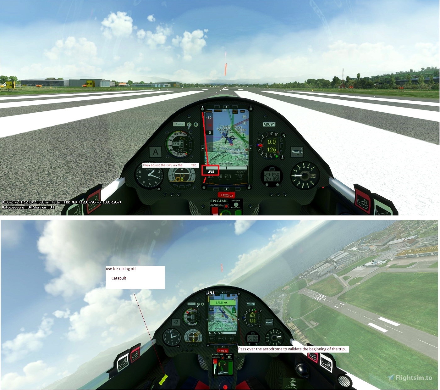
Use your engine to take off.
Pass over the aerodrome to valid LFLB
Make sure that you have validated the crossing point above the aerodrome.
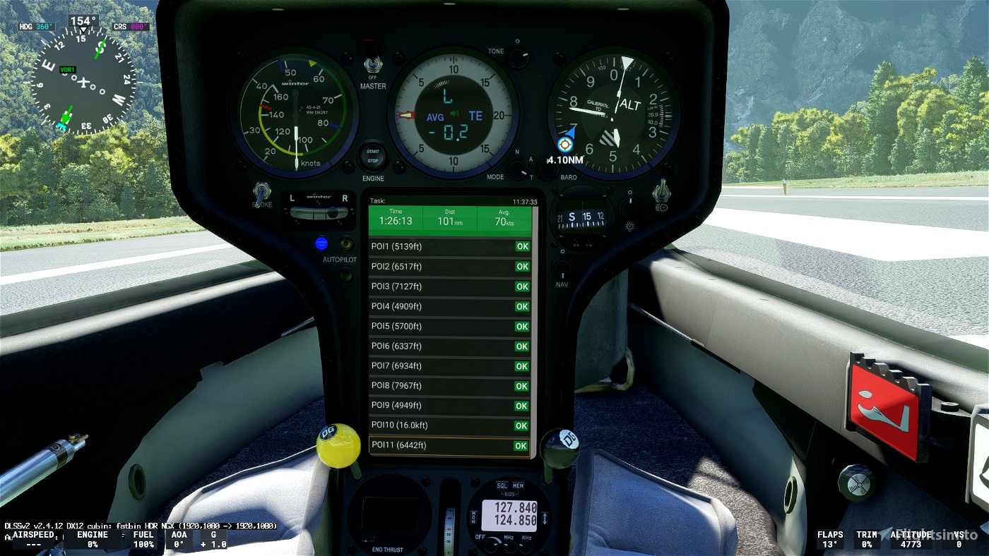
5000 Maximum height to pass the POI1 start line.
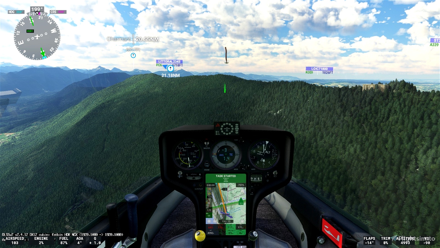
POI1: Starting line. Elevation 4524 feet
POI2: Charmant Elevation 5761 feet
POI3: la Dent de Crolles Elevation 6535 feet
POI4: Mont Granier Elevation 6020 feet
POI5: Pic de la Sauge. Elevation 6488 feet
POI6: Mont Margeriaz. Elevation 5771 feet
POI7: la Dent d Arclusaz. Elevation 6352 feet
POI8: La tournet. Elevation 7513 feet
POI9: Col des Aravis. Elevation 4495 feet
POI10: Col Majeur. Elevation 15387 feet
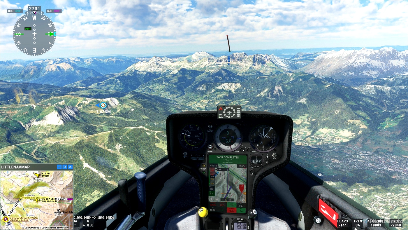
POI11: Finish line. Elevation 6122 feet
go Landing on Megeve Airport Airport - LFHM 4793 feet
----
Turn off your main battery after landing if you are using the DG808, wait a few minutes to get the trip completed message.
JackBilbo
https://fr.flightsim.to/discover/LXN%20Nav%20Replacement
https://fr.flightsim.to/file/41698/dg808s-lxn-nav-replacement
https://fr.flightsim.to/file/41623/discus-2c-lxn-nav-replacement
MADoloSimulations
ASS33 me 1.83
https://fr.flightsim.to/file/15090/as-33-me
Got Friends
Discus-2c: Premium
https://fr.flightsim.to/product/discus-2c-premium
MSFS ALBATROSS
DG Flugzeugbau DG-808S
SCC Sim Soaring Club
https://discord.com/invite/8TaW8QjH
https://www.instagram.com/simsoaringclub/


 ADCKillerman


Sigo
Thank you for all the bush trips you have uploaded. Keep up the good work !
ADCKillerman author
thanks for your support
1 years ago