Did the AI turn your plane in a flippy cup with malformed taxiways and runways? Me too.
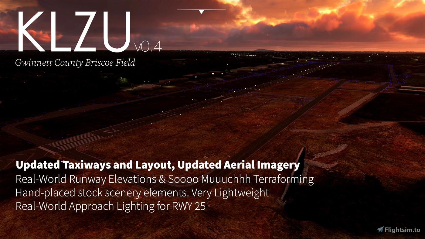
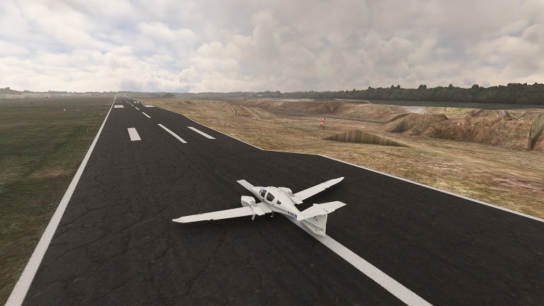
It was a labor of Love to Terraform this place using the built-in tools (polygons and rectangles), but after throwing myself at this one 6 hours, I finally was able to make accurate elevation and gradients for the runway, taxiways, the aprons, and even the creek bed!
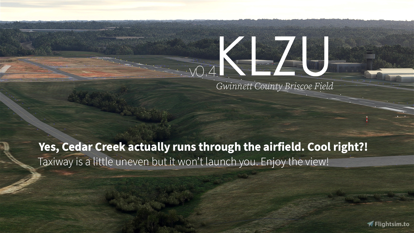
A River Runs Through It
Yeah it's really a creek that got manscaped into an overgrown drainage ditch, but bless the conservationists for trying to preserve some habitat out here. It was probably more expensive to pave it over and do constant maintenance anwyays. I loved doing the creekbed for some reason. Wish I could I play in it.
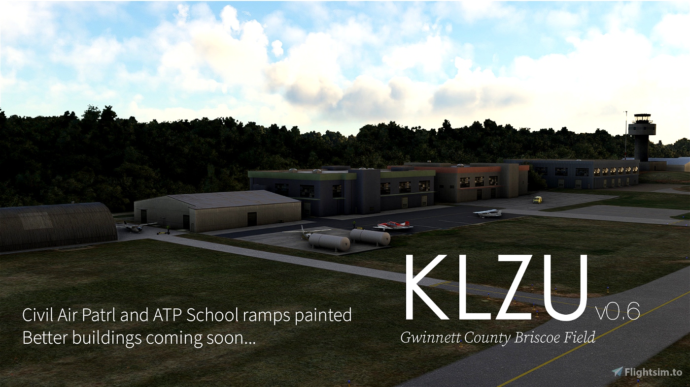
Stay Current with the New Taxiway Y!
Gwinnett County Briscoe Field has a newly form taxiway as of Spring 2021 and gosh darn what a surprise, old Bing scenery doesn't have it it. With this scenery, you can now taxi to RWY 25 via T D Y just like in real life.
This scenery uses aerial photography from USGS sources. Currently it looks like all dead grass but I'll make a color corrected one first so it doesn't look like scorched earth forever.
I learned how to import aerial images. It was a pain trying to understand why I had "invalid CGL parameters" until I figured out I had not specified the correct xml and bing tile locations. I can't believe I wasted 6 hours troubleshooting this.
This towered airfield is not as close to midtown Atlanta, but it is a 7-minute flight to Lake Lanier. Go buzz some boats why dontcha.
As with all my sceneries, handplaced stock everything so it's super lightweight.
- Creek bed bushes!
- Real-life elevations
- Reworked Real-World Taxiway Y
- Replacement Aerial photography for Taxiway Y
- RWY 25/7
- ILS Frequencies, Glideslope, DME
- Real-World Approach Lighting and Edge Lighting
- Real-World Glide Slope Indicator
- Accurate Elevations and Gradients
- AI usable
- All taxiway Edge Lights placed
- All Taxiway signs placed
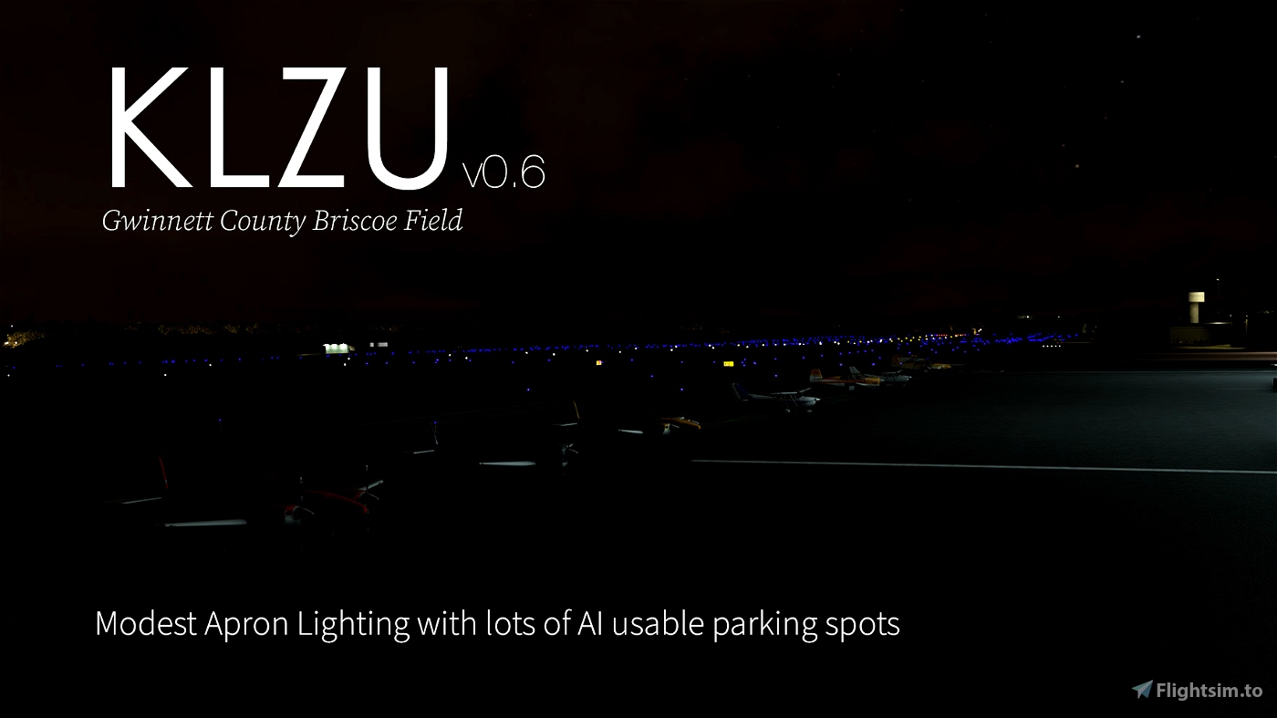
- Handplaced North FBO Apron Lighting
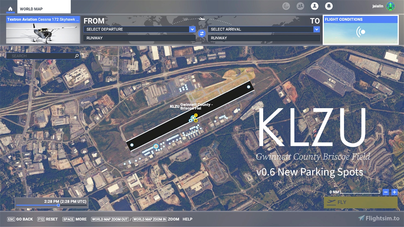
- Lots of parking spots for now (planning >100 handplaced parking spots)
- Scenery Additions
- Handplaced Beacon and Tower
- Handplaced stock Hangar and Lights to come
Minor Dependencies:
Hangars from MSFS 2020 object library 200+ models (https://flightsim.to/file/16007/msfs-object-library-with-150-models-ranging-from-towers-hangers-terminals-to-cones)
In the future
- Replacing all AI generated buildings with stock buildings
- More apron lights


duffystavern
Do you, "overwrite" or delete and replace?
OccamsRazor
brettfreston
Thank you very much for getting my home field updated!
z80cpu
As a native of Atlanta and someone who lived in that area for approx 20+ years, thanks!
😊
Jazz44
Thanks again for your continued improvements! Do you plan to have custom hangars added? Would love to see Advanced Aviation and neighboring hangars.
mangosprout author
As soon as I learn Blender... :p or as soon as a modeler volunteers!
1 years ago
dkortman
Is there any way you could make some tiny tweaks to the scenery of D73 Cy Nunally Memorial Airport about 18NM southeast of this field? It's my home airport and it's a little broken, and I have access to the airport IRL if you need photos for comparison. Just let me know, thanks!
Ernie
The today's downloaded scenery (0.71) doesn't load, MSFS is stuck at ~90%.
Latest versions give real good loading times! Thank you for this really amazing place!
mangosprout author
I have a couple more tweaks coming for 0.72, hopefully that should work for you.
1 years ago
duffystavern
Thank you Magosprout, for giving this a/p a little attention. Much appreciated.
Greazer
Awesome job! Keep it going!
Jazz44
Thank you so much for working on my local airport! Looking forward to your roadmap.
wstew
I'd appreciate anyone listing an airport to include the state it is in the listing.
DennyAtkin
This one's in Georgia. Agreed -- you can tell Flightsim.to isn't based in North America or they'd have states and provinces in the metadata for the USA and Canada.
1 years ago