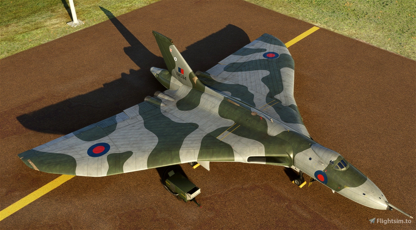
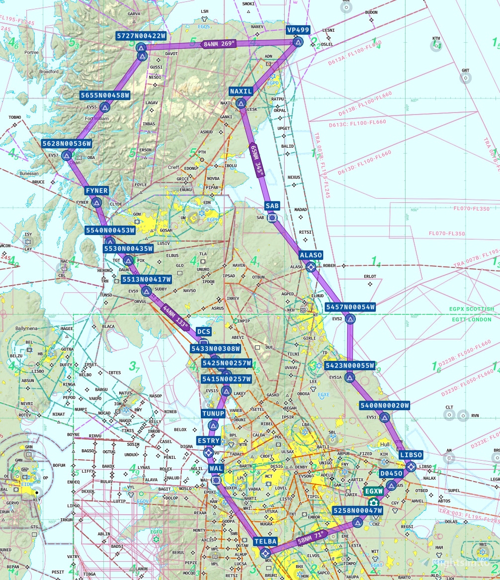
MSFS Flight plan constructed using Navigraph. Starting and concluding at runway 02 at EGXW Waddington. Set in the latter years of the operational service of the B2 in the late 1970`s, the profile will be using the classic High - Low - High. The simulated target is Prestwick airport in Scotland. After departing to the north east to the Humber estuary, then north along the Northumberrland and Scottish east coast. The let down to low altitude will begin just prior to Lossiemouth. Then follow the Great Glen via Loch Ness.
After exiting near Oban, a south easterly track at low level to Prestwick. Bomb run can either be at high speed over the airfield using simulated retarded bombs or a loft manouvre at the IP for an airburst nuclear attack. Escape via the lake district, before climbing back to high altitude at Deans Cross and Wallesey. Return via the Lichfield corridor at FL140, before landing back at Waddy. Conditions should be intresting over the coming days with snow forecast over Eastern Scotland and the Highlands.

Hxmii
vulcan281 author
7 months ago
Flyingscotsman