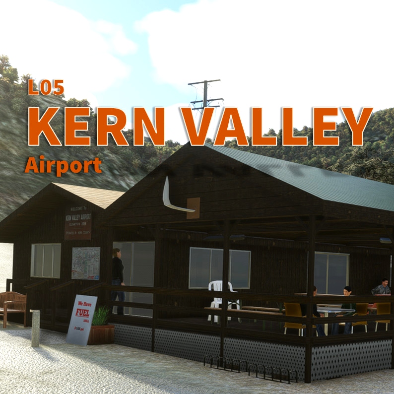
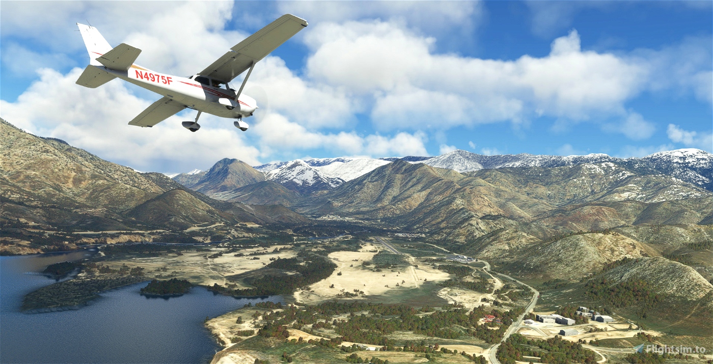
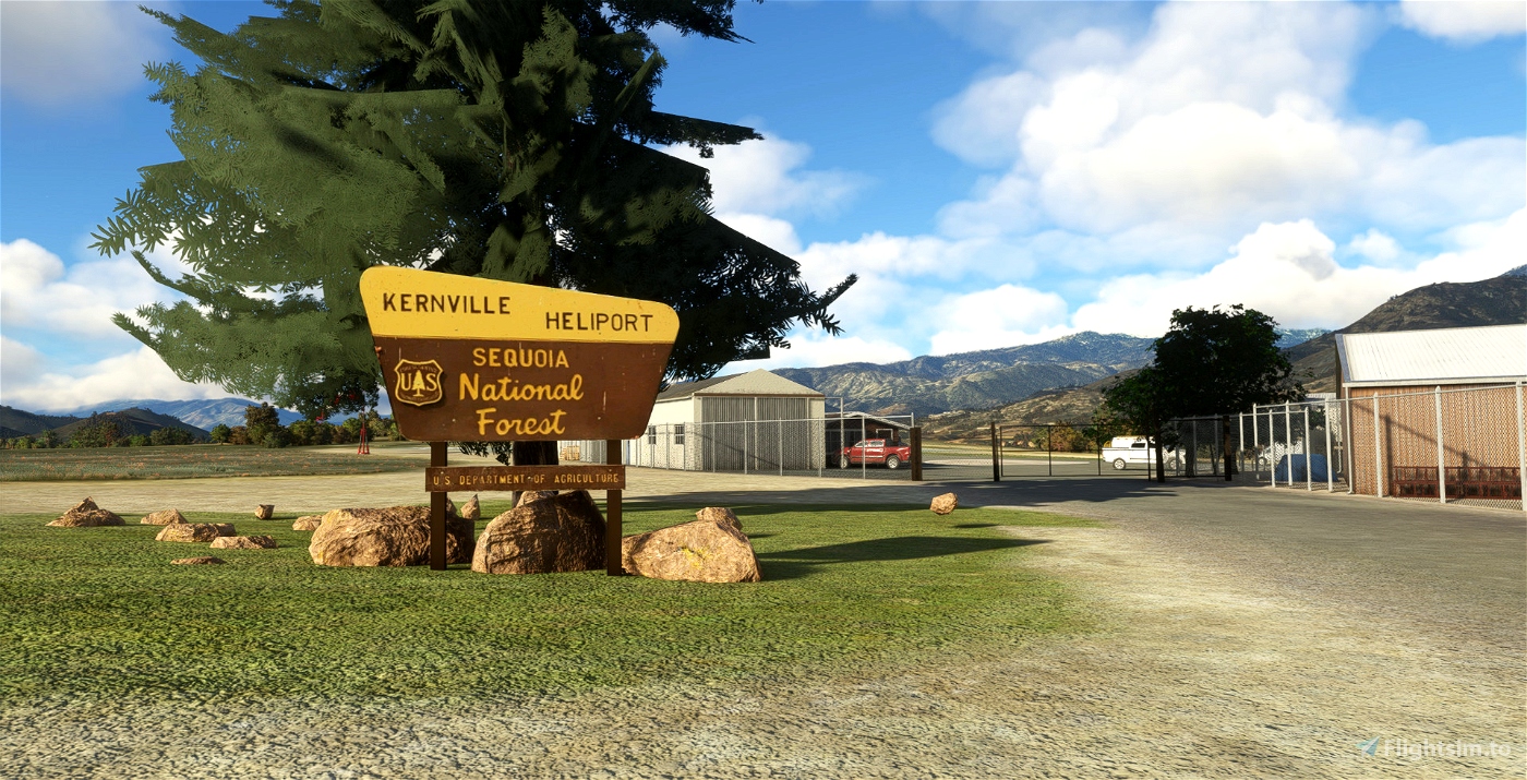
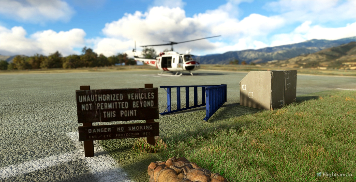
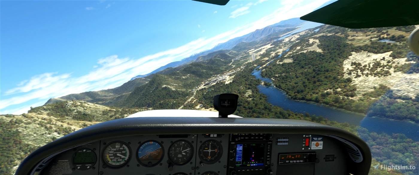
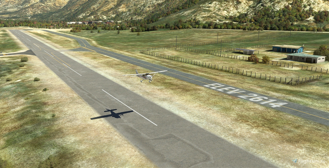
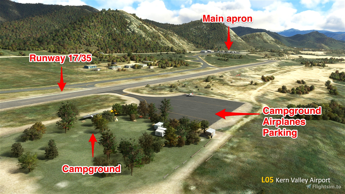
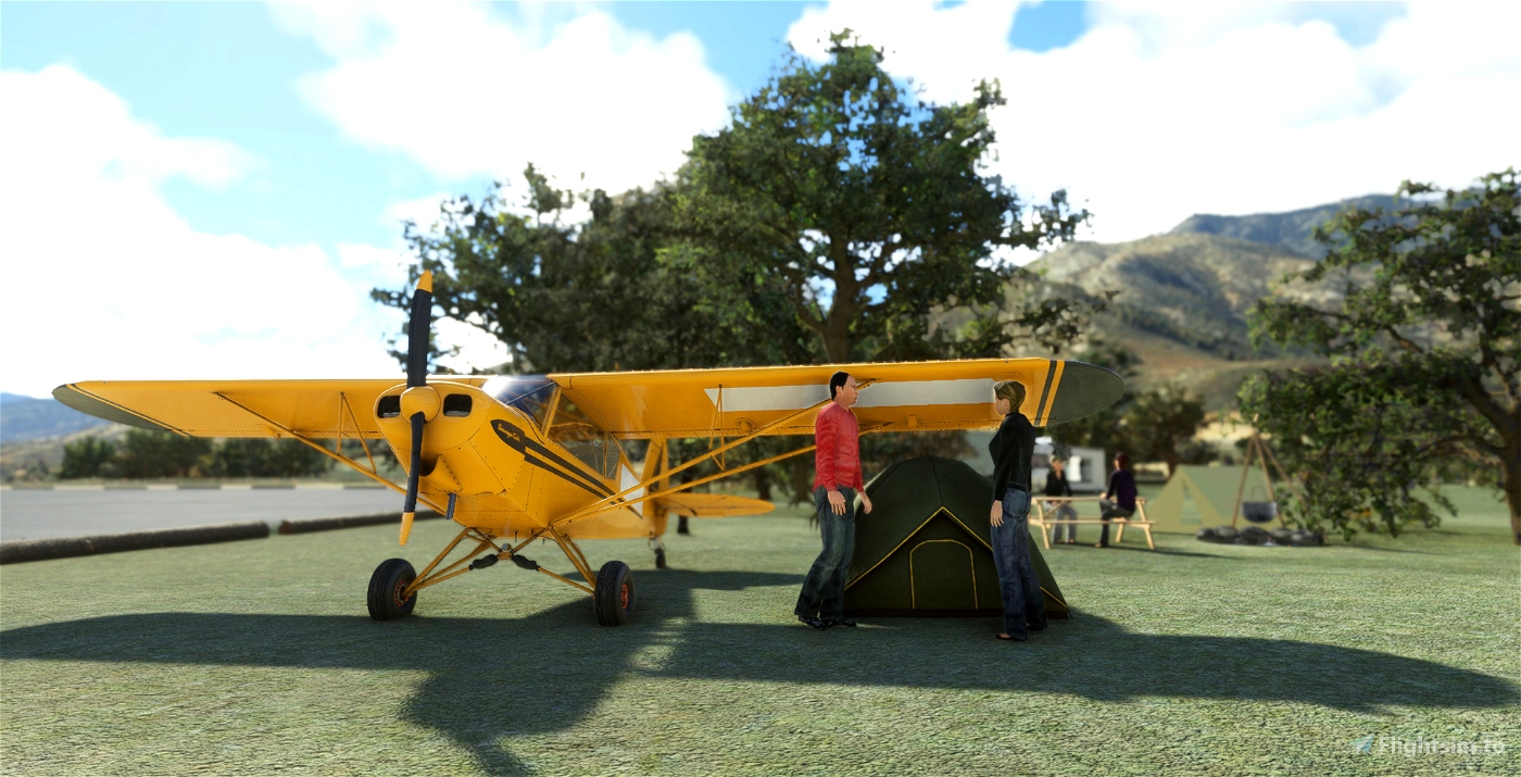
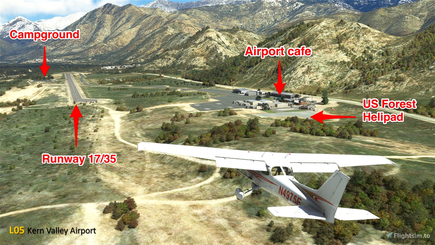
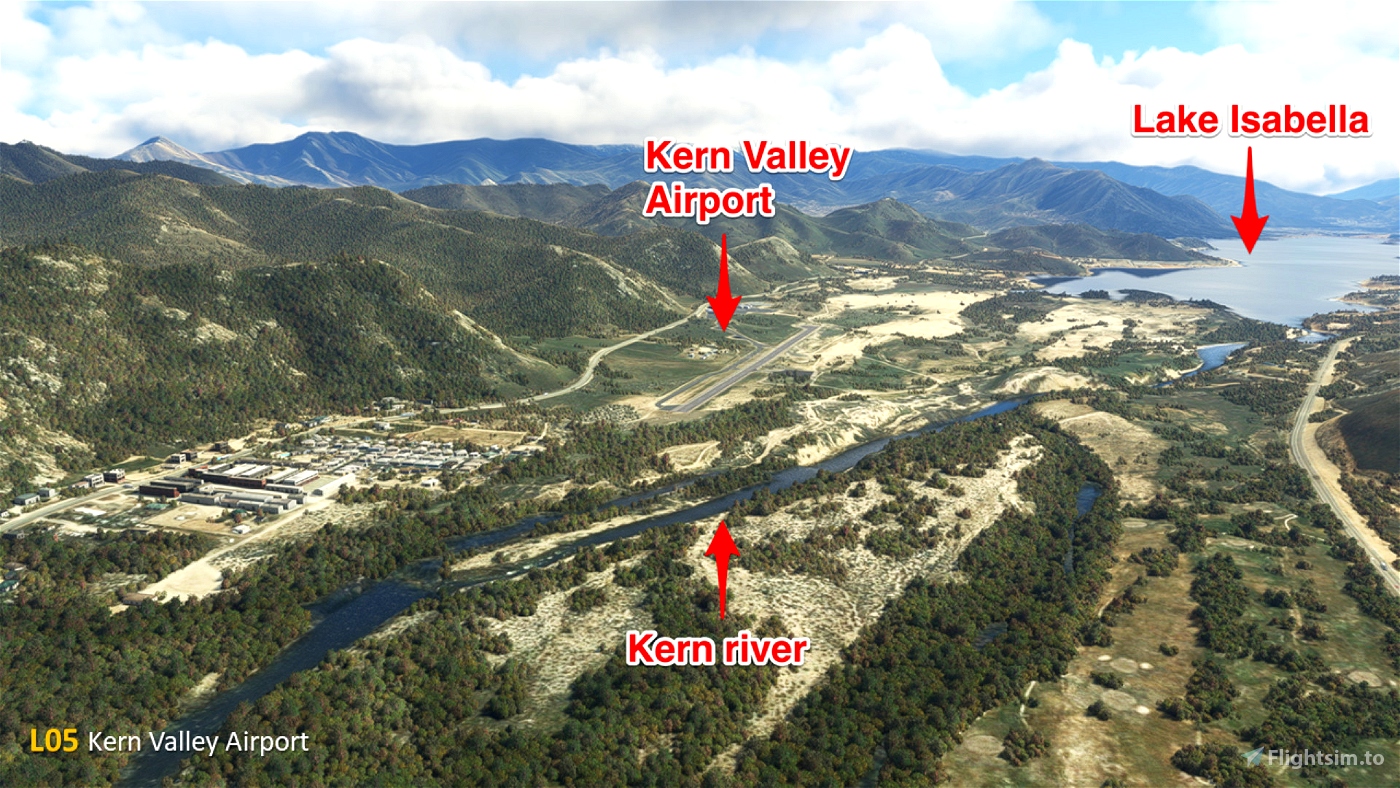
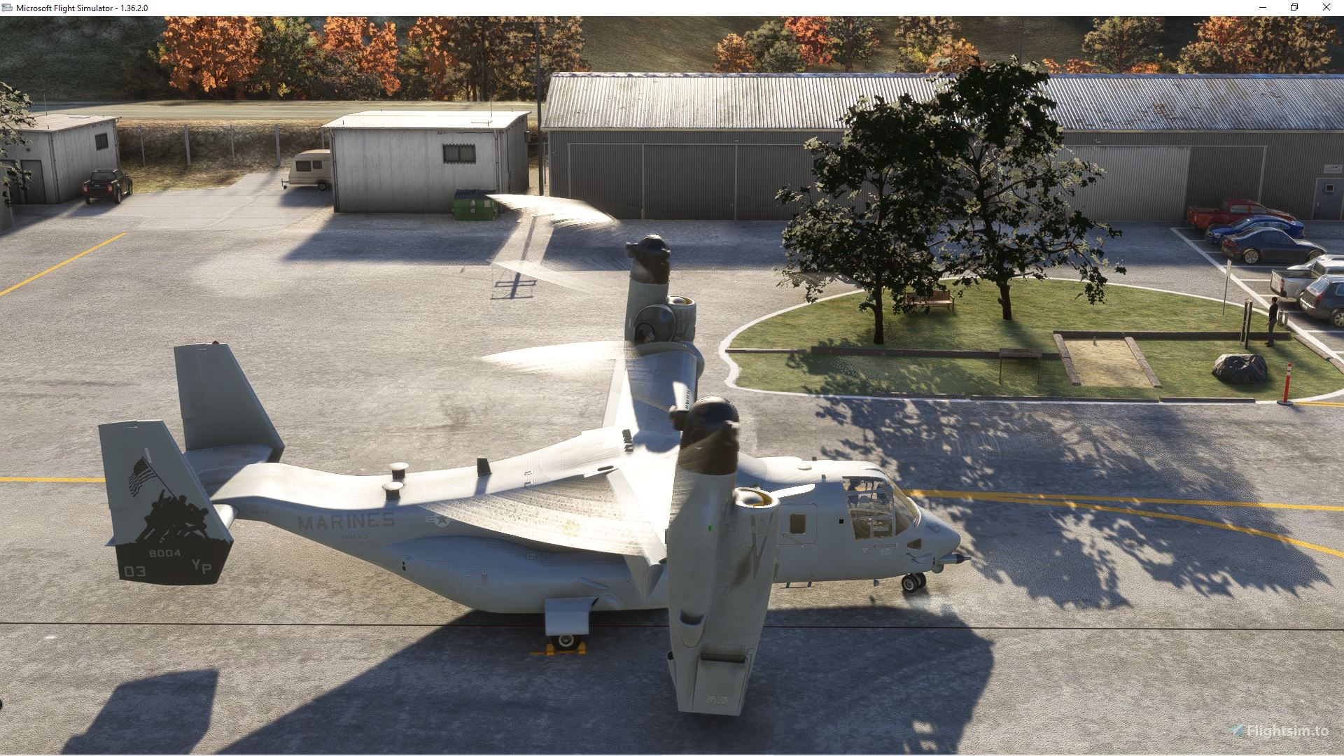
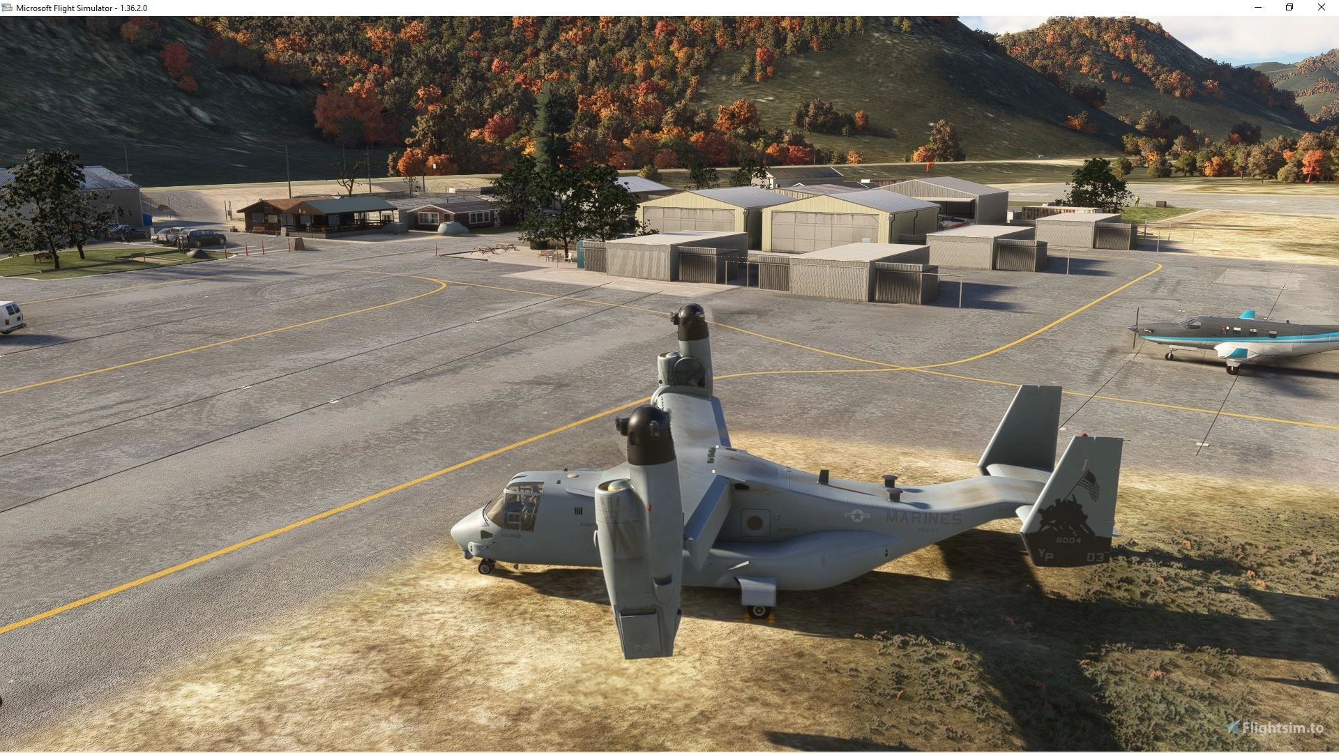
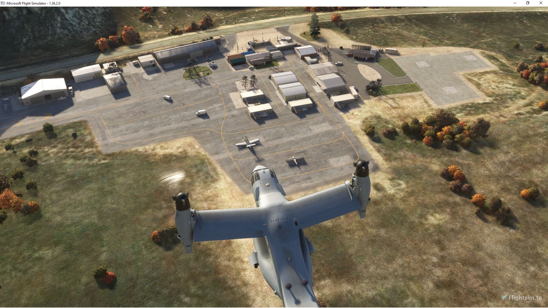
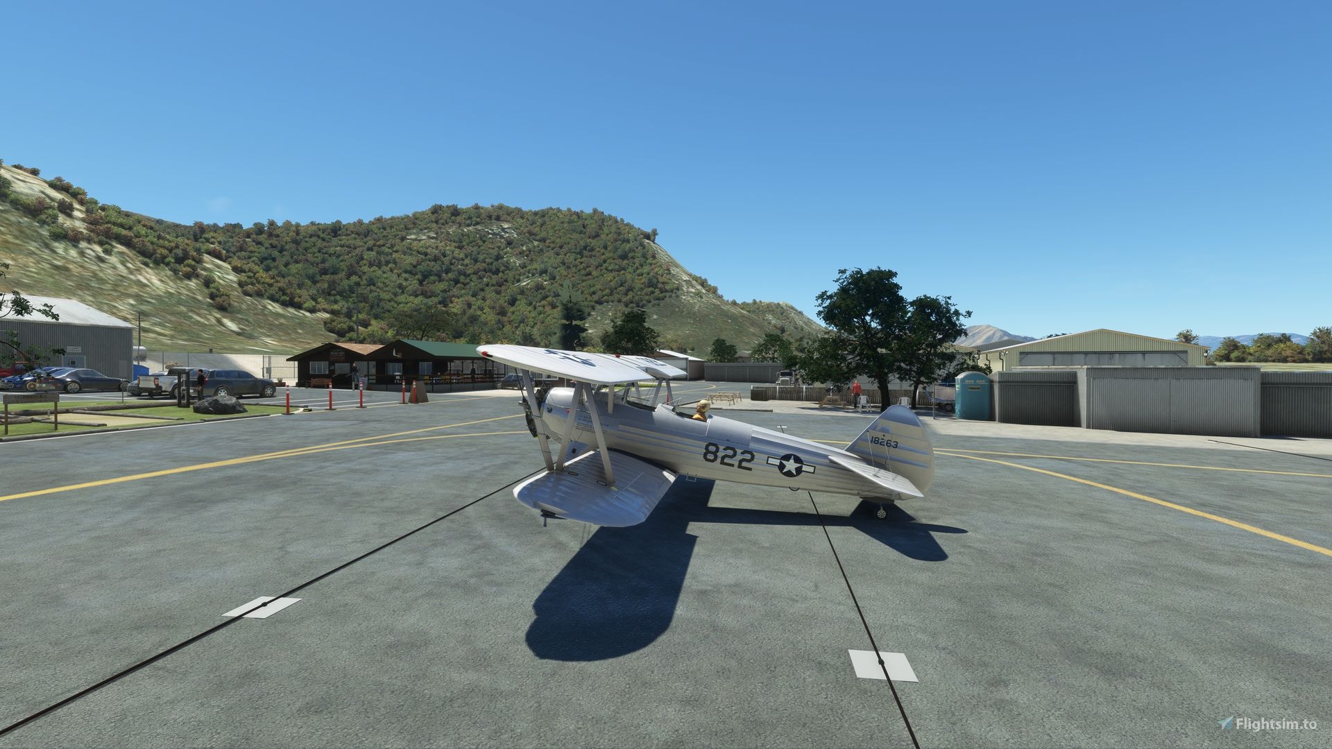
L05 is located in Southern California, in the southern Sierra Mountains. In the stunning area of Lake Isabella, Kern Valley Airport is great little airport, with a single 3'500 ft (1067 meters) runway. You will enjoy on camping for pilot flying in, next to the Kern River, with its own parking and taxiway. Don't forget the iconic onsite Kern Airport cafe! For helo addicts, Kern Valley has a helipad used by the U.S. Forest Service where you can do firefighting operations.
Kern Valley Airport was one of my favorite small airfield in FSx/P3D. Nor only because of the great rendition by Orbx but also because the region was stunning: Isabella lake, Kern river, the south of the Sierra Nevada mountains, the runway into the valley. It’s also a pilot’s challenge due to the high altitude + high temperature. Did I mention the wind also?
Features
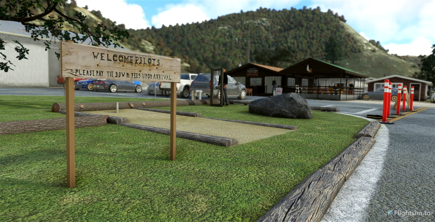
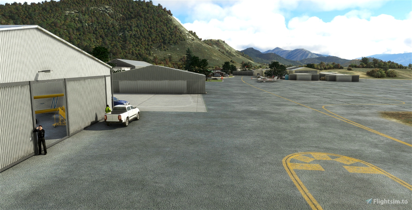
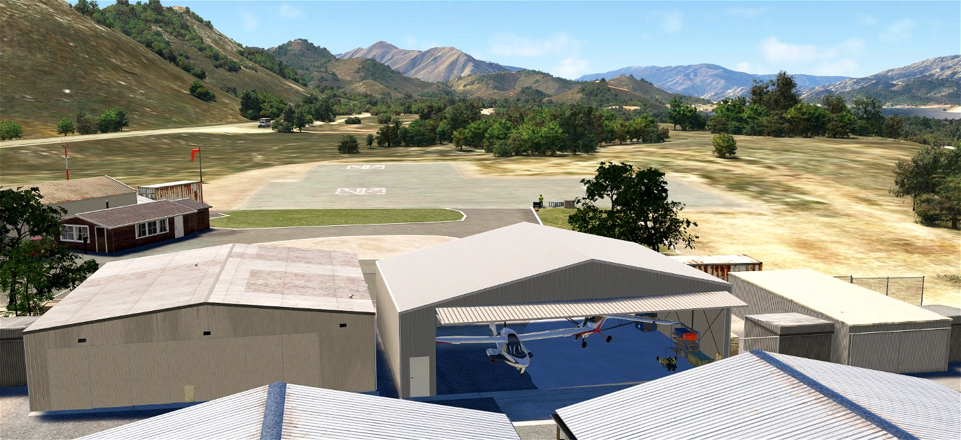
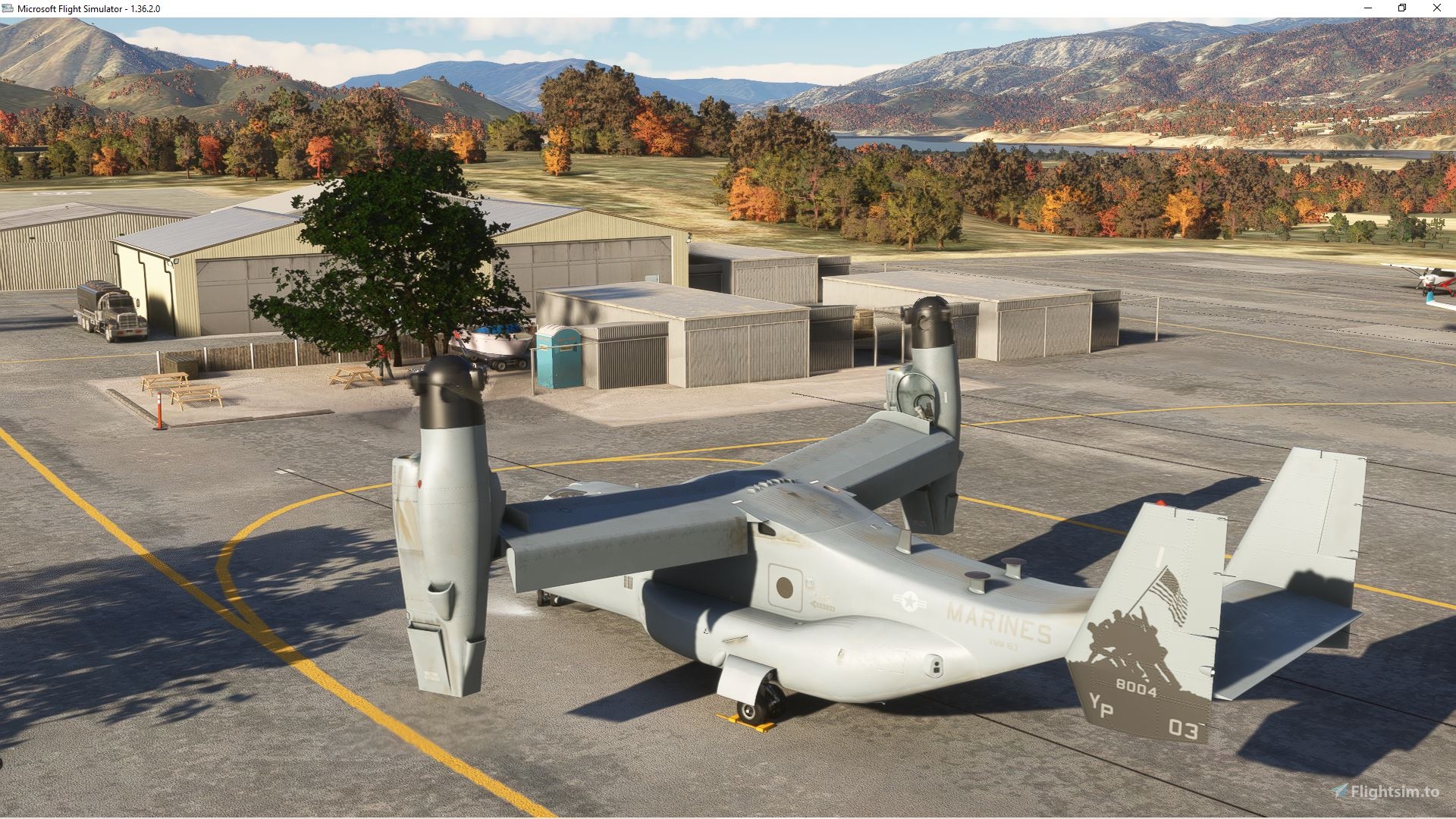
- Add the iconic Kern Cafe custom building
- Add the sloped parking area
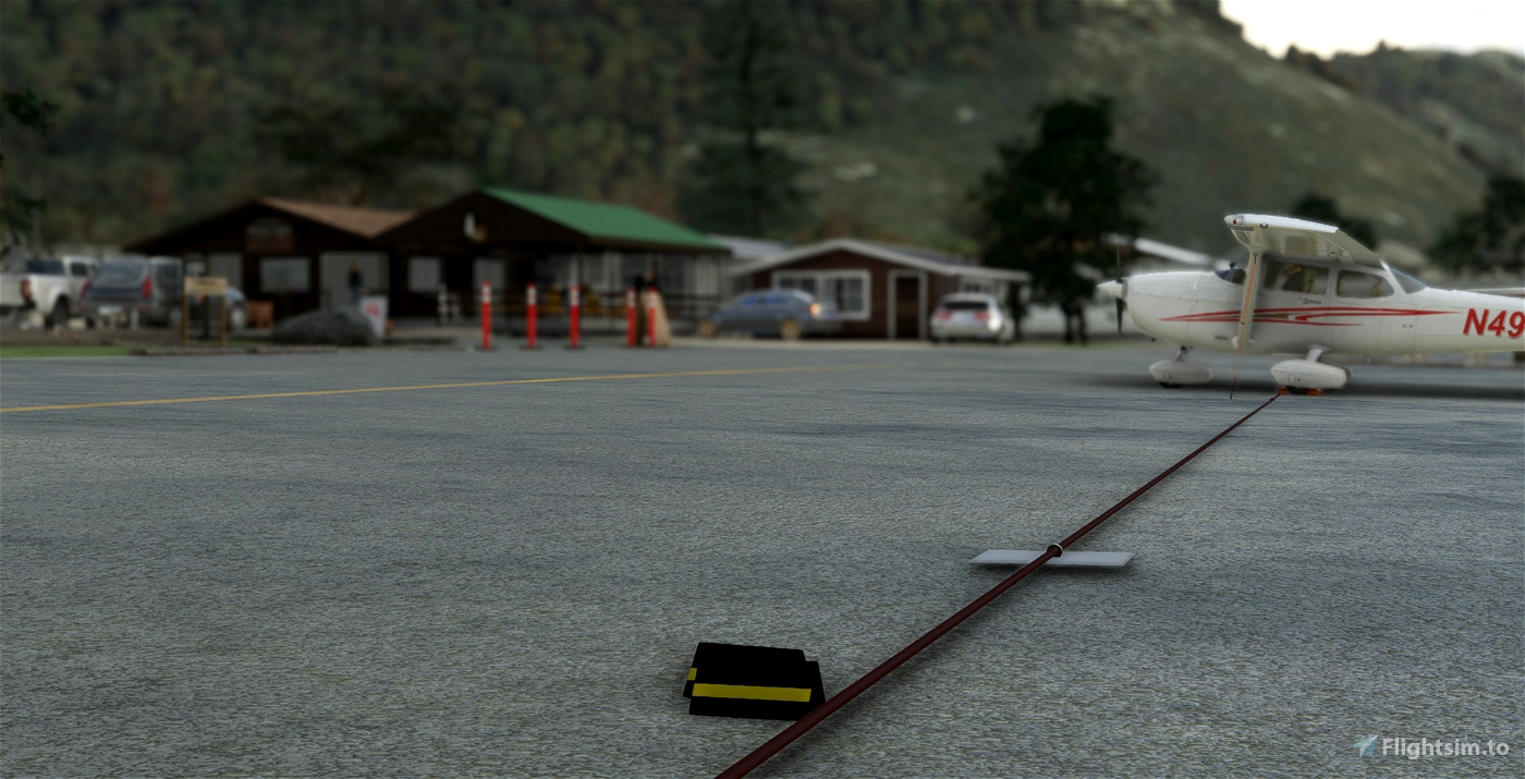
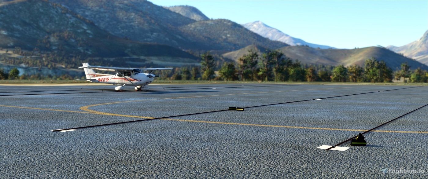
- Add parallel wire ropes/cable on main apron to secure your aircraft
- Add tents and redesign the camp ground
- Add the only taxiway sign (you have to find it :) )
- Add perimeter fence (most... still WIP, almost done)
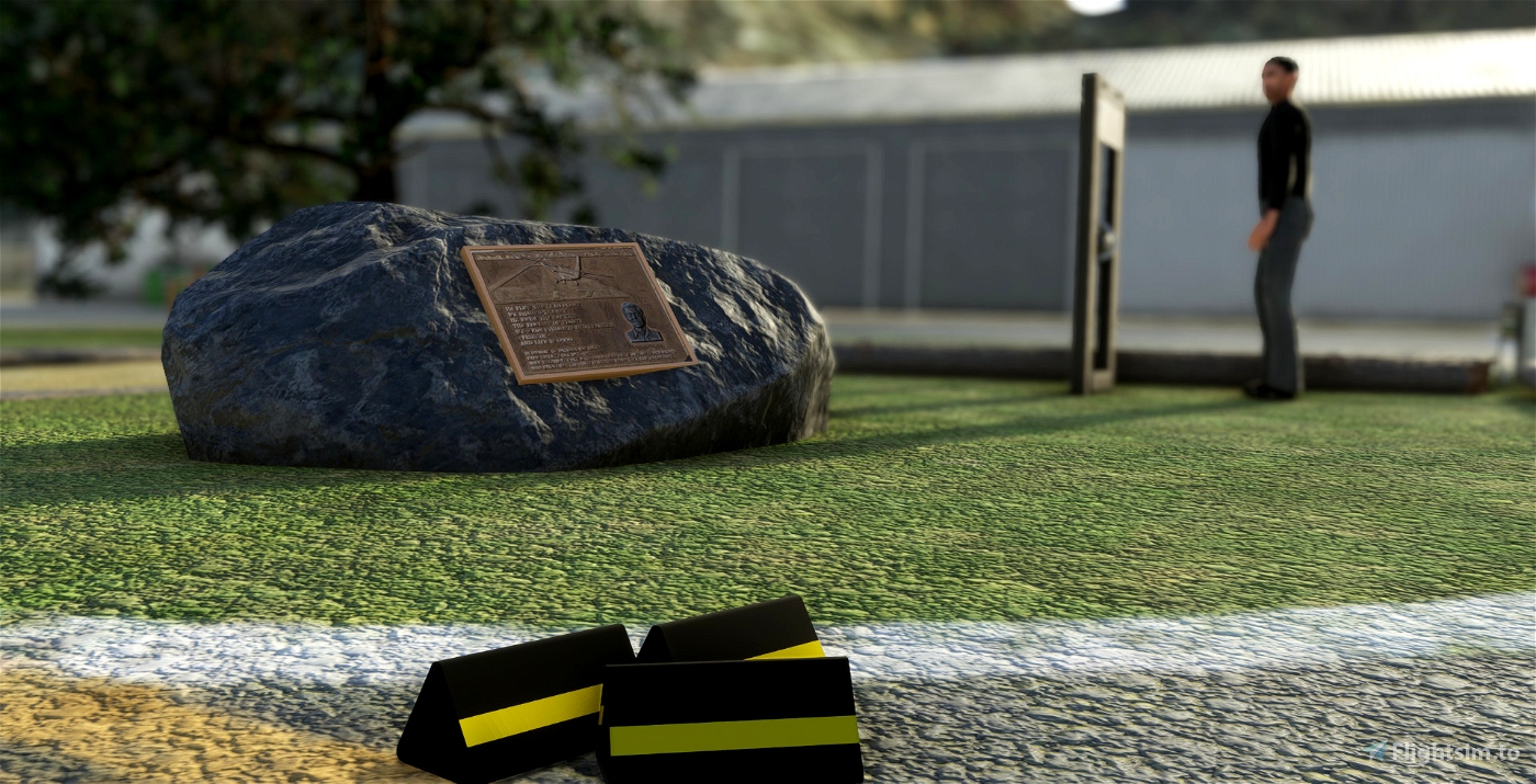
- Add numerous objects in front of the Cafe : iconic weather report stone, commemorative sign, playground, welcome sign
- Add the segmented circle for the Windsock
- Add helipads starting position
- Delete all (unreal) autogen taxiway signs
- Enhanced the terraforming
- Replace all default autogen buildings
- Reposition taxiways and markings
- Reveal the "ELEV 2614" marking on the taxiway
- Clean up the shore and watermask of Lake Isabella close to the airport
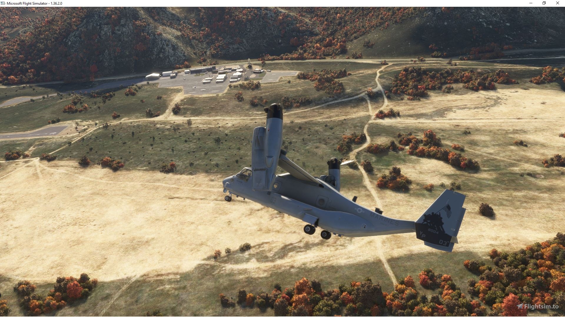
- Fix the traffic pattern location: right for both side because of the mountain on east side
- No extra library or depedencies required.
From the flight deck
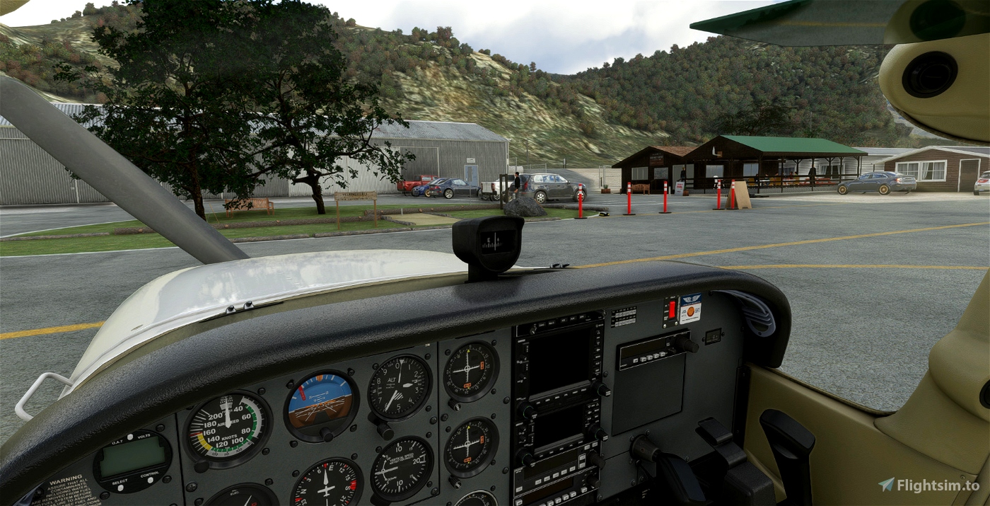
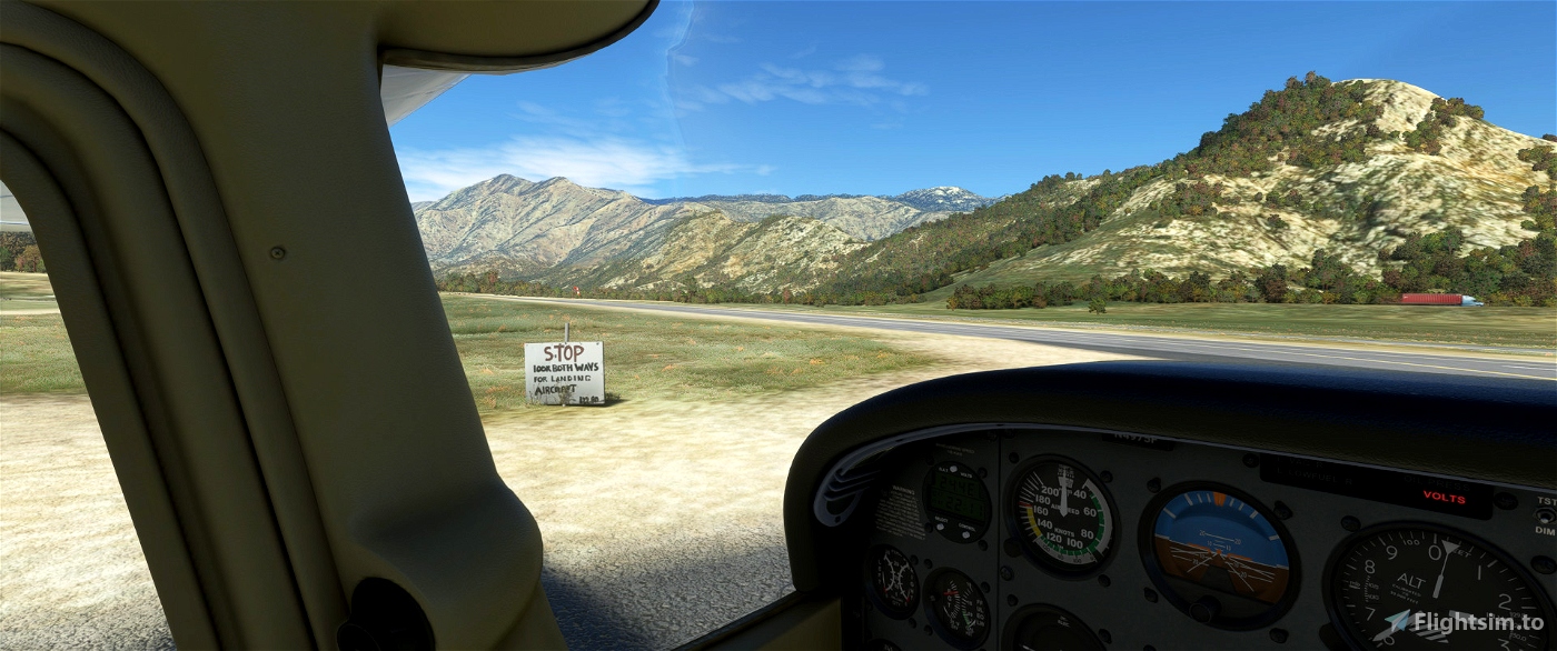
The traffic pattern is right for both side because of the mountain on east side. From the official web site: "Typical canyon winds generally prevail. Light, early-morning down-canyon winds from the north favor Runway 35, though early morning departures on Runway 17 with a light tailwind are common to avoid rising terrain and the town of Kernville to the north. Later, the wind often reverses mid-morning and flows from the south, up the Kern River canyon, favoring Runway 17." Even if the sign says "We have fuel", don't expect a fuel station. You have to "stop by the cafe to get someone to pump from the truck or text/call ahead". All flight end only when you secure your plane: pay attention to the sloped parking in front of the Cafe. Set the parking brakes, put a couple of chocks on the wheels (I drop some in the scenery) and secure the airplane with chains or ropes: https://www.flyingmag.com/technique-tip-week-pay-attention-sloped-parking/)
More aviation and real info
- Official website: http://www.kernvalleyairport.com/
- Skyvector: https://skyvector.com/?ll=35.72823110611119,-118.41970824816357&chart=301&zoom=5
- Airnav.com: https://airnav.com/airport/L05
- SOCAL Backcountry airstrips guide : http://www.kernvalleyairport.com/uploads/4/5/0/3/45030039/socal_backcountry_airstrip_guide_v1.2_1.pdf
How to install?
Unzip the file into your Community folder. Keep the folder structure from the zip (\AirportServices \ContentInfo, \MaterialLibs, \scenery, layout.json and manifest.json at the root directory). Once installed, select "L05" as usual. This scenery replace the stocked MSFS one.
Requirements
- World Update II (USA) and X (USA)
- World Update XI Canada
- FAWC (Worcester Glider Airport - South Africa) and KRVL (Mifflin Co, Reedsville - USA) free from the MSFS 40th Anniversary Edition
- No other extra library required.
Known bugs
Some terraforming issue. I'm still learning! And things I'm not aware of that you'll notice me, thanks for providing feedback!
Author's final note
As for all of my MSFS mod, this small scenery is made from a pilot-eyes perspective. The scenery is inspired by aerial views from Bing and Google maps. It's a mix between the satellite imagery displayed from MSFS and more accurate data found on Internet. I did my best, based on online videos and pictures freely available. I also used some of my personal video taken during a flight I did here in 2019 (https://youtu.be/BdQNtJLEIl4). Hundreds of objects have been added to the default scenery to make in more live and bring a touch of an active area.
If you have local pictures to help being more accurate, let me know!

 vbazillio


SteveAutoPilot
vbazillio author
25 days ago
PAPYDANIEL66
et voila je me suis balader dans le secteur e L05 vers China Lake KNID en passant par KIYK
superbe
merci
vbazillio author
1 months ago
StevePHL
vbazillio author
25 days ago
browns11
vbazillio author
25 days ago
neucoas
https://i.imgur.com/9dbJfFK.jpeg
vbazillio author
3 months ago
pmrose
Thank you
vbazillio author
4 months ago
hvh9001
vbazillio author
4 months ago
jvortiz56
GoneFlyin
vbazillio author
8 months ago
riveter
vbazillio author
9 months ago
Venford
Malichos
pile
vbazillio author
12 months ago
jmkarr
Should have taken a picture of the 1/2 lb. hamburger available at the Kern Cafe. I lived in the area and made frequent trips to the cafe for the best hamburger in the area.
Your rendition of the airport is pretty right on. Good job.
vbazillio author
12 months ago
Dexdoggy
This is just brilliant! Flew north to The Needles (never knew of these!) and back on a mostly clear day with some drizzle and wind thrown in. As with all of your airfields this is 100% immersive. Thank you so much!