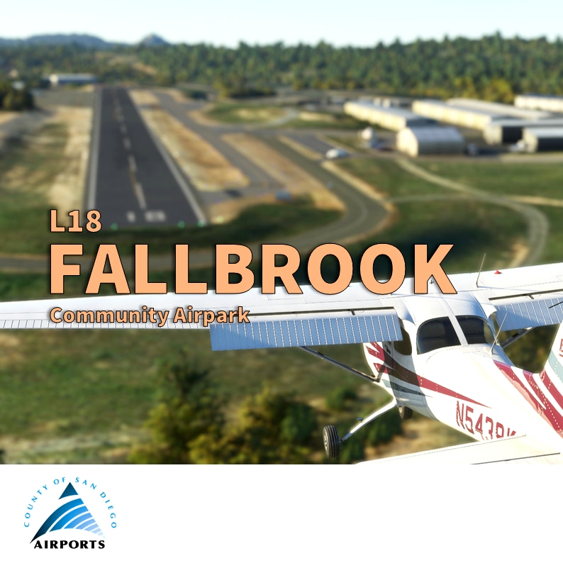
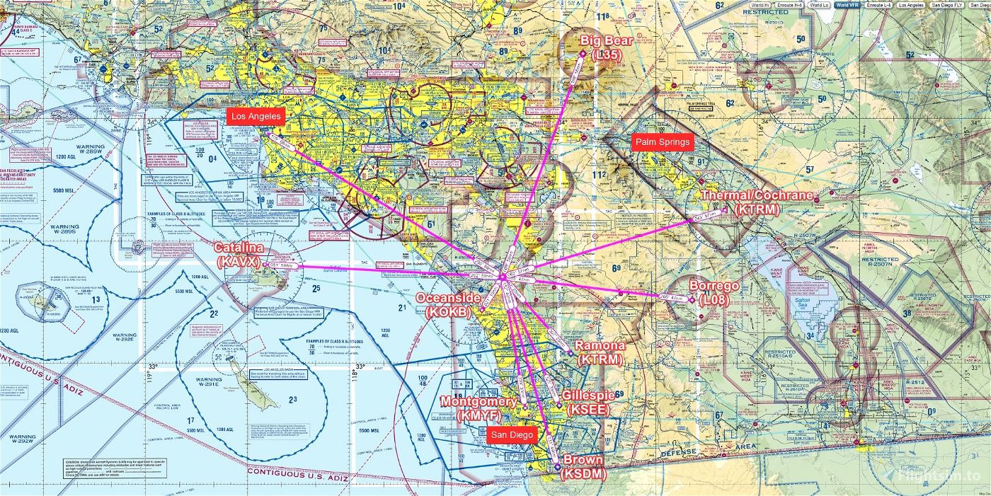
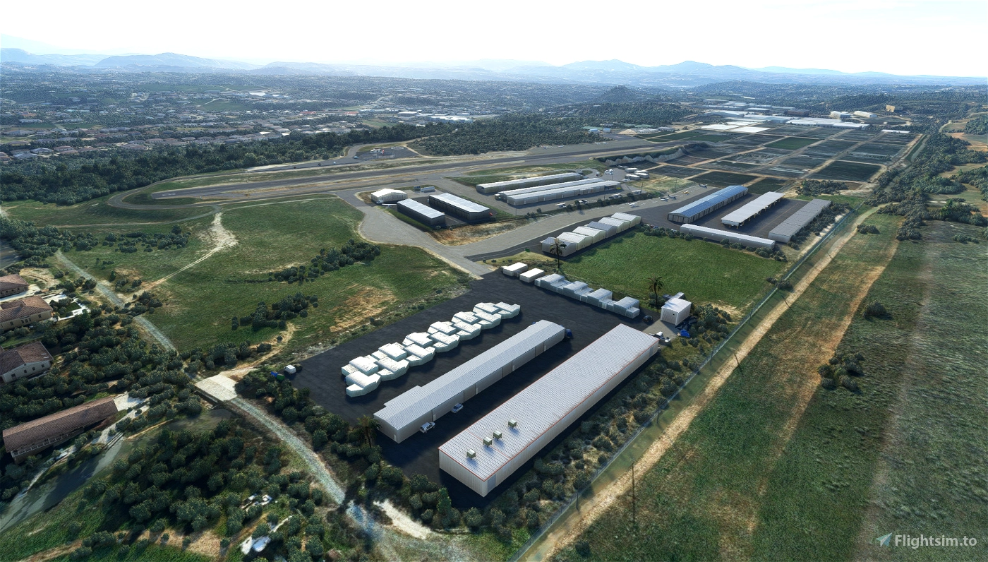
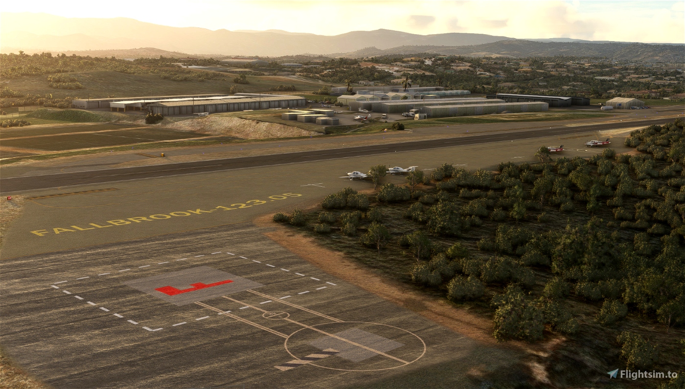
Fallbrook is a small general aviation airport and uniquely located. Few miles between San Diego, Los Angeles and Palm Springs, it’s unique, sited on a lone mesa a few hundred feet above the city. "Its spectacular runway views include Mt. Palomar, home to the world-famous 200-inch reflecting telescope, to the east. To the west is the Marine’s Camp Pendleton, to the south is the San Luis Rey Valley, and to the north sits the largely agricultural community of Fallbrook, most famous for its avocados, and a handful of celebrities who mostly want to remain anonymous" (source AirportJournal).
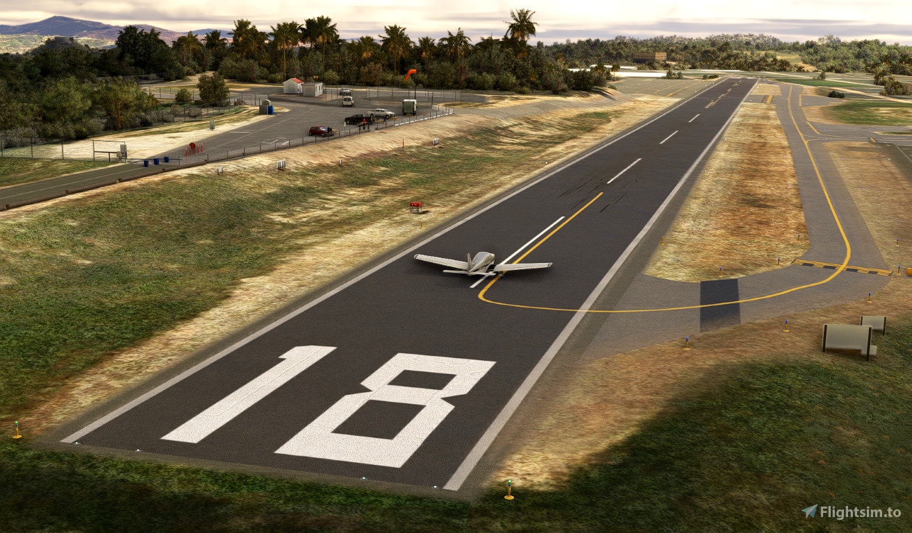
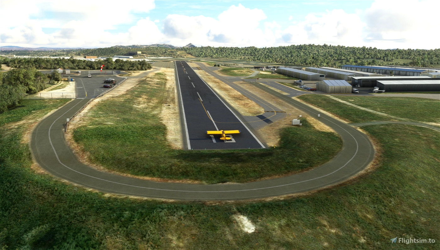
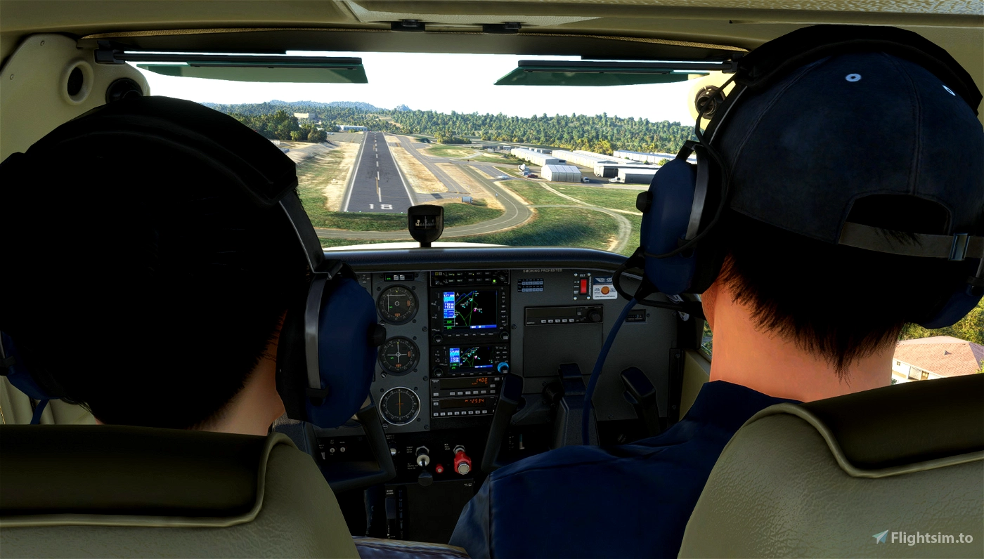
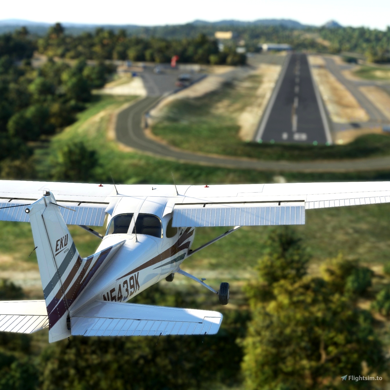
Fallbrook is part of County of San Diego airports and one my freeware covering GA airports (see my flightsim.to Collection). Its challenging for the GA pilot because of its relatively short runway of 2160 feet (658 meters). The airport remarks of the chart supplement says "No safety area available due to abrupt drop–off each end of runway"
IMPORTANT: please note that my skill in terraforming were highly challenged and that I'm not fully satisfied with the result but so far it's the best I can do. For example, the taxiway going uphill are far from perfect and should be taken at slow speed and with maximum caution.
Features
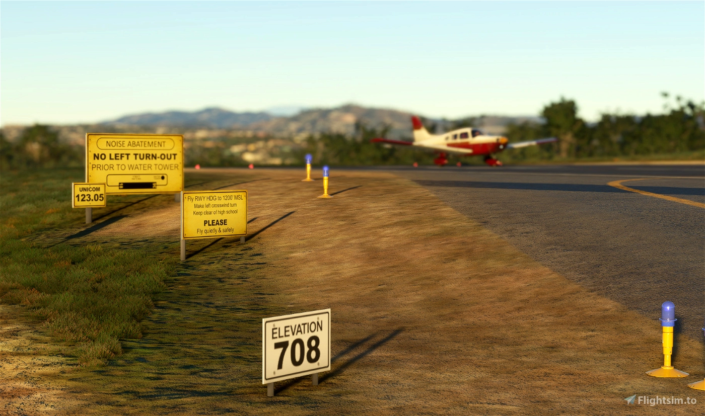
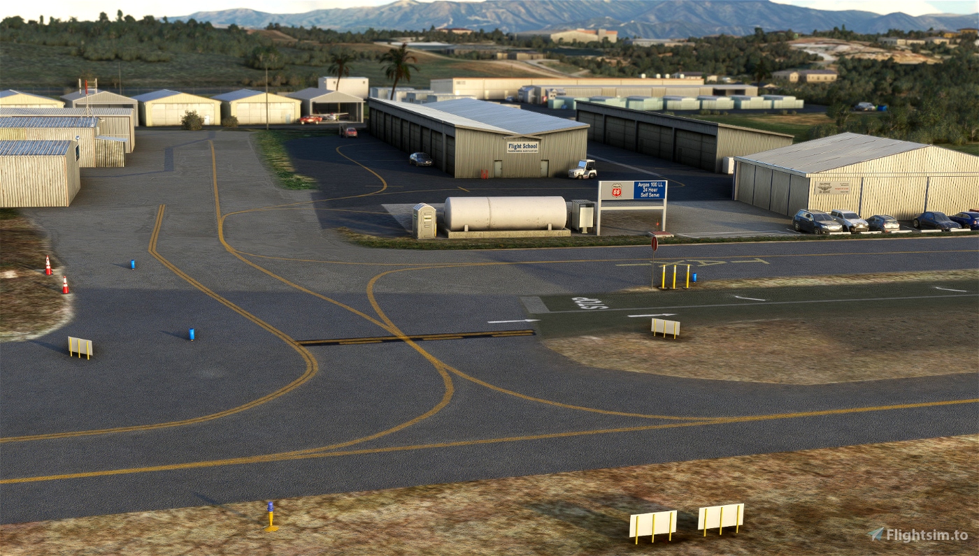
- Add the pulsating VASI (Pulsating white – Too high // Steady white – On glide path // Steady red – Too low // Pulsating red – Dangerously low)
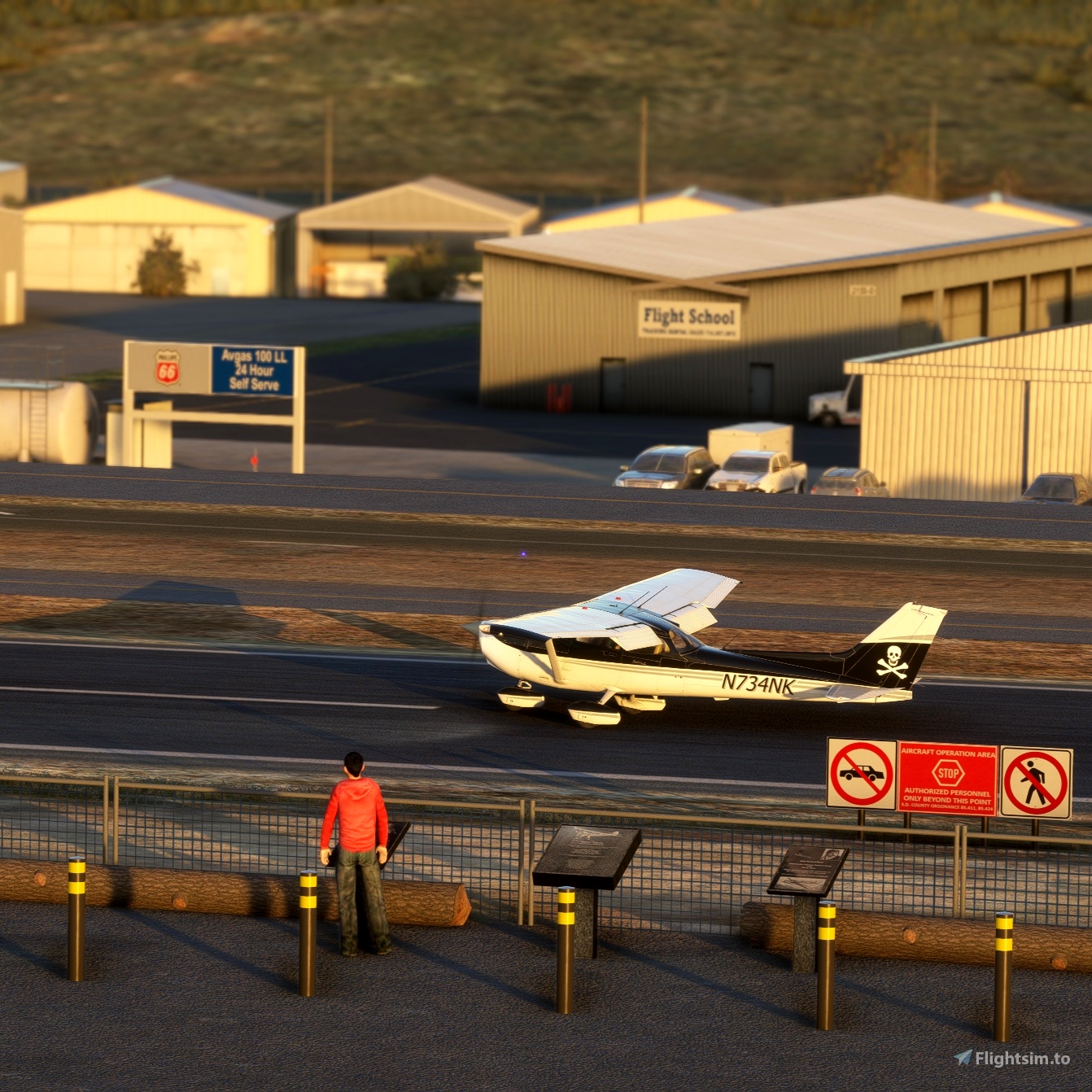
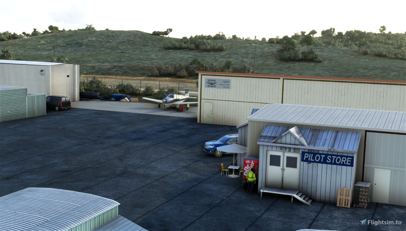
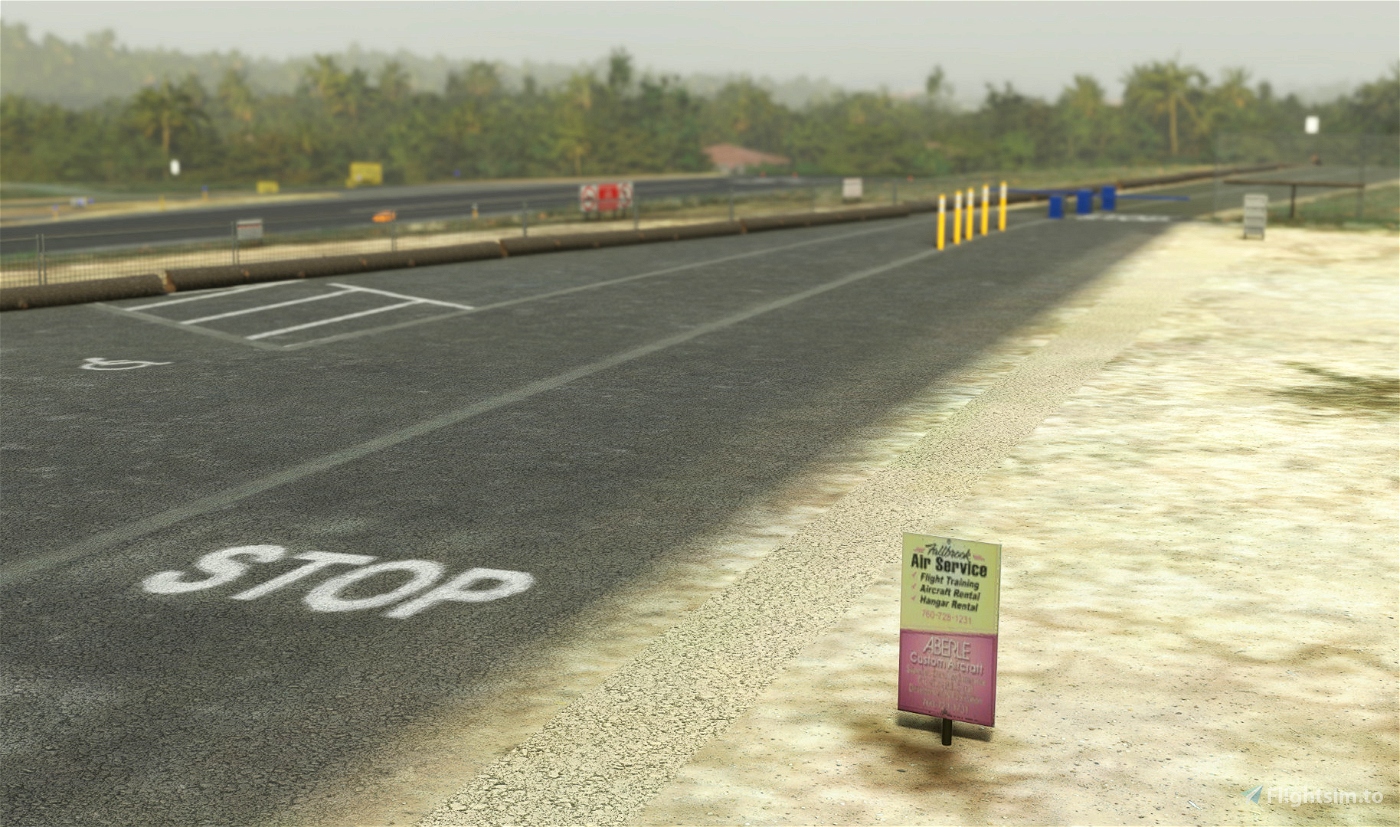
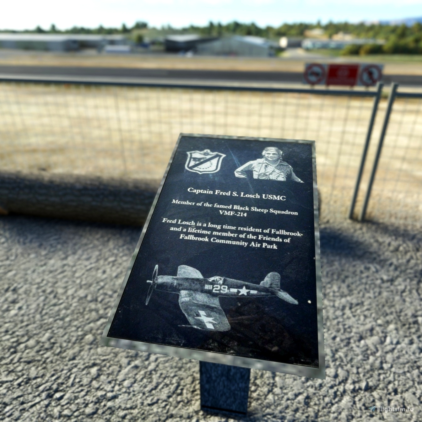
- Add several building's signs of local business (if you know more, let me know!)
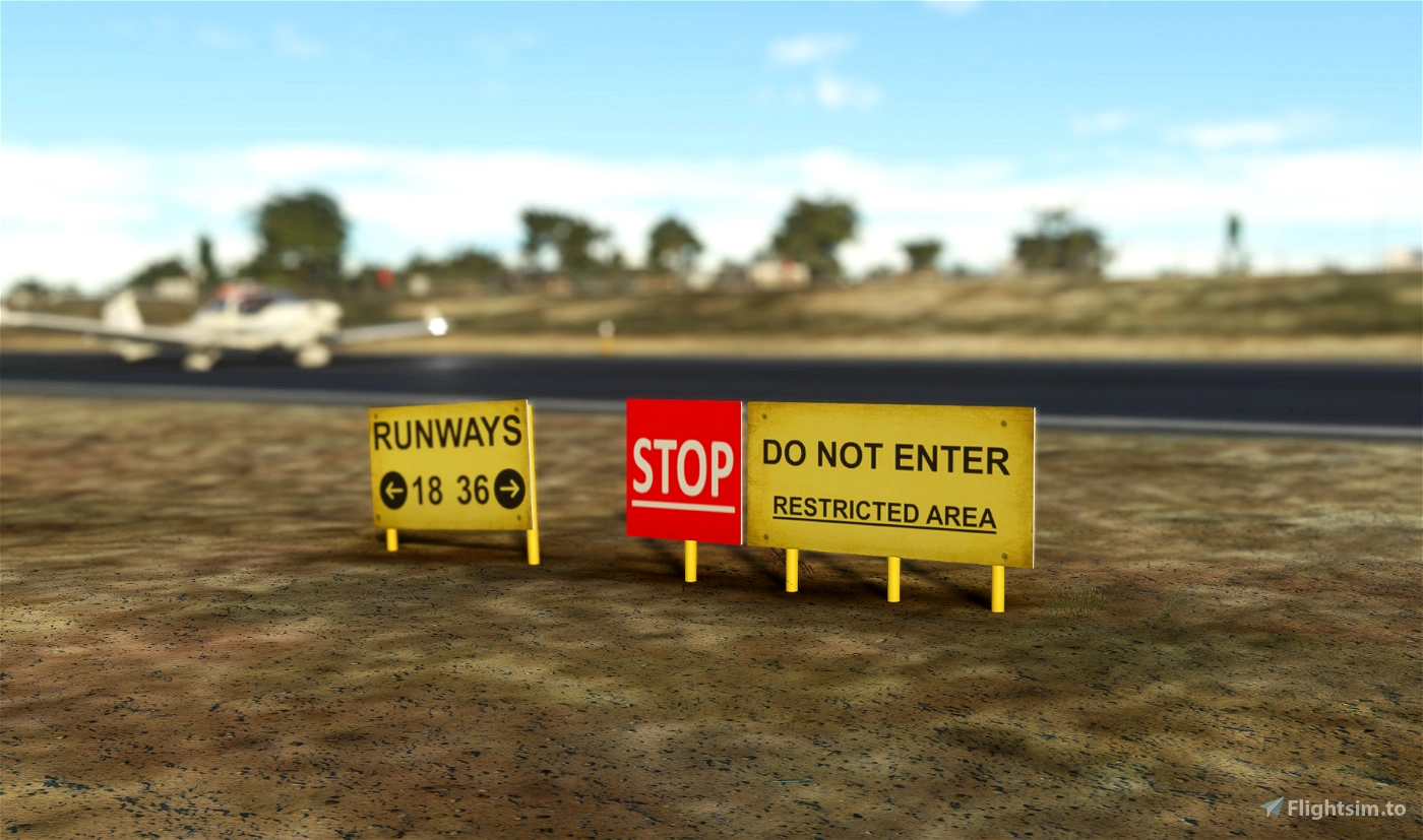
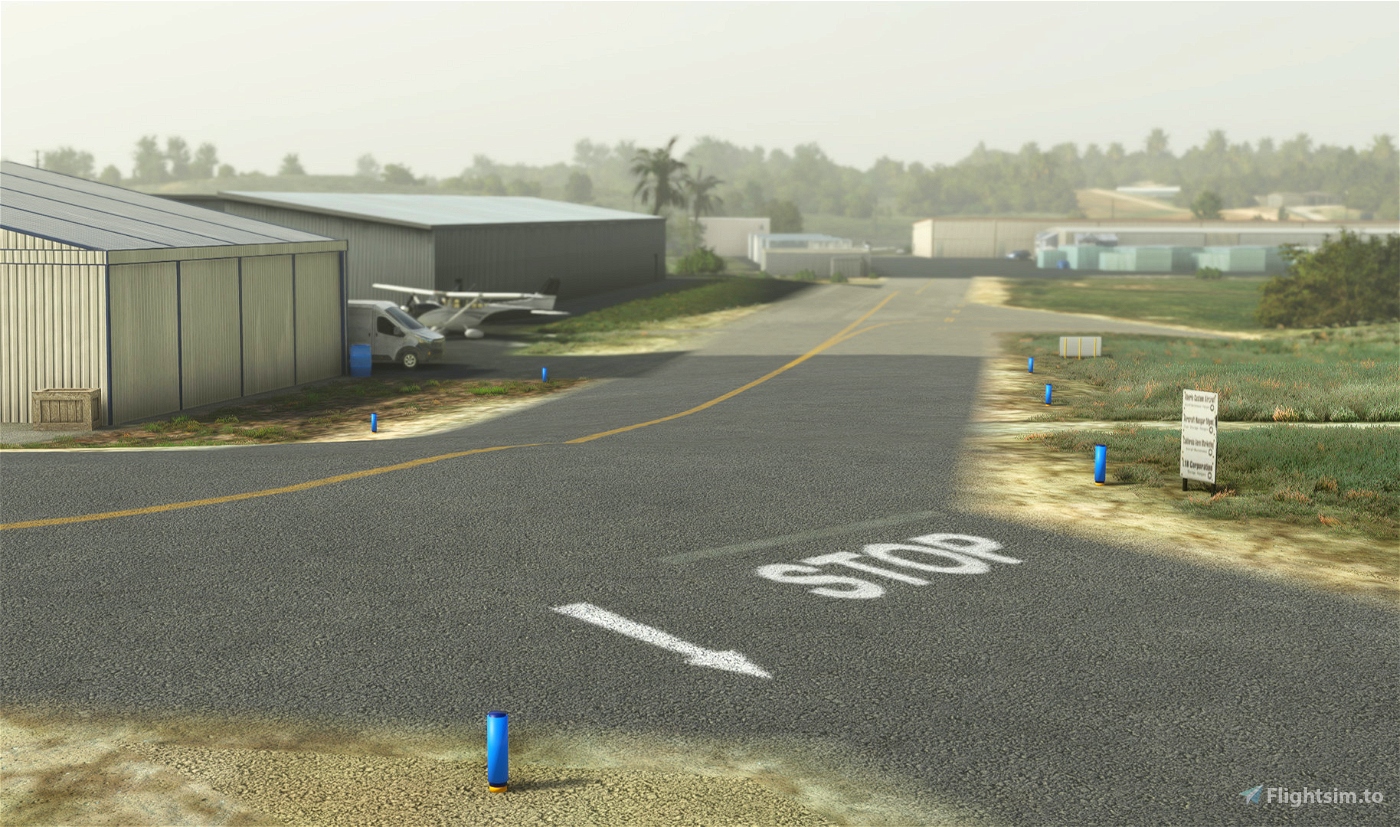
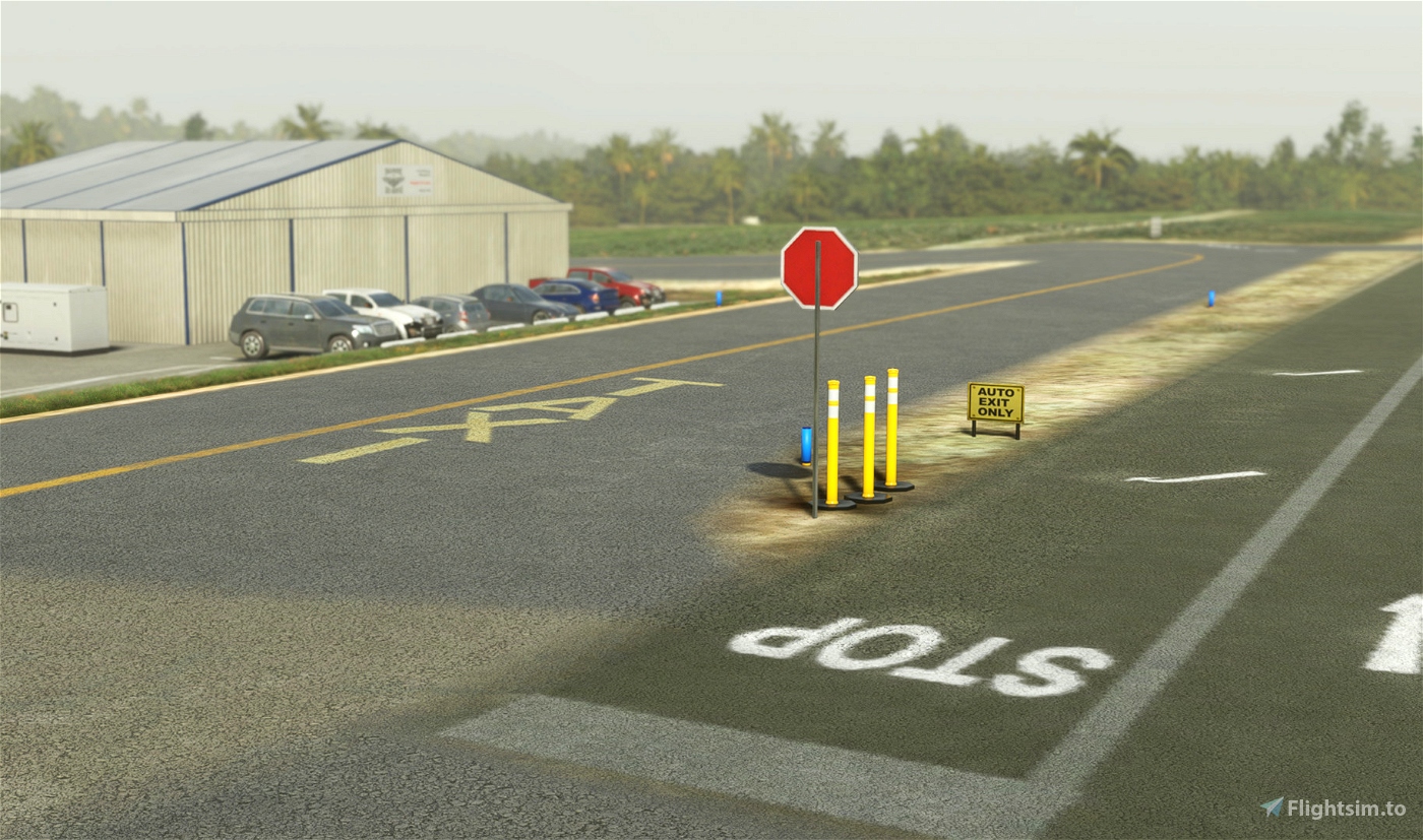
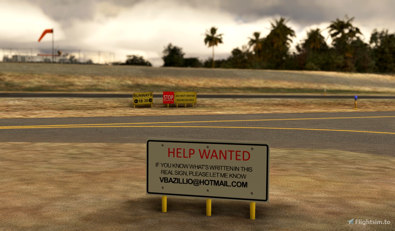
- Add specific taxiway signs (warning, do not enter, runway direction...)
- Add the water tower and solar farm (POI) indicating the downwind
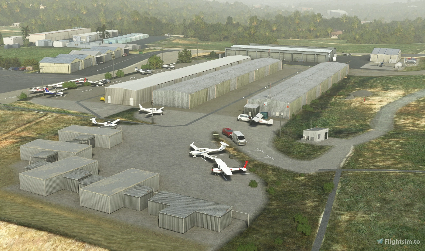
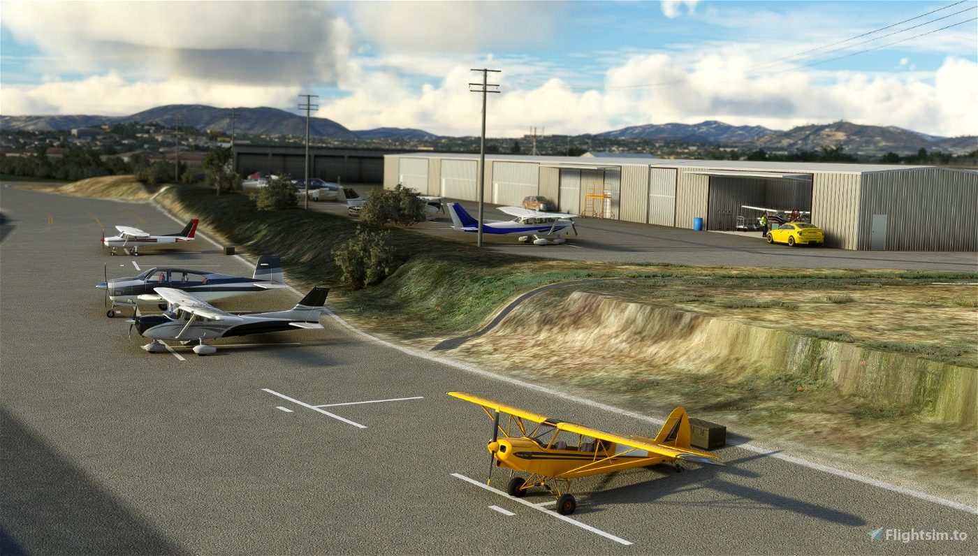
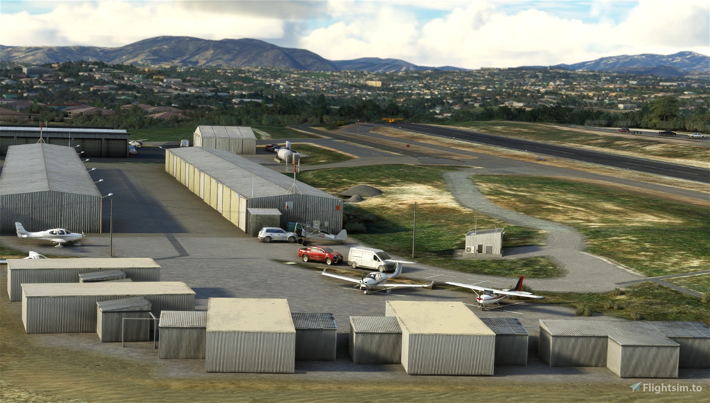
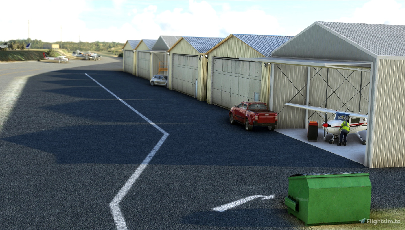
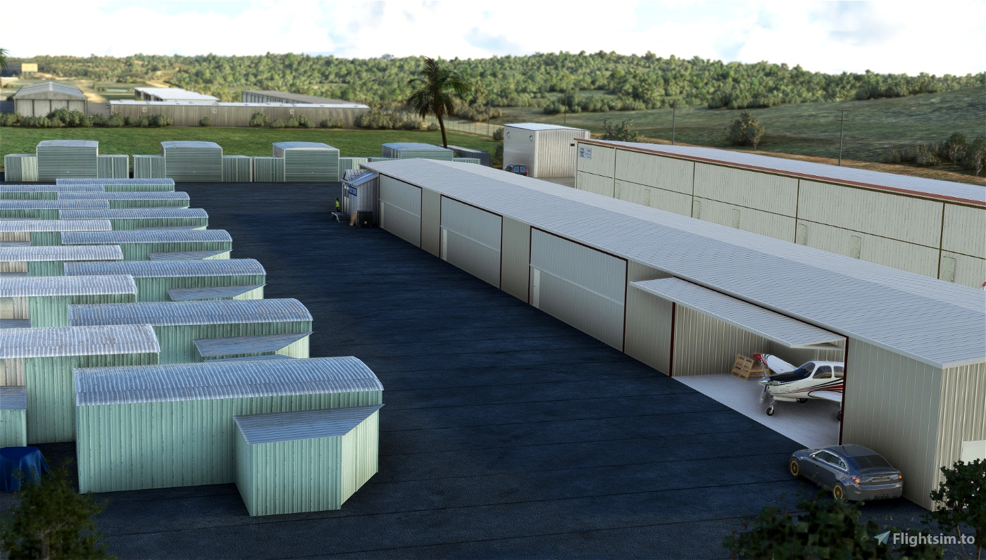
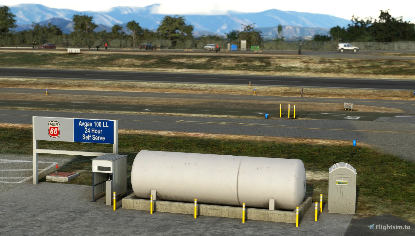
- Add hundreds of detail: static aircrafts, opened hangars, small objects spread all around the airfield, ground markings...
- Special attention to blend all apron with the underlying satellite image
- Replace the windsock with a handcrafted all orange animated windsock
- Replace all AI generated hangars by more appropriate object (opened hangars and shade shelters)
- Enhance the Sheriff's helipads and add the one at transient apron (start position capable)
- Clean of AI generated taxiway signs, replace blue poles by passive reflector blue one as in real life
More info for pilots
- Skyvector: https://skyvector.com/airport/L18/Fallbrook-Community-Airpark-Airport
- Airnav: https://www.airnav.com/airport/L18
- Airport Journal: http://airportjournals.com/returning-fallbrook-airport-to-former-glory/
If you love the San Diego area, you should also consider my other sceneries (in this collection:https://flightsim.to/collection/35/san-diego-general-aviation-airports)
- KMYF Montgomery Field: https://flightsim.to/file/5856/montgomery-gibbs-exec-airport-taxiway-fix-and-many-more
- KRNM Ramona: https://flightsim.to/file/25710/ramona-krnm
- KSEE Gillespie: https://flightsim.to/file/36679/gillespie-field-ksee
- KOKB Oceanside: https://flightsim.to/file/37328/oceanside-box-maxwell-memorial-airfield-kokb
- KSDM Brown Field Muni : https://flightsim.to/file/38035/brown-field-muni-kdsm
- L08 Borrego Valley: https://flightsim.to/file/38247/san-diego-borrego-valley-l08
- L18 Fallbrook Airpark Community: https://flightsim.to/file/63441/fallbrook-community-airpark-l18
- L54 Agua Caliente: https://flightsim.to/file/66221/agua-caliente-springs-l54
The Bush Trip "San Diego VFR Transition": https://flightsim.to/file/6276/vfr-transitions-at-san-diego
Remarks
I noticed that on my configuration REX Accuseason create artefact on ground sand textures but also add too many palm trees.
Requirements
- This scenery doesn't required any extra library. It's only made with stocked MSFS object from the integrated library, except the open Windhover hangars and some handmade very small object like taxiway signs.
- Sedona scenery (free included in standard MSFS)
- World Update II (USA) + World Update X (USA)
Thanks to
This scenery uses Windhover "Open Hangar Library" (https://flightsim.to/profile/Windhover) but no need to install anything extra. Just a BIG THANK YOU : https://flightsim.to/file/26325/open-hangar-library
Author's final note
As for all of my MSFS mod, this small scenery is made from a pilot-eyes perspective. The scenery is inspired by aerial views from Bing and Google maps. It's a mix between the satellite imagery displayed from MSFS and more accurate data found on Internet. I did my best, based on online videos and pictures freely available. If you have local pictures to help being more accurate, please let me know!

 vbazillio


browns11
pavel.k
DaveR997
vbazillio author
7 months ago
LegibleSphere
jetpilot82
Could you maybe consider to make KTOA (Torrance) and San Carlos (KSQL)
would be great 😊
vbazillio author
7 months ago
JockoFlocko76
Cheers! 😊
vbazillio author
7 months ago
GNJM
Merci Vincent.
vbazillio author
7 months ago
gosub
vbazillio author
7 months ago
Maki152
vbazillio author
8 months ago
PastyBoy74
I need to fly there in real life now to check out those signs for you!
All the best from KTOA.
vbazillio author
8 months ago
BurstixTV
vbazillio author
8 months ago
CalsFM
Greazer