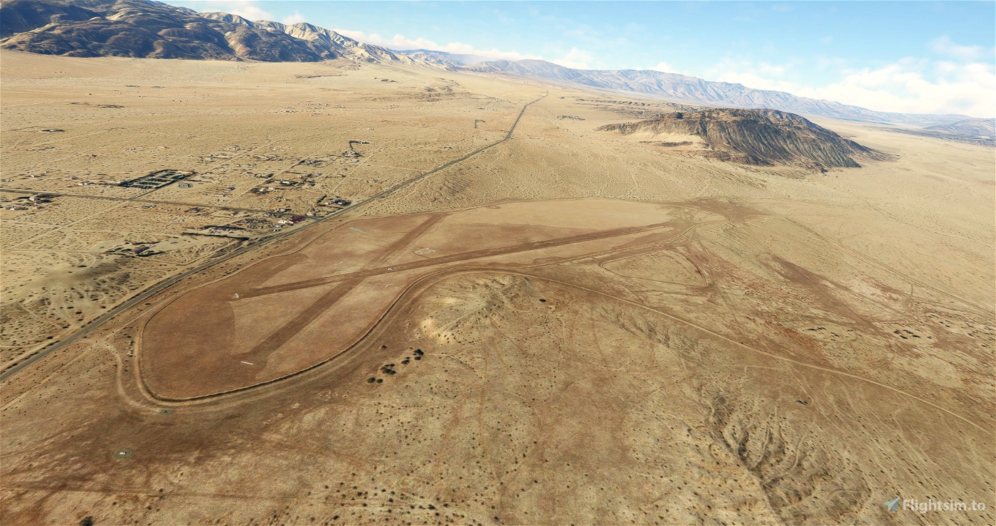
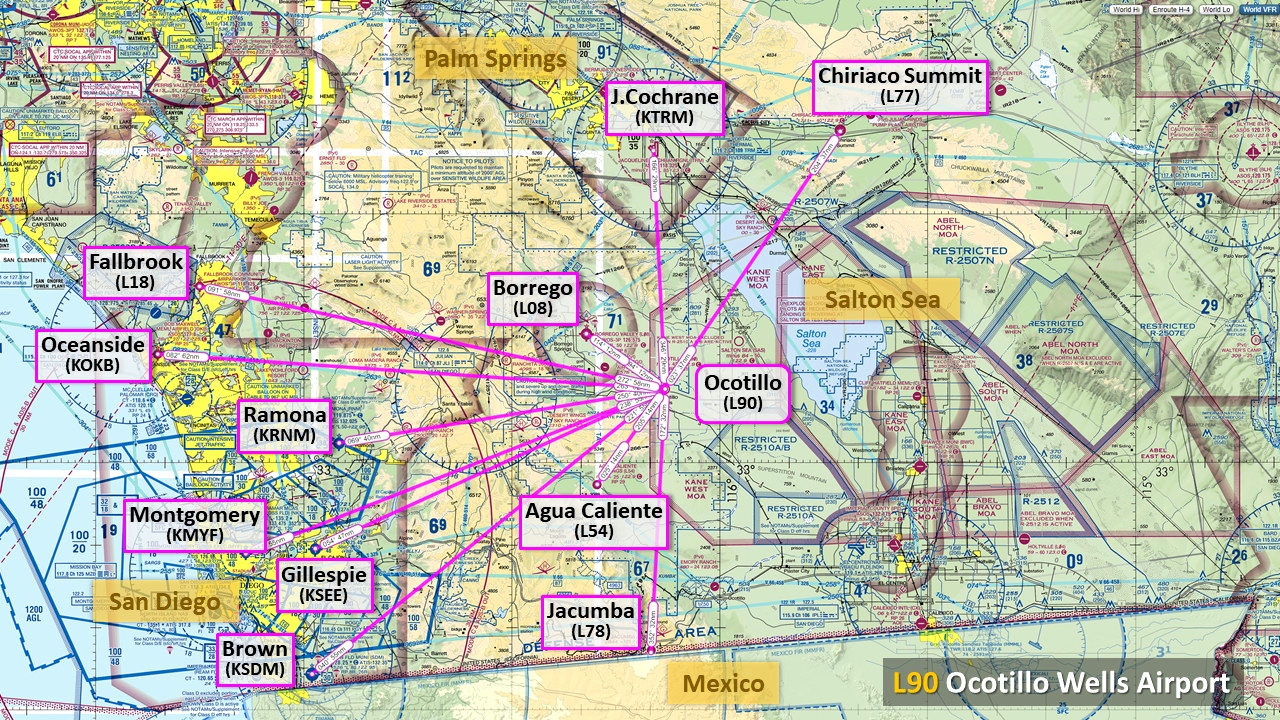
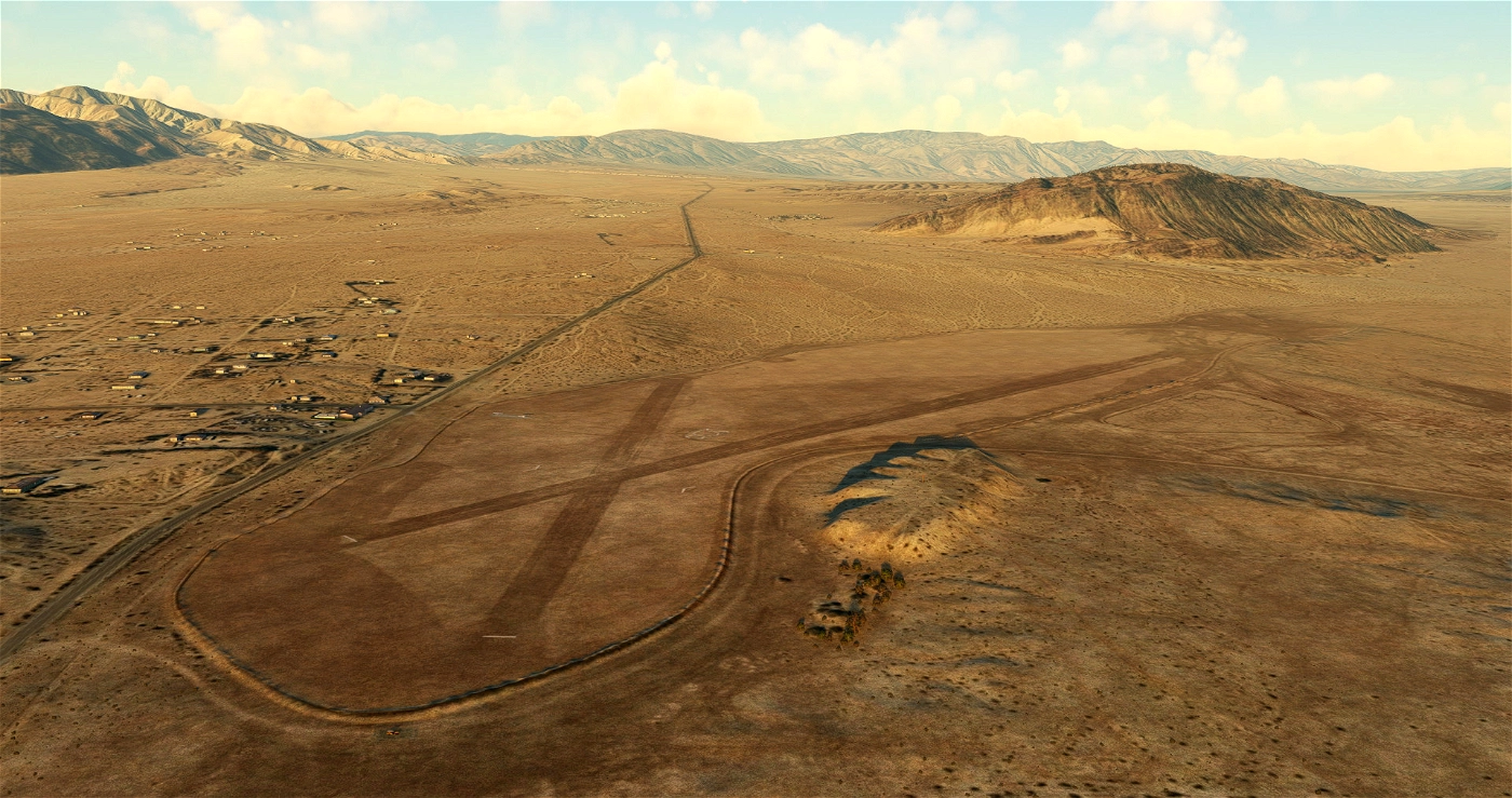
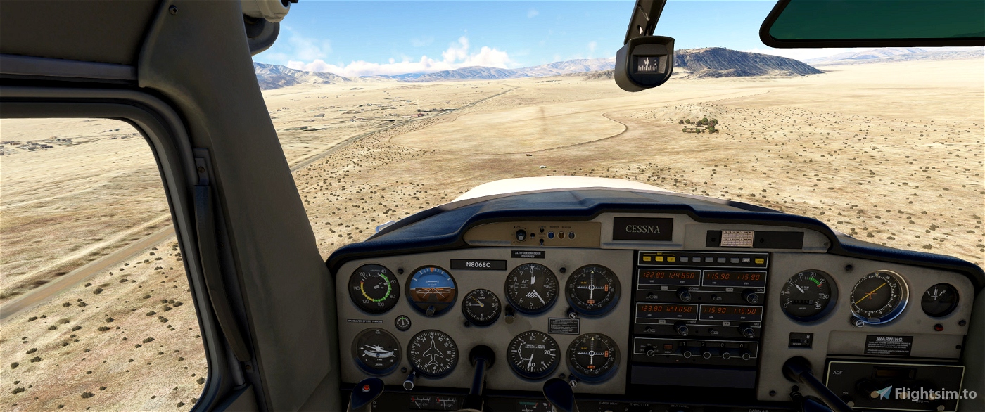
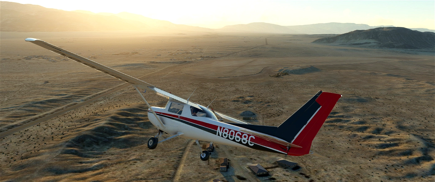
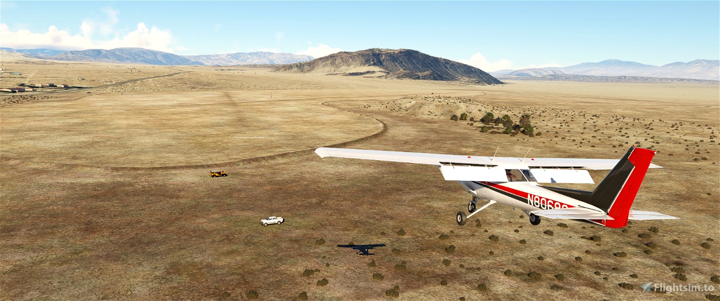
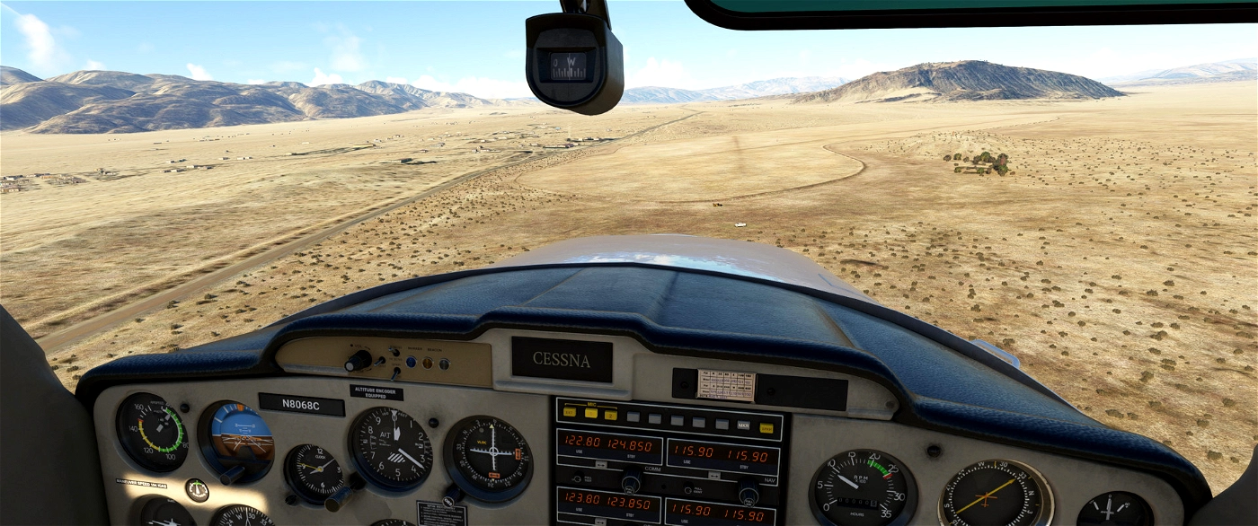
Ocotillo Airport (L90) is located in Ocotillo Wells, San Diego County, California.It features two runways with dirt surfaces. The first runway, 13/31, measures 4.210 by 150 feet (1,283 x 46 m), while the second runway 9/27 is 2,330 by 150 feet (710 x 46 m). on’t expect taxi sign, runway lights and even edge marking. The airport is surrounded by hills, adding a unique challenge for pilots. The airport sees an average of 60 aircraft operations per month, primarily transient general aviation and even some military. You can meet Osprey blowing sand here!
Historically, during World War II, the airport was used by the US Navy and was known as Naval Outlying Field, Ocotillo Dry Lake1. It served as a training base and supported various operations. The airport was returned to the county in 1956.
This airport, with its dirt runways and surrounding hills, offers a unique flying experience that blends history and challenge. It's the latest of the 8 aviation facilities owned by the County of San Diego included in the collection San Diego General Aviation enhancement for Microsoft Flight Simulator).
Features
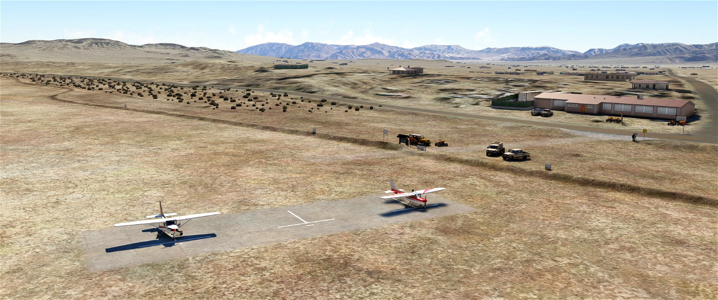
- Add the correct Windsock and its circle
- Add the Veterans Memorial (hill)
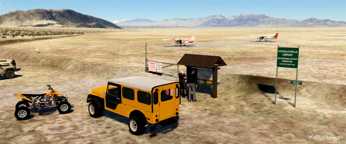
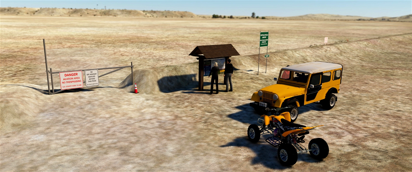
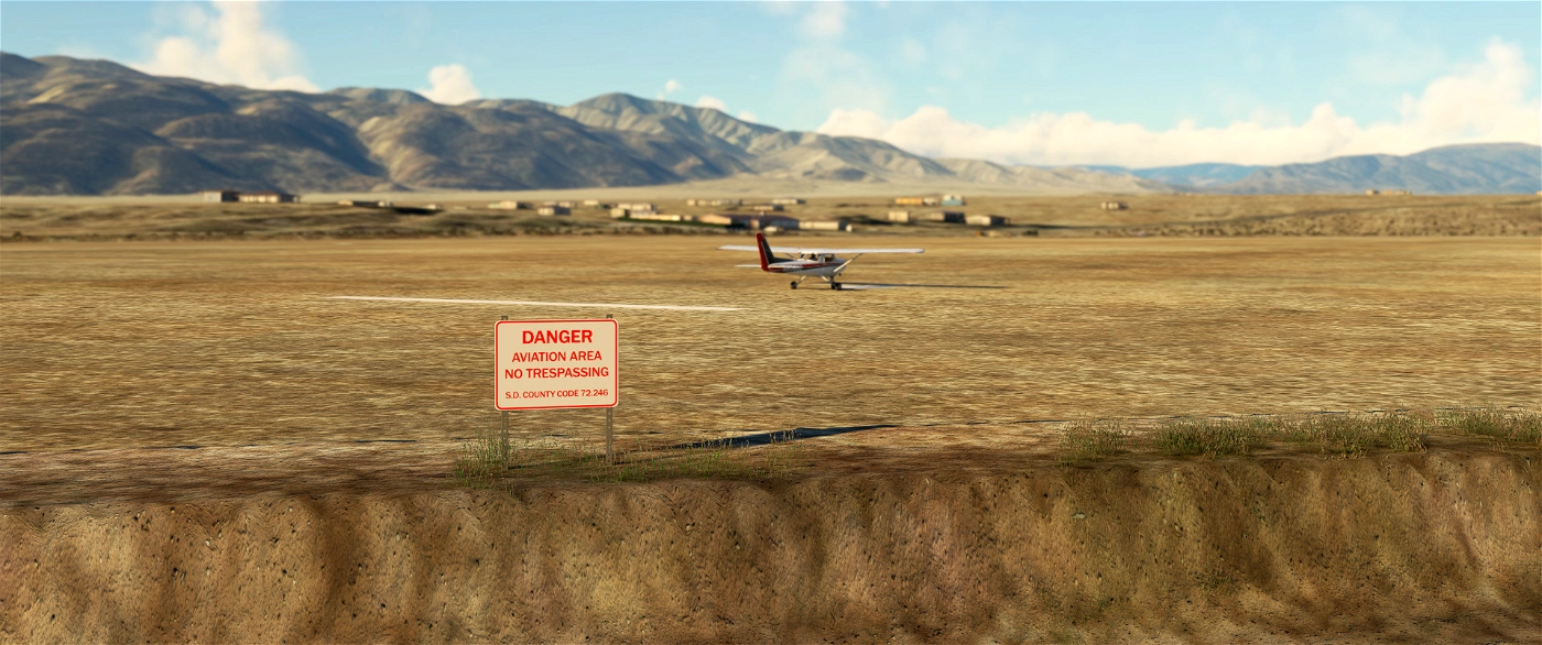
- Add handmade signs (warning, danger…) all around the field
- Add white paving at all runway intersections and thresholds
- Add one (fictious) helipad start position close to the “apron”Add ATV and 4x4 vehicles to illustrate the Ocotillo Wells State Vehicle Recreational Park
- Improve ground objects in the vicinity of the circuit pattern (for example the Holmes Camp)
More info for pilots
Requirement
- Sedona scenery (free included in standard MSFS)
- World Update USA II and X
- World Update Canada
- No other extra library required
How to install? Unzip the downloaded file into your Community folder. Keep the overall structure. Once installed go to L90 or Ocotillo via the World Map as usual, the scenery replaces the existing default one.
Author's final note
As for all of my MSFS mods, this small scenery is made from a pilot-eyes perspective. The scenery is inspired by aerial views from Bing and Google maps. It's a mix between the satellite imagery displayed from MSFS and more accurate data found on Internet. I did my best, based on online videos and pictures freely available. It uses also a lot of stocked object as my skill in 3D buildings creation is very limited. If you have local pictures to help being more accurate, please let me know!


 vbazillio


antoniozzi
vbazillio author
4 months ago
CaptainMoonlight
vbazillio author
4 months ago
bugdani
vbazillio author
4 months ago