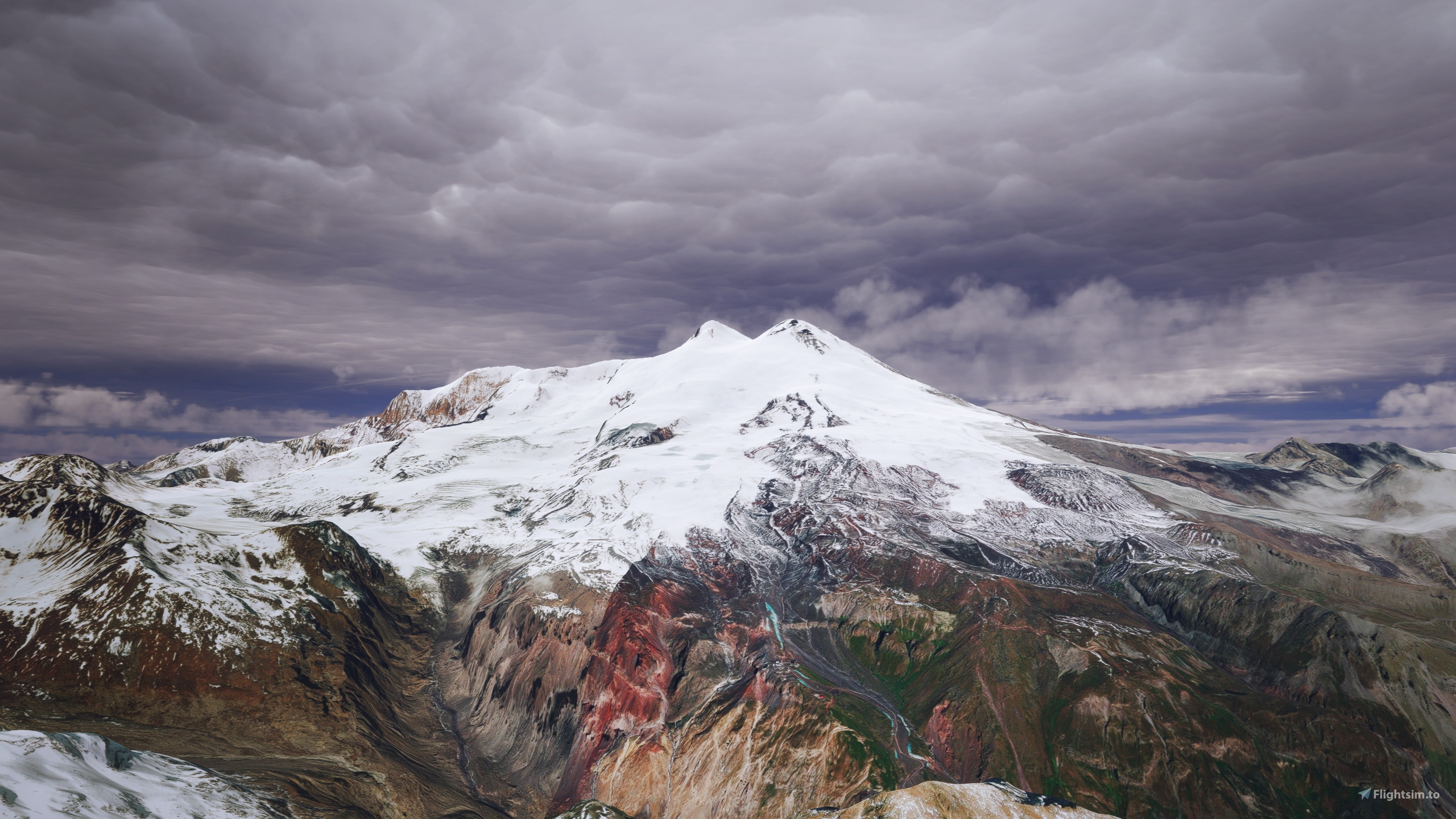
DEM | ETM10m Central Caucasus Mountain Range - Mount Elbrus vers. 1.0
This is an Enhanced Terrain Mesh derived from Sentinel-1A mission of the European Radar Observatory for the Copernicus joint initiative of the European Commission (EC) and the European Space Agency (ESA), 10 meters (1/3 arc sec). Mainly the area covered by this terrain mesh is related to the region of ... see coverage map (Russia |Kabardino-Balkaria, North Ossetia Alatia and South Ossetia, Ingushetia, part of Chechenya, part of Dagestan and part of Georgia).
Affected Sceneries
Any large Payware and Freeware Airport I could think of, has been excluded from the mesh. So hopefully the glitches will be minimal.
Please report any bugs with sceneries or airports and I will see what I can do!
Created using MSFS Toolkit by Nool Aerosystems (MSFS Toolkit).
Flattening for all bodies of water, excluding rivers. (Thanks to @Henrikx)
On Discord: ItalianCharter Team // Gjanosh61#9850
Please don’t feel as though you have to, but if you wanted to buy us and the team a coffee to support the work. Thank you very much.
https://www.buymeacoffee.com/gjanosh


 Gjanosh61


gryper
Gjanosh61 author
5 days ago
TheAfricanFlyer
Looks stunning
Gjanosh61 author
22 days ago
aero1979
Gjanosh61 author
27 days ago
David65001
Gjanosh61 author
28 days ago
Valery
Gjanosh61 author
28 days ago
Snoopy7412
Gjanosh61 author
28 days ago
fruehlingimwald
Gjanosh61 author
29 days ago